Login
Register


04TN
Hensley Airpark Airport
Official FAA Data Effective 2024-04-18 0901Z
VFR Chart of 04TN
Sectional Charts at SkyVector.com
IFR Chart of 04TN
Enroute Charts at SkyVector.com
Location Information for 04TN
Coordinates: N36°11.00' / W82°40.73'Located 02 miles S of Chuckey, Tennessee on 7 acres of land. View all Airports in Tennessee.
Estimated Elevation is 1430 feet MSL.
Operations Data
|
|
Airport Communications
| CTAF: | 122.700 |
|---|---|
| AWOS-3 at GCY (6.5 W): | 128.425 423-639-5081 |
| ATIS at TRI (21.9 NE): | 118.25 |
| ASOS at TRI (21.9 NE): | 118.25 423-279-0363 |
Nearby Navigation Aids
|
| ||||||||||||||||||||||||||||||||||||||||||||||||||||||||||||


Runway 01/19
| Dimensions: | 3000 x 40 feet / 914 x 12 meters | |
|---|---|---|
| Surface: | Asphalt | |
| Runway 01 | Runway 19 | |
| Markings: | Non-Standard | Non-Standard |
Ownership Information
| Ownership: | Privately Owned | |
|---|---|---|
| Owner: | HENSLEY AIR PARK | |
| PO BOX 564 | ||
| CHUCKEY, TN 37641 | ||
| Manager: | BARNEY JOHNSON | |
| 235 MITCHELL RD. | ||
| CHUCKEY, TN 37641 | ||
| 423-388-9175 | ||
Other Remarks
- PPR FOR ARR - AMGR.
- FOR CD CTC ATLANTA ARTCC AT 770-210-7692.
- WHITE STRIPES DOWN CNTRLN.
- WHITE STRIPES DOWN CNTRLN.
Nearby Airports with Instrument Procedures
| ID | Name | Heading / Distance | ||
|---|---|---|---|---|
 |
KGCY | Greeneville Municipal Airport | 276° | 6.5 |
|
KRVN | Hawkins County Airport | 328° | 19.2 |
|
KTRI | Tri-Cities Airport | 036° | 21.9 |
|
0A9 | Elizabethton Municipal Airport | 065° | 27.0 |
|
KMOR | Moore-Murrell Airport | 269° | 33.8 |
|
0VG | Lee County Airport | 317° | 38.4 |
|
KVJI | Virginia Highlands Airport | 045° | 43.5 |
|
6A4 | Johnson County Airport | 071° | 43.7 |
|
3A2 | New Tazewell Municipal Airport | 287° | 44.7 |
|
KAVL | Asheville Regional Airport | 171° | 45.3 |
|
KGKT | Gatlinburg-Pigeon Forge Airport | 245° | 45.7 |
|
KLNP | Lonesome Pine Airport | 008° | 48.7 |
Airport Images
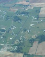
By: rettm5


