Login
Register


06AR
Cy Bond Memorial Airport
Official FAA Data Effective 2024-04-18 0901Z
VFR Chart of 06AR
Sectional Charts at SkyVector.com
IFR Chart of 06AR
Enroute Charts at SkyVector.com
Location Information for 06AR
Coordinates: N35°32.67' / W92°11.09'Located 03 miles SE of Higden, Arkansas on 4 acres of land. View all Airports in Arkansas.
Surveyed Elevation is 499 feet MSL.
Operations Data
|
|
Airport Communications
| AWOS-3 at CCA (13.1 W): | 118.725 501-745-5000 |
|---|---|
| AWOS-3PT at BVX (28.4 E): | 126.375 870-251-1369 |
| AWOS-3PT at SRC (29.7 SE): | 128.325 501-268-4280 |
Nearby Navigation Aids
|
| ||||||||||||||||||||||||||||||||||||||||||||||||||||||||||||


Runway 16/34
| Dimensions: | 2900 x 125 feet / 884 x 38 meters | |
|---|---|---|
| Surface: | Turf in Excellent Condition | |
| Edge Lighting: | Low Intensity | |
| Runway 16 | Runway 34 | |
| Traffic Pattern: | Left | Left |
| Glide Slope Indicator | NSTD 3 LIGHT VASI. | |
Services Available
| Fuel: | NONE |
|---|---|
| Transient Storage: | NONE |
| Airframe Repair: | NONE |
| Engine Repair: | NONE |
| Bottled Oxygen: | NOT AVAILABLE |
| Bulk Oxygen: | NOT AVAILABLE |
Ownership Information
| Ownership: | Privately Owned | |
|---|---|---|
| Owner: | LAKE SHORE PROP | LAKE SHORE PROPERTY OWNERS ASSOCIATION, INC. |
| 779 BONDAIR RD. | ||
| HIGDEN, AR 72067 | ||
| (214) 697-0348 | ||
| Manager: | JIM MOORE | CONTACT TOM MADDING 501-681-7851 |
| 779 BONDAIR ROAD | ||
| HIGDEN, AR 72067 | ||
| (214) 697-0348 | ||
Other Remarks
- FOR CD CTC MEMPHIS ARTCC AT 901-368-8453/8449.
- ACTVT LIRL RY 16/34 & VASI RY 34 - 122.70.
Nearby Airports with Instrument Procedures
| ID | Name | Heading / Distance | ||
|---|---|---|---|---|
 |
KHBZ | Heber Springs Municipal Airport | 103° | 8.6 |
|
2A2 | Holley Mountain Airpark Airport | 300° | 12.5 |
|
KCCA | Clinton Municipal Airport | 283° | 13.4 |
|
7M2 | Mountain View Wilcox Memorial Field Airport | 013° | 19.7 |
|
KBVX | Batesville Regional Airport | 067° | 28.4 |
|
KSRC | Searcy Regional Airport | 132° | 29.7 |
|
4A5 | Searcy County Airport | 312° | 31.3 |
|
KBDQ | Morrilton Municipal Airport | 226° | 35.7 |
|
42A | Melbourne Municipal - John E Miller Field Airport | 028° | 36.0 |
|
KCXW | Conway Regional Airport | 210° | 36.3 |
|
KLRF | Little Rock AFB Airport | 177° | 37.6 |
|
KORK | North Little Rock Municipal Airport | 184° | 42.8 |
Airport Images
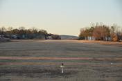
By: ZRotheohv


