Login
Register


33V
Walden-Jackson County Airport
Official FAA Data Effective 2024-03-21 0901Z
Chart Supplement

VFR Chart of 33V
Sectional Charts at SkyVector.com
IFR Chart of 33V
Enroute Charts at SkyVector.com
Location Information for 33V
Coordinates: N40°45.02' / W106°16.29'Located 01 miles NE of Walden, Colorado on 320 acres of land. View all Airports in Colorado.
Surveyed Elevation is 8153 feet MSL.
Operations Data
|
|
Airport Communications
| AWOS-3: | 118.625 Tel. 970-723-4513 |
|---|---|
| CTAF: | 122.900 |
| AWOS-3 at SBS (30.6 SW): | 118.325 970-879-7794 |
| AWOS-3PT at C07 (30.8 SW): | 127.125 970-824-0261 |
| AWOS-3 at 20V (41.9 S): | 118.425 970-724-9659 |
- APCH/DEP SVC PRVDD BY DENVER ARTCC (ZDV) ON FREQS 126.5/371.85 (WALTON PEAK RCAG).
Nearby Navigation Aids
|
| ||||||||||||||||||||||||||||||||||||||||||


Runway 04/22
| Dimensions: | 5900 x 75 feet / 1798 x 23 meters | |
|---|---|---|
| Surface: | Asphalt in Poor Condition RWY 4-22 ASPH PVMT USBL BUT CRACKED THRUT AND DELAMINATING AT APCH ENDS. | |
| Weight Limits: | S-25 | |
| Edge Lighting: | Medium Intensity | |
| Runway 04 | Runway 22 | |
| Coordinates: | N40°44.67' / W106°16.76' | N40°45.35' / W106°15.84' |
| Elevation: | 8153.1 | 8150.0 |
| Traffic Pattern: | Left | Left |
| Runway Heading: | 45° True | 225° True |
| Markings: | Non-Precision Instrument in poor condition. | Non-Precision Instrument in poor condition. |
| Glide Slope Indicator | P4L (3.00° Glide Path Angle) | P4L (3.00° Glide Path Angle) |
Runway 17/35
| Dimensions: | 4020 x 100 feet / 1225 x 30 meters | |
|---|---|---|
| Surface: | Turf in Fair Condition | |
| Runway 17 | Runway 35 | |
| Coordinates: | N40°45.38' / W106°16.27' | N40°44.71' / W106°16.29' |
| Elevation: | 8138.6 | 8153.6 |
| Traffic Pattern: | Left | Left |
| Runway Heading: | 181° True | 1° True |
| Obstacles: | 4 ft Fence 0 ft from runway FENCE POSTS MKD WITH YELLOW PAINT; WORN & FADED. |
10 ft Road 0 ft from runway |
Services Available
| Fuel: | NONE |
|---|---|
| Transient Storage: | Tiedowns |
| Airframe Repair: | NOT AVAILABLE |
| Engine Repair: | NOT AVAILABLE |
| Bottled Oxygen: | NOT AVAILABLE |
| Bulk Oxygen: | NOT AVAILABLE |
Ownership Information
| Ownership: | Publicly owned | |
|---|---|---|
| Owner: | JACKSON COUNTY | |
| CO COURTHOUSE PO BOX 1019 | ||
| WALDEN, CO 80480 | ||
| 970-723-4660 | ||
| Manager: | SAMANTHA MARTIN | |
| P. O. BOX 1019 | ||
| WALDEN, CO 80480 | ||
| 970-723-4660 | ||
Operational Statistics
| Single Engine Aircraft Based on Field: | 8 | Statistics collected for 12 month period ending 2018-12-31 | |
|---|---|---|---|
| Multi-Engine Aircraft Based on Field: | none | Annual Commercial Operations: | none |
| Jet Aircraft Based on Field: | 1 | Annual Commuter Operations: | none |
| Helicopters Based on Field: | none | Annual Air Taxi Operations: | none |
| Military Aircraft Based on Field: | none | Annual Military Operations: | none |
| Gliders Based on Field: | none | Annual GA Local Operations: | 200 |
| Ultralights Based on Field: | none | Annual GA Itinerant Operations: | 800 |
Other Remarks
- RDO CTL MODEL ACFT OPS SE CORNER OF ARPT; DEER & ANTELOPE ON RWYS.
- FOR CD CTC DENVER ARTCC AT 303-651-4257.
- +20 FT PLINE 660 FT FM RWY END 750 FT L OF CNTRLN; 50 FT DROPOFF 450 FT FM THR.
- 6 FT POLE 100 FT FM THR 10 FT L OF RWY EDGE.
- +38 FT TREES 300 FT FM THR 154 FT R OF APCH END; +4 FT FENCE AT THR L & R; FENCE POSTS MKD WITH WORN & FADED YELLOW PAINT; ROAD 24 FT FM THR.
- WORN & ERODED.
- ORANGE CONES.
- WORN & ERODED; THR MKD 125 FT FM END.
- ORANGE CONES.
- ACTVT PAPI RWY 04 & 22; MIRL RWY 04/22 - CTAF.
Weather Minimums
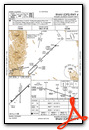
Instrument Approach Procedure (IAP) Charts
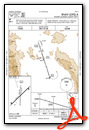
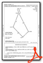
Departure Procedure Obstacles (DPO) Charts
Nearby Airports with Instrument Procedures
| ID | Name | Heading / Distance | ||
|---|---|---|---|---|
 |
KSBS | Steamboat Springs/Bob Adams Field Airport | 242° | 30.6 |
|
20V | Mc Elroy Airfield Airport | 186° | 42.0 |
|
KGNB | Granby-Grand County Airport | 157° | 42.8 |
|
KLAR | Laramie Regional Airport | 038° | 43.2 |
|
KHDN | Yampa Valley Airport | 249° | 46.1 |
|
KSAA | Shively Field Airport | 328° | 48.6 |
|
KDWX | Dixon Airport | 287° | 58.2 |
|
KCAG | Craig-Moffat Airport | 255° | 59.1 |
|
KFNL | Northern Colorado Regional Airport | 106° | 60.3 |
|
KLMO | Vance Brand Airport | 124° | 61.7 |
|
KCYS | Cheyenne Regional/Jerry Olson Field Airport | 069° | 70.7 |
|
KEIK | Erie Municipal Airport | 127° | 71.5 |
Airport Images
Do you have a recent image of this airport? Upload it here!


