Login
Register


42A
Melbourne Municipal - John E Miller Field Airport
Official FAA Data Effective 2024-04-18 0901Z
Chart Supplement

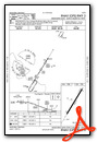
VFR Chart of 42A
Sectional Charts at SkyVector.com
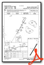
IFR Chart of 42A
Enroute Charts at SkyVector.com
Location Information for 42A
Coordinates: N36°4.26' / W91°49.81'Located 03 miles E of Melbourne, Arkansas on 130 acres of land. View all Airports in Arkansas.
Surveyed Elevation is 734 feet MSL.
Operations Data
|
|
Airport Communications
| AWOS-3PT: | 121.575 Tel. 870-916-2768 |
|---|---|
| CTAF: | 122.900 |
| AWOS-3PT at BVX (22.5 SE): | 126.375 870-251-1369 |
| ASOS at BPK (35.8 NW): | 133.975 870-481-5946 |
| AWOS-3PT at FLP (38.9 W): | 132.075 870-453-2380 |
- APCH/DEP SVC PRVDD BY MEMPHIS ARTCC ON FREQS 126.85/281.55 (HARRISON RCAG).
Nearby Navigation Aids
|
| ||||||||||||||||||||||||||||||||||||||||||||||||||||||||||||


Runway 03/21
| Dimensions: | 4003 x 75 feet / 1220 x 23 meters 150 FT PAVED STOPWAY EACH END - FULL STRENGTH. | |
|---|---|---|
| Surface: | Asphalt in Good Condition | |
| Edge Lighting: | Medium Intensity | |
| Runway 03 | Runway 21 | |
| Coordinates: | N36°3.98' / W91°50.02' | N36°4.54' / W91°49.59' |
| Elevation: | 734.8 | 708.9 |
| Runway Heading: | 32° True | 212° True |
| Markings: | Non-Precision Instrument in good condition. | Non-Precision Instrument in good condition. |
| Glide Slope Indicator | P2L (3.00° Glide Path Angle) | P2L (3.00° Glide Path Angle) |
| REIL: | Yes | Yes |
| Obstacles: | 42 ft Tree 1800 ft from runway, 465 ft right of center | 50 ft Tree 1550 ft from runway, 425 ft left of center |
Services Available
| Fuel: | 100LL (blue), Jet-A |
|---|---|
| Transient Storage: | Hangars,Tiedowns |
| Airframe Repair: | MAJOR |
| Engine Repair: | MAJOR |
| Bottled Oxygen: | NOT AVAILABLE |
| Bulk Oxygen: | NOT AVAILABLE |
| Other Services: | PILOT INSTRUCTION,AIRCRAFT RENTAL |
Ownership Information
| Ownership: | Publicly owned | |
|---|---|---|
| Owner: | CITY OF MELBOURNE | |
| PO BOX 800 | ||
| MELBOURNE, AR 72556 | ||
| 870-368-4215 | ||
| Manager: | KEN CLARK | |
| P.O. BOX 800 | ||
| MELBOURNE, AR 72556 | ||
| (870) 291-1227 | ||
Operational Statistics
| Single Engine Aircraft Based on Field: | 22 | Statistics collected for 12 month period ending 2022-01-31 | |
|---|---|---|---|
| Multi-Engine Aircraft Based on Field: | 2 | Annual Commercial Operations: | none |
| Jet Aircraft Based on Field: | none | Annual Commuter Operations: | none |
| Helicopters Based on Field: | none | Annual Air Taxi Operations: | none |
| Military Aircraft Based on Field: | none | Annual Military Operations: | 20 |
| Gliders Based on Field: | none | Annual GA Local Operations: | 60000 |
| Ultralights Based on Field: | none | Annual GA Itinerant Operations: | 5000 |
Other Remarks
- FOR CD CTC MEMPHIS ARTCC AT 901-368-8453/8449.
- 0LL SELF SERVE FUEL H24 WITH CREDIT CARD.
- ACTVT MIRL RWY 03/21 & REIL RWY 03/21 - CTAF
Weather Minimums

Instrument Approach Procedure (IAP) Charts
Nearby Airports with Instrument Procedures
| ID | Name | Heading / Distance | ||
|---|---|---|---|---|
 |
6M2 | Horseshoe Bend Airport | 021° | 9.7 |
|
KCVK | Sharp County Regional Airport | 048° | 17.4 |
|
7M2 | Mountain View Wilcox Memorial Field Airport | 225° | 17.7 |
|
KBVX | Batesville Regional Airport | 156° | 22.5 |
|
KHBZ | Heber Springs Municipal Airport | 194° | 34.7 |
|
KBPK | Baxter County Airport | 300° | 35.9 |
|
2A2 | Holley Mountain Airpark Airport | 228° | 37.6 |
|
KFLP | Marion County Regional Airport | 289° | 39.2 |
|
M19 | Newport Regional Airport | 128° | 41.1 |
|
4A5 | Searcy County Airport | 255° | 41.5 |
|
KCCA | Clinton Municipal Airport | 227° | 41.5 |
|
M70 | Pocahontas Municipal Airport | 075° | 43.8 |
Airport Images
Do you have a recent image of this airport? Upload it here!


Comments
Fuel
Melbourne now offers self-serve AVGAS and Jet A