Login
Register


4TN2
Buck Creek Ranch Airport
Official FAA Data Effective 2024-04-18 0901Z
VFR Chart of 4TN2
Sectional Charts at SkyVector.com
IFR Chart of 4TN2
Enroute Charts at SkyVector.com
Location Information for 4TN2
Coordinates: N35°53.00' / W84°58.13'Located 06 miles SE of Crossville, Tennessee. View all Airports in Tennessee.
Estimated Elevation is 1800 feet MSL.
Operations Data
|
|
Airport Communications
| ASOS at CSV (6.8 NW): | 120.625 931-456-4406 |
|---|---|
| AWOS-3 at RKW (13.8 E): | 118.775 865-354-9262 |
| AWOS-3 at 2A0 (24.2 S): | 135.075 423-775-4695 |
Nearby Navigation Aids
|
| ||||||||||||||||||||||||||||||||||||||||||||||||||||||||||||


Runway 11/29
| Dimensions: | 2200 x 75 feet / 671 x 23 meters | |
|---|---|---|
| Surface: | Turf | |
| Runway 11 | Runway 29 | |
| Obstacles: | 50 ft Trees 500 ft from runway | 6 ft Fence 400 ft from runway |
Ownership Information
| Ownership: | Privately Owned | |
|---|---|---|
| Owner: | EARL THOMAS PELFREY | |
| 696 BUCK CREEK ROAD | ||
| CROSSVILLE, TN 38555 | ||
| 931-484-6096 | ||
| Manager: | EARL THOMAS PELFREY | |
| 696 BUCK CREEK ROAD | ||
| CROSSVILLE, TN 38555 | ||
| 931-484-6096 | 931-510-4371 | |
Other Remarks
- FOR CD CTC ATLANTA ARTCC AT 770-210-7692.
Nearby Airports with Instrument Procedures
| ID | Name | Heading / Distance | ||
|---|---|---|---|---|
 |
KCSV | Crossville Memorial-Whitson Field Airport | 305° | 7.0 |
|
KRKW | Rockwood Municipal Airport | 080° | 13.8 |
|
2A0 | Mark Anton Airport | 175° | 23.9 |
|
2A1 | Jamestown Municipal Airport | 002° | 28.0 |
|
KSRB | Upper Cumberland Regional Airport | 290° | 29.2 |
|
KMNV | Monroe County Airport | 124° | 35.2 |
|
KMMI | Mcminn County Airport | 145° | 35.2 |
|
8A3 | Livingston Municipal Airport | 332° | 35.8 |
|
KSCX | Scott Municipal Airport | 028° | 39.0 |
|
KRZR | Cleveland Regional Jetport Airport | 168° | 41.1 |
|
0A3 | Smithville Municipal Airport | 278° | 41.4 |
|
KRNC | Warren County Memorial Airport | 255° | 44.1 |
Airport Images
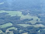
By: Big Orange Bird


