Login
Register


5M5
Crystal Lake Airport
Official FAA Data Effective 2024-04-18 0901Z
Chart Supplement

VFR Chart of 5M5
Sectional Charts at SkyVector.com
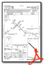
IFR Chart of 5M5
Enroute Charts at SkyVector.com
Location Information for 5M5
Coordinates: N36°20.62' / W94°26.69'Located 02 miles NE of Decatur, Arkansas on 55 acres of land. View all Airports in Arkansas.
Surveyed Elevation is 1177 feet MSL.
Operations Data
|
|
Airport Communications
| RAZORBACK APPROACH: | 121.0 244.575 |
|---|---|
| RAZORBACK DEPARTURE: | 121.0 244.575 |
| CLEARANCE DELIVERY: | 126.6 |
| CTAF: | 122.800 |
| UNICOM: | 122.800 |
| ATIS at XNA (7.6 SE): | 119.425 |
| ASOS at XNA (7.6 SE): | 119.425 479-203-0109 |
| AWOS-3PT at SLG (9.4 S): | 118.375 479-524-9893 |
- APCH/DEP SVC PRVDD BY MEMPHIS ARTCC ON FREQS 126.1/269.0 (FAYETTEVILLE RCAG) WHEN RAZORBACK APCH CTL CLSD.
Nearby Navigation Aids
|
| ||||||||||||||||||||||||||||||||||||||||||||||||||||||||||||


Runway 13/31
| Dimensions: | 3863 x 75 feet / 1177 x 23 meters | |
|---|---|---|
| Surface: | Asphalt in Fair Condition | |
| Weight Limits: | S-10 | |
| Edge Lighting: | Low Intensity | |
| Runway 13 | Runway 31 | |
| Coordinates: | N36°20.84' / W94°26.97' | N36°20.39' / W94°26.41' |
| Elevation: | 1154.0 | 1176.4 |
| Traffic Pattern: | Left | Left |
| Runway Heading: | 134° True | 314° True |
| Markings: | Non-Precision Instrument in fair condition. | Non-Precision Instrument in fair condition. |
| Glide Slope Indicator | V2L (3.50° Glide Path Angle) VASI OTS INDEFLY. | V2L (3.50° Glide Path Angle) VASI OTS INDEFLY. |
| Obstacles: | 55 ft Trees 450 ft from runway, 185 ft right of center | 41 ft Trees 300 ft from runway, 125 ft left of center |
Services Available
| Fuel: | NONE |
|---|---|
| Transient Storage: | Hangars,Tiedowns |
| Airframe Repair: | MAJOR |
| Engine Repair: | MAJOR |
| Bottled Oxygen: | NOT AVAILABLE |
| Bulk Oxygen: | NONE |
| Other Services: | PILOT INSTRUCTION |
Ownership Information
| Ownership: | Privately Owned | |
|---|---|---|
| Owner: | CRYSTAL LAKE FLY-IN COMMUNITY, LLC | |
| 33801 KANIS ROAD | ||
| PARON, AR 72122 | ||
| 501-351-4545 | ||
| Manager: | LANCE DIXON | |
| 18820 CRYSTAL LAKE ROAD | ||
| DECATUR, AR 72722 | ||
| 479-220-5047 | ||
Operational Statistics
| Single Engine Aircraft Based on Field: | 11 | Statistics collected for 12 month period ending 2021-03-31 | |
|---|---|---|---|
| Multi-Engine Aircraft Based on Field: | none | Annual Commercial Operations: | none |
| Jet Aircraft Based on Field: | none | Annual Commuter Operations: | none |
| Helicopters Based on Field: | 3 | Annual Air Taxi Operations: | none |
| Military Aircraft Based on Field: | none | Annual Military Operations: | none |
| Gliders Based on Field: | none | Annual GA Local Operations: | 1200 |
| Ultralights Based on Field: | none | Annual GA Itinerant Operations: | 500 |
Other Remarks
- BE ALERT FOR +176 FT TWR APRXLY 1300 FT N OF RY 13.
- DEER & GEESE ON & INVOF ARPT.
- FOR CD CTC RAZORBACK APCH 479-649-2416, WHEN APCH CLSD CTC MEMPHIS ARTCC AT 901-368-8453/8449.
- NSTD THLD MARKINGS DUE TO SIZE.
- NSTD THLD MARKNIGS DUE TO SIZE.
Weather Minimums

Instrument Approach Procedure (IAP) Charts
Nearby Airports with Instrument Procedures
| ID | Name | Heading / Distance | ||
|---|---|---|---|---|
 |
KXNA | Northwest Arkansas Ntl Airport | 119° | 7.6 |
|
KSLG | Smith Field Airport | 193° | 9.4 |
|
KVBT | Bentonville Municipal/Louise M Thaden Field Airport | 089° | 10.9 |
|
KROG | Rogers Exec - Carter Field Airport | 083° | 16.5 |
|
KASG | Springdale Municipal Airport | 122° | 18.7 |
|
KGMJ | Grove Regional Airport | 318° | 21.2 |
|
KFYV | Drake Field Airport | 146° | 24.3 |
|
KEOS | Neosho Hugh Robinson Airport | 005° | 28.1 |
|
1K8 | South Grand Lake Regional Airport | 293° | 30.1 |
|
94K | Cassville Municipal Airport | 050° | 33.8 |
|
KTQH | Tahlequah Municipal Airport | 227° | 36.8 |
|
H34 | Huntsville Municipal Airport | 115° | 37.1 |
Airport Images
Do you have a recent image of this airport? Upload it here!


