Login
Register


DNA
Dona Ana County International Jetport Airport
Official FAA Data Effective 2024-04-18 0901Z
Chart Supplement

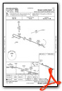
VFR Chart of KDNA
Sectional Charts at SkyVector.com
IFR Chart of KDNA
Enroute Charts at SkyVector.com
Location Information for KDNA
Coordinates: N31°52.83' / W106°42.19'Located 04 miles NW of Santa Teresa, New Mexico on 170 acres of land. View all Airports in New Mexico.
Surveyed Elevation is 4112 feet MSL.
Operations Data
|
|
Airport Communications
| AWOS-3PT: | 124.175 Tel. 575-589-2643 |
|---|---|
| EL PASO APPROACH: | 119.15 |
| EL PASO DEPARTURE: | 119.15 |
| UNICOM: | 122.725 |
| CTAF: | 122.725 |
| ASOS at ELP (16.1 E): | 915-774-9497 |
| D-ATIS at ELP (17.2 E): | 120.0 |
| AWOS-3 at LRU (26.7 NW): | 119.025 575-526-4831 |
Nearby Navigation Aids
|
| ||||||||||||||||||||||||||||||||||||


Runway 10/28
| Dimensions: | 9550 x 100 feet / 2911 x 30 meters | |
|---|---|---|
| Surface: | Asphalt / Grooved in Excellent Condition | |
| Weight Limits: | 90 /F/A/X/T, S-50, D-90 | |
| Edge Lighting: | Medium Intensity | |
| Runway 10 | Runway 28 | |
| Coordinates: | N31°53.12' / W106°43.05' | N31°52.53' / W106°41.34' |
| Elevation: | 4111.3 | 4109.8 |
| Traffic Pattern: | Right | |
| Runway Heading: | 112° True | 292° True |
| Markings: | Non-Precision Instrument in good condition. | Non-Precision Instrument in good condition. |
| Glide Slope Indicator | P4L (3.00° Glide Path Angle) | P4L (3.00° Glide Path Angle) |
| REIL: | Yes | Yes |
Services Available
| Fuel: | 100LL (blue), Jet A-1+ |
|---|---|
| Transient Storage: | Hangars,Tiedowns SHADE HANGARS ONLY. |
| Airframe Repair: | MAJOR |
| Engine Repair: | MAJOR |
| Bottled Oxygen: | HIGH/LOW BOTTLE OXY AVAILABLE ON WEEKDAYS ONLY AT HANGAR 14. |
| Bulk Oxygen: | HIGH/LOW BULK OXY IS AVAILABLE WEEKDAYS ONLY AT HANGAR 14. |
| Other Services: | CHARTER SERVICE,PILOT INSTRUCTION,PARACHUTE JUMP ACTIVITY,AIRCRAFT RENTAL |
Ownership Information
| Ownership: | Publicly owned | |
|---|---|---|
| Owner: | DONA ANA COUNTY | |
| 845 N. MOTEL | ||
| LAS CRUCES, NM 88007 | ||
| 575-647-7200 | ||
| Manager: | BILL PROVANCE | |
| 8014 AIRPORT RD. | ||
| SANTA TERESA, NM 88008 | ||
| 575-644-2358 | EMERGENCY PHONE: 575-644-2358. | |
Operational Statistics
| Single Engine Aircraft Based on Field: | 88 | Statistics collected for 12 month period ending 2023-04-08 | |
|---|---|---|---|
| Multi-Engine Aircraft Based on Field: | 13 | Annual Commercial Operations: | none |
| Jet Aircraft Based on Field: | 20 | Annual Commuter Operations: | none |
| Helicopters Based on Field: | 9 | Annual Air Taxi Operations: | 200 |
| Military Aircraft Based on Field: | none | Annual Military Operations: | 1200 |
| Gliders Based on Field: | none | Annual GA Local Operations: | 27100 |
| Ultralights Based on Field: | none | Annual GA Itinerant Operations: | 13000 |
Other Remarks
- FOR CD CTC ALBUQUERQUE ARTCC AT 505-856-4861.
- 0LL 24 HR, 100 LL SELF SERVICE AVBL WITH MAJOR CREDIT CARD. JET A AFTER HOURS CALL FRANCIS AVIATION 844-589-4586. CALL-OUT FEE $100, $150 (HOLIDAYS) AFTER 6 PM.
- ACTVT REIL RWY 10 & 28; PAPI RWY 10 & 28; MIRL RWY 10/28 - CTAF.
- AUTOMATED UNICOM; 3 CLICKS.
Weather Minimums
Instrument Approach Procedure (IAP) Charts
Nearby Airports with Instrument Procedures
| ID | Name | Heading / Distance | ||
|---|---|---|---|---|
 |
KELP | El Paso International Airport | 104° | 17.3 |
|
KLRU | Las Cruces International Airport | 335° | 26.9 |
|
KDMN | Deming Municipal Airport | 294° | 56.6 |
|
KHMN | Holloman AFB Airport | 027° | 65.5 |
|
KALM | Alamogordo-White Sands Regional Airport | 032° | 67.9 |
|
KTCS | Truth Or Consequences Municipal Airport | 340° | 86.1 |
|
KSVC | Grant County Airport | 301° | 86.7 |
|
KVHN | Culberson County Airport | 116° | 110.1 |
|
KSRR | Sierra Blanca Regional Airport | 031° | 111.7 |
|
KCNM | Cavern City Air Trml Airport | 076° | 127.3 |
|
KATS | Artesia Municipal Airport | 062° | 127.6 |
|
KROW | Roswell Air Center Airport | 051° | 139.2 |


