Login
Register


6J2
St George Airport
Official FAA Data Effective 2024-04-18 0901Z
Chart Supplement

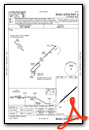
VFR Chart of 6J2
Sectional Charts at SkyVector.com
IFR Chart of 6J2
Enroute Charts at SkyVector.com
Location Information for 6J2
Coordinates: N33°11.73' / W80°30.51'Located 03 miles E of St George, South Carolina on 103 acres of land. View all Airports in South Carolina.
Surveyed Elevation is 84 feet MSL.
Operations Data
|
|
Airport Communications
| CHARLESTON APPROACH: | 120.7 306.925 |
|---|---|
| CHARLESTON DEPARTURE: | 120.7 306.925 |
| UNICOM: | 122.800 |
| CTAF: | 122.800 |
| AWOS-3 at DYB (14.0 SE): | 119.575 843-821-8403 |
| AWOS-3PT at RBW (17.5 SW): | 118.725 843-538-3575 |
| ASOS at OGB (23.6 NW): | 118.525 803-536-3901 |
Nearby Navigation Aids
|
| ||||||||||||||||||||||||||||||||||||||||||||||||||||||||||||


Runway 05/23
| Dimensions: | 3201 x 60 feet / 976 x 18 meters | |
|---|---|---|
| Surface: | Asphalt in Good Condition | |
| Weight Limits: | S-21, D-30 | |
| Edge Lighting: | Low Intensity | |
| Runway 05 | Runway 23 | |
| Coordinates: | N33°11.55' / W80°30.73' | N33°11.91' / W80°30.28' |
| Elevation: | 82.6 | 82.5 |
| Traffic Pattern: | Left | Left |
| Runway Heading: | 46° True | 226° True |
| Markings: | Basic in fair condition. | Basic in fair condition. |
| Obstacles: | 90 ft Tree 1177 ft from runway, 186 ft left of center TREES IN DITCHES EITHER SIDE OF RWY. |
7 ft Tree 285 ft from runway, 69 ft right of center TREES IN DITCHES EITHER SIDE OF RWY. |
Services Available
| Fuel: | NONE |
|---|---|
| Transient Storage: | Tiedowns NO ROPES FOR TIEDOWNS. |
| Airframe Repair: | NONE |
| Engine Repair: | NONE |
| Bottled Oxygen: | NONE |
| Bulk Oxygen: | NONE |
Ownership Information
| Ownership: | Publicly owned | |
|---|---|---|
| Owner: | DORCHESTER COUNTY | |
| PO BOX 416 | ||
| ST GEORGE, SC 29477 | ||
| 843-563-0100 | ||
| Manager: | DON HAY | |
| PO BOX 347, BOX 3 | ||
| HARLEYVILLE, SC 29448 | ||
| 843-412-1999 | ||
Operational Statistics
| Single Engine Aircraft Based on Field: | 2 | Statistics collected for 12 month period ending 2021-10-08 | |
|---|---|---|---|
| Multi-Engine Aircraft Based on Field: | none | Annual Commercial Operations: | none |
| Jet Aircraft Based on Field: | none | Annual Commuter Operations: | none |
| Helicopters Based on Field: | none | Annual Air Taxi Operations: | none |
| Military Aircraft Based on Field: | none | Annual Military Operations: | none |
| Gliders Based on Field: | none | Annual GA Local Operations: | 300 |
| Ultralights Based on Field: | none | Annual GA Itinerant Operations: | 700 |
Other Remarks
- THIS AIRPORT HAS BEEN SURVEYED BY THE NATIONAL GEODETIC SURVEY.
- FOR CD CTC CHARLESTON APCH AT 843-414-2832.
- MARKING IS FADED.
- RY 05 HAS NPI APCH, BUT VISUAL MARKINGS.
- MARKING IS FADED.
Weather Minimums

Instrument Approach Procedure (IAP) Charts
Nearby Airports with Instrument Procedures
| ID | Name | Heading / Distance | ||
|---|---|---|---|---|
 |
KDYB | Summerville Airport | 124° | 14.0 |
|
KRBW | Lowcountry Regional Airport | 202° | 17.7 |
|
KOGB | Orangeburg Municipal Airport | 311° | 23.6 |
|
KMKS | Berkeley County Airport | 091° | 23.7 |
|
KCHS | Charleston AFB/International Airport | 126° | 29.5 |
|
99N | Bamberg County Airport | 282° | 30.9 |
|
KJZI | Charleston Exec Airport | 139° | 39.1 |
|
KAQX | Allendale County Airport | 252° | 40.2 |
|
KLRO | Mt Pleasant Regional-Faison Field Airport | 115° | 40.7 |
|
KBNL | Barnwell Regional Airport | 275° | 44.4 |
|
KCKI | Williamsburg Regional Airport | 046° | 45.2 |
|
KMMT | Mc Entire Jngb Airport | 341° | 45.8 |
Airport Images

By: Big Orange Bird


