Login
Register


7W5
Henry County Airport
Official FAA Data Effective 2024-04-18 0901Z
Chart Supplement

VFR Chart of 7W5
Sectional Charts at SkyVector.com
IFR Chart of 7W5
Enroute Charts at SkyVector.com
Location Information for 7W5
Coordinates: N41°22.46' / W84°4.07'Located 03 miles E of Napoleon, Ohio on 47 acres of land. View all Airports in Ohio.
Surveyed Elevation is 682 feet MSL.
Operations Data
|
|
Airport Communications
| TOLEDO APPROACH: | 134.35 307.0 |
|---|---|
| TOLEDO DEPARTURE: | 134.35 307.0 |
| UNICOM: | 123.000 |
| CTAF: | 123.000 |
| AWOS-3P at USE (14.5 N): | 127.375 419-335-0775 |
| ASOS at DFI (16.4 W): | 121.425 419-658-2301 |
| ATIS at TOL (17.3 NE): | 118.75 |
Nearby Navigation Aids
|
| ||||||||||||||||||||||||||||||||||||||||||||||||||||||||||||


Runway 10/28
| Dimensions: | 4001 x 60 feet / 1220 x 18 meters | |
|---|---|---|
| Surface: | Asphalt in Excellent Condition | |
| Edge Lighting: | Medium Intensity | |
| Runway 10 | Runway 28 | |
| Coordinates: | N41°22.52' / W84°4.50' | N41°22.39' / W84°3.64' |
| Elevation: | 680.8 | 682.8 |
| Traffic Pattern: | Left | |
| Runway Heading: | 101° True | 281° True |
| Markings: | Non-Precision Instrument in good condition. | Non-Precision Instrument in good condition. |
| Glide Slope Indicator | P2L (3.00° Glide Path Angle) | P2L (3.00° Glide Path Angle) |
| REIL: | Yes | Yes |
| Obstacles: | 5 ft Crops 200 ft from runway, 95 ft right of center CTLG OBSTN EXCEEDS A 45 DEG SLP. +5 FT CROPS/CULTIVATED FLD, 140-200 FT DIST, 95-125 FT R. |
6 ft Crops 200 ft from runway, 125 ft left of center CTLG OBSTN EXCEEDS A 45 DEG SLP. +6 FT CROPS/CULTIVATED FLD, 0-200 FT DIST, 125 FT L TO 130 FT R. |
Services Available
| Fuel: | 100LL (blue), Jet-A |
|---|---|
| Transient Storage: | Hangars,Tiedowns PRIOR CDN RQRD. |
| Airframe Repair: | MAJOR |
| Engine Repair: | MAJOR |
| Bottled Oxygen: | LOW |
| Bulk Oxygen: | NONE |
| Other Services: | AIRCRAFT SALES |
Ownership Information
| Ownership: | Publicly owned | |
|---|---|---|
| Owner: | HENRY CO ARPT AUTH | |
| 10646 COUNTY ROAD O | ||
| NAPOLEON, OH 43545-6217 | ||
| 419-599-6494 | ||
| Manager: | JARED AMES, ACTING AMGR | |
| 10646 COUNTY ROAD O | ||
| NAPOLEON, OH 43545-6217 | ||
| 419-599-6494 | CELL 419-388-9259. | |
Operational Statistics
| Single Engine Aircraft Based on Field: | 15 | Statistics collected for 12 month period ending 2023-10-03 | |
|---|---|---|---|
| Multi-Engine Aircraft Based on Field: | 1 | Annual Commercial Operations: | none |
| Jet Aircraft Based on Field: | none | Annual Commuter Operations: | none |
| Helicopters Based on Field: | none | Annual Air Taxi Operations: | 10 |
| Military Aircraft Based on Field: | none | Annual Military Operations: | 10 |
| Gliders Based on Field: | none | Annual GA Local Operations: | 5000 |
| Ultralights Based on Field: | none | Annual GA Itinerant Operations: | 500 |
Other Remarks
- FOR CD CTC TOLEDO APCH AT 419-865-1495.
- ACTVT REIL RWY 10 & 28; PAPI RWY 10 & 28; MIRL RWY 10/28 - CTAF.
Weather Minimums

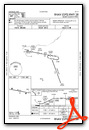
Instrument Approach Procedure (IAP) Charts
Nearby Airports with Instrument Procedures
| ID | Name | Heading / Distance | ||
|---|---|---|---|---|
 |
KUSE | Fulton County Airport | 349° | 14.4 |
|
KDFI | Defiance Memorial Airport | 262° | 16.5 |
|
KTOL | Eugene F Kranz Toledo Express Airport | 042° | 17.3 |
|
1G0 | Wood County Airport | 086° | 19.8 |
|
0G6 | Williams County Airport | 285° | 20.6 |
|
KOWX | Putnam County Airport | 169° | 20.7 |
|
KFDY | Findlay Airport | 140° | 28.3 |
|
KDUH | Toledo Suburban Airport | 040° | 28.5 |
|
KTDZ | Toledo Exec Airport | 066° | 28.8 |
|
KADG | Lenawee County Airport | 359° | 29.6 |
|
5G7 | Bluffton Airport | 162° | 30.7 |
|
KFZI | Fostoria Metro Airport | 109° | 32.4 |
Airport Images
Do you have a recent image of this airport? Upload it here!


