Login
Register


99N
Bamberg County Airport
Official FAA Data Effective 2024-04-18 0901Z
Chart Supplement

VFR Chart of 99N
Sectional Charts at SkyVector.com
IFR Chart of 99N
Enroute Charts at SkyVector.com
Location Information for 99N
Coordinates: N33°18.27' / W81°6.51'Located 05 miles W of Bamberg, South Carolina on 94 acres of land. View all Airports in South Carolina.
Estimated Elevation is 231 feet MSL.
Operations Data
|
|
Airport Communications
| COLUMBIA APPROACH: | 124.15 338.2 |
|---|---|
| COLUMBIA DEPARTURE: | 124.15 338.2 |
| UNICOM: | 122.800 |
| CTAF: | 122.800 |
| AWOS-3 at BNL (14.3 W): | 119.775 803-259-4536 |
| ASOS at OGB (15.5 NE): | 118.525 803-536-3901 |
| AWOS-3PT at AQX (20.4 SW): | 118.950 803-584-3696 |
- APCH/DEP SVC PRVDD BY COLUMBIA APCH CTL ON FREQS 124.15/338.2
Nearby Navigation Aids
|
| ||||||||||||||||||||||||||||||||||||||||||||||||||||||||||||


Runway 05/23
| Dimensions: | 3603 x 60 feet / 1098 x 18 meters | |
|---|---|---|
| Surface: | Asphalt in Good Condition | |
| Weight Limits: | S-30, D-60 | |
| Edge Lighting: | Medium Intensity | |
| Runway 05 | Runway 23 | |
| Coordinates: | N33°18.06' / W81°6.75' | N33°18.49' / W81°6.26' |
| Elevation: | 208.3 | 230.7 |
| Runway Heading: | 44° True | 224° True |
| Markings: | Non-Precision Instrument in good condition. | Non-Precision Instrument in good condition. |
| Glide Slope Indicator | P2L (3.00° Glide Path Angle) | P2L (3.00° Glide Path Angle) |
| Obstacles: | 73 ft Tree 559 ft from runway, 294 ft left of center | 70 ft Tree 634 ft from runway, 309 ft right of center |
Services Available
| Fuel: | 100LL (blue) |
|---|---|
| Transient Storage: | Tiedowns |
| Airframe Repair: | NONE |
| Engine Repair: | NONE |
| Bottled Oxygen: | NONE |
| Bulk Oxygen: | NONE |
Ownership Information
| Ownership: | Publicly owned | |
|---|---|---|
| Owner: | BAMBERG COUNTY | |
| PO BOX 149 | ||
| BAMBERG, SC 29003 | ||
| 803-245-5191 | ||
| Manager: | MR. JOEY PRESTON | COUNTY ADMINISTRATOR. |
| PO BOX 149 | ||
| BAMBERG, SC 29003 | ||
| 803-245-5191 | ||
Operational Statistics
| Single Engine Aircraft Based on Field: | 3 | Statistics collected for 12 month period ending 2020-07-29 | |
|---|---|---|---|
| Multi-Engine Aircraft Based on Field: | none | Annual Commercial Operations: | none |
| Jet Aircraft Based on Field: | none | Annual Commuter Operations: | none |
| Helicopters Based on Field: | none | Annual Air Taxi Operations: | none |
| Military Aircraft Based on Field: | none | Annual Military Operations: | none |
| Gliders Based on Field: | none | Annual GA Local Operations: | 200 |
| Ultralights Based on Field: | none | Annual GA Itinerant Operations: | 500 |
Other Remarks
- THIS AIRPORT HAS BEEN SURVEYED BY THE NATIONAL GEODETIC SURVEY.
- FOR CD CTC COLUMBIA APCH AT 803-822-5242 OR 803-822-5040.
- ACTVT PAPI RWY 05 & 23; MIRL RWY 05/23 - CTAF.
Weather Minimums

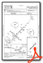
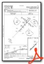
Instrument Approach Procedure (IAP) Charts
Nearby Airports with Instrument Procedures
| ID | Name | Heading / Distance | ||
|---|---|---|---|---|
 |
KBNL | Barnwell Regional Airport | 258° | 14.4 |
|
KOGB | Orangeburg Municipal Airport | 053° | 15.5 |
|
KAQX | Allendale County Airport | 203° | 20.2 |
|
6J0 | Lexington County Airport | 346° | 30.2 |
|
6J2 | St George Airport | 102° | 30.9 |
|
KRBW | Lowcountry Regional Airport | 134° | 32.9 |
|
KAIK | Aiken Regional Airport | 305° | 35.6 |
|
KCAE | Columbia Metro Airport | 359° | 38.0 |
|
KMMT | Mc Entire Jngb Airport | 022° | 40.0 |
|
KCUB | Jim Hamilton L B Owens Airport | 008° | 40.3 |
|
KAGS | Augusta Regional At Bush Field Airport | 275° | 43.2 |
|
KDYB | Summerville Airport | 108° | 44.1 |
Airport Images
Do you have a recent image of this airport? Upload it here!


