Login
Register


AMG
Bacon County Airport
Official FAA Data Effective 2024-04-18 0901Z
Chart Supplement

VFR Chart of KAMG
Sectional Charts at SkyVector.com
IFR Chart of KAMG
Enroute Charts at SkyVector.com
Location Information for KAMG
Coordinates: N31°32.16' / W82°30.39'Located 03 miles W of Alma, Georgia on 232 acres of land. View all Airports in Georgia.
Surveyed Elevation is 199 feet MSL.
Operations Data
|
|
Airport Communications
| ASOS: | 118.325 Tel. 912-632-8738 |
|---|---|
| CTAF: | 122.700 |
| UNICOM: | 122.700 |
| AWOS-3PT at BHC (12.2 NE): | 118.2 912-705-5865 |
| AWOS-3 at AYS (18.2 S): | 118.575 912-287-4466 |
| AWOS-3 at DQH (18.5 W): | 119.075 912-383-7258 |
- APCH/DEP SVC PRVDD BY JACKSONVILLE ARTCC ON FREQS 127.575/269.025 (ALMA RCAG).
Nearby Navigation Aids
|
| ||||||||||||||||||||||||||||||||||||||||||||||||||||||||||||


Runway 16/34
| Dimensions: | 5000 x 100 feet / 1524 x 30 meters | |
|---|---|---|
| Surface: | Asphalt in Excellent Condition | |
| Weight Limits: | S-30 | |
| Edge Lighting: | Medium Intensity | |
| Runway 16 | Runway 34 | |
| Coordinates: | N31°32.52' / W82°30.63' | N31°31.80' / W82°30.16' |
| Elevation: | 199.8 | 190.2 |
| Traffic Pattern: | Left | Left |
| Runway Heading: | 151° True | 331° True |
| Markings: | Non-Precision Instrument in good condition. | Non-Precision Instrument in good condition. |
| Glide Slope Indicator | P2L (3.00° Glide Path Angle) | P2L (3.00° Glide Path Angle) PAPI RWY 34 UNUSBL 5 DEG LEFT OF RCL. |
| REIL: | Yes | Yes |
| Obstacles: | 34 ft Trees 201 ft from runway, 375 ft right of center CTLNG OBSTN EXCEEDS A 45 DEG SLP. 25 FT TREES, 301 FT RIGHT, BETWEEN EOR AND 200 FT FROM EOR. |
27 ft Trees 223 ft from runway, 316 ft right of center 30 FT - 70 FT TREES 300 FT LEFT AND RIGHT, FROM EOR TO 200 FT EOR. |
Services Available
| Fuel: | 100LL (blue), Jet A+ |
|---|---|
| Transient Storage: | Tiedowns |
| Airframe Repair: | MINOR |
| Engine Repair: | MINOR |
| Bottled Oxygen: | NONE |
| Bulk Oxygen: | NONE |
Ownership Information
| Ownership: | Publicly owned | |
|---|---|---|
| Owner: | BACON COUNTY | |
| BACON COUNTY COURTHOUSE, 302 WEST 12TH STREET | ||
| ALMA, GA 31510 | ||
| 912-632-5214 | ||
| Manager: | CARL LEGGETT | |
| P.O. BOX 356 | ||
| ALMA, GA 31510 | ||
| 912-282-4887 | ||
Operational Statistics
| Single Engine Aircraft Based on Field: | 7 | Statistics collected for 12 month period ending 2022-12-31 | |
|---|---|---|---|
| Multi-Engine Aircraft Based on Field: | 2 | Annual Commercial Operations: | none |
| Jet Aircraft Based on Field: | none | Annual Commuter Operations: | none |
| Helicopters Based on Field: | none | Annual Air Taxi Operations: | none |
| Military Aircraft Based on Field: | none | Annual Military Operations: | none |
| Gliders Based on Field: | none | Annual GA Local Operations: | 2000 |
| Ultralights Based on Field: | none | Annual GA Itinerant Operations: | 4000 |
Other Remarks
- FOR CD IF UNA TO CTC ON FSS FREQ, CTC JACKSONVILLE ARTCC AT 904-845-1592.
- ACTVT REIL RWY 16 & 34; PAPI RWY 16 & 34; MIRL RWY 16/34 - CTAF.
Weather Minimums

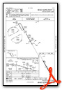
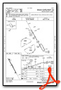
Instrument Approach Procedure (IAP) Charts
Nearby Airports with Instrument Procedures
| ID | Name | Heading / Distance | ||
|---|---|---|---|---|
 |
KBHC | Baxley Municipal Airport | 028° | 12.1 |
|
KAYS | Waycross-Ware County Airport | 161° | 18.1 |
|
KDQH | Douglas Municipal Airport | 259° | 18.5 |
|
KAZE | Hazlehurst Airport | 340° | 22.1 |
|
KHOE | Homerville Airport | 205° | 31.8 |
|
KJES | Jesup-Wayne County Airport | 087° | 32.0 |
|
KRVJ | Swinton Smith Field At Reidsville Municipal Airport | 029° | 36.2 |
|
4J1 | Brantley County Airport | 122° | 36.6 |
|
KMQW | Telfair-Wheeler Airport | 330° | 38.6 |
|
KVDI | Vidalia Regional Airport | 009° | 39.9 |
|
KFZG | Fitzgerald Municipal Airport | 282° | 40.2 |
|
4J2 | Berrien County Airport | 242° | 41.7 |
Airport Images

By: anthom03


