Login
Register


AMN
Gratiot Community Airport
Official FAA Data Effective 2024-03-21 0901Z
Chart Supplement

VFR Chart of KAMN
Sectional Charts at SkyVector.com
IFR Chart of KAMN
Enroute Charts at SkyVector.com
Location Information for KAMN
Coordinates: N43°19.33' / W84°41.28'Located 03 miles SW of Alma, Michigan on 631 acres of land. View all Airports in Michigan.
Surveyed Elevation is 754 feet MSL.
Operations Data
|
|
Airport Communications
| AWOS-3P: | 124.175 Tel. 989-463-3433 |
|---|---|
| GREAT LAKES APPROACH: | 126.45 235.625 |
| GREAT LAKES DEPARTURE: | 126.45 235.625 |
| CLEARANCE DELIVERY: | 119.25 |
| UNICOM: | 122.800 |
| CTAF: | 122.800 |
| AWOS-3 at MOP (18.1 N): | 133.025 989-773-2885 |
| AWOS-3 at IKW (27.7 NE): | 119.525 989-835-5841 |
| AWOS-3 at Y70 (28.3 SW): | 118.9 616-523-1852 |
- APCH/DEP SVC PRVDD BY CLEVELAND ARTCC (ZOB) ON FREQS 126.75/348.75 (FLINT RCAG) WHEN GREAT LAKES APCH CTL CLSD.
Nearby Navigation Aids
|
| ||||||||||||||||||||||||||||||||||||||||||||||||||||||||||||


Runway 09/27
| Dimensions: | 5004 x 75 feet / 1525 x 23 meters | |
|---|---|---|
| Surface: | Asphalt / Grooved in Good Condition | |
| Weight Limits: | S-40, D-65 | |
| Edge Lighting: | Medium Intensity | |
| Runway 09 | Runway 27 | |
| Coordinates: | N43°19.38' / W84°41.76' | N43°19.38' / W84°40.63' |
| Elevation: | 750.5 | 753.2 |
| Traffic Pattern: | Left | Left |
| Runway Heading: | 90° True | 270° True |
| Markings: | Non-Precision Instrument in fair condition. | Non-Precision Instrument in fair condition. |
| Glide Slope Indicator | P4L (3.00° Glide Path Angle) | P4L (3.00° Glide Path Angle) |
| REIL: | Yes | Yes |
| Obstacles: | 79 ft Tree 2307 ft from runway, 266 ft left of center | |
Runway 18/36
| Dimensions: | 3198 x 75 feet / 975 x 23 meters | |
|---|---|---|
| Surface: | Asphalt / Grooved in Good Condition | |
| Weight Limits: | S-26 | |
| Edge Lighting: | Medium Intensity | |
| Runway 18 | Runway 36 | |
| Coordinates: | N43°19.51' / W84°41.40' | N43°18.99' / W84°41.40' |
| Elevation: | 753.2 | 754.0 |
| Traffic Pattern: | Left | Left |
| Runway Heading: | 180° True | 0 |
| Markings: | Non-Precision Instrument in fair condition. | Non-Precision Instrument in fair condition. |
| Obstacles: | 56 ft Tree 1119 ft from runway, 383 ft left of center | |
Services Available
| Fuel: | 100LL (blue), Jet A+ |
|---|---|
| Transient Storage: | Hangars,Tiedowns CALL AHD FOR HNGR AVBL. |
| Airframe Repair: | NONE |
| Engine Repair: | NONE |
| Bottled Oxygen: | NONE |
| Bulk Oxygen: | NONE |
| Other Services: | PILOT INSTRUCTION,AIRCRAFT RENTAL |
Ownership Information
| Ownership: | Publicly owned | |
|---|---|---|
| Owner: | CITY OF ALMA/CO OF GRATIOT | |
| 525 E SUPERIOR ST, PO BOX 278 | ||
| ALMA, MI 48801 | ||
| 989-463-8336 | ||
| Manager: | SCOTT MCDONALD | |
| 3999 W SEAMAN RD | ||
| ALMA, MI 48801-9232 | ||
| 989-463-5500 | ||
Operational Statistics
| Single Engine Aircraft Based on Field: | 31 | Statistics collected for 12 month period ending 2022-12-31 | |
|---|---|---|---|
| Multi-Engine Aircraft Based on Field: | 3 | Annual Commercial Operations: | none |
| Jet Aircraft Based on Field: | none | Annual Commuter Operations: | none |
| Helicopters Based on Field: | none | Annual Air Taxi Operations: | none |
| Military Aircraft Based on Field: | none | Annual Military Operations: | none |
| Gliders Based on Field: | none | Annual GA Local Operations: | 5500 |
| Ultralights Based on Field: | none | Annual GA Itinerant Operations: | 4000 |
Other Remarks
- DEER & LRG BIRDS ON & INVOF ARPT.
- ADMIN BLDG ACES, PRESS V, THEN III & II SIMUL, THEN I.
- FOR CD CTC GREAT LAKES APCH AT 269-459-3345, WHEN APCH CLSD CTC CLEVELAND ARTCC AT 440-774-0224/0490.
- ACTVT REIL RWY 09 & 27; PAPI RWY 09 & 27; MIRL RWY 09/27 & 18/36 - CTAF.
Weather Minimums
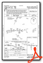
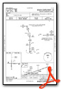
Instrument Approach Procedure (IAP) Charts
Nearby Airports with Instrument Procedures
| ID | Name | Heading / Distance | ||
|---|---|---|---|---|
 |
KMOP | Mount Pleasant Municipal Airport | 353° | 18.1 |
|
13C | Lakeview/Griffith Field Airport | 287° | 26.4 |
|
6D6 | Greenville Municipal Airport | 246° | 27.1 |
|
KIKW | Jack Barstow Airport | 042° | 27.7 |
|
Y70 | Ionia County Airport | 215° | 28.3 |
|
KMBS | Mbs International Airport | 064° | 29.4 |
|
48D | Clare Municipal Airport | 355° | 30.8 |
|
KRNP | Owosso Community Airport | 129° | 31.2 |
|
4D0 | Abrams Municipal Airport | 183° | 32.9 |
|
KLAN | Capital Region International Airport | 172° | 32.9 |
|
KHYX | Saginaw County/H W Browne Airport | 079° | 36.7 |
|
3CM | James Clements Municipal Airport | 068° | 37.2 |
Airport Images
 - 2010-07-25")
By: Ton Phanan


