Login
Register


ANB
Anniston Regional Airport
Official FAA Data Effective 2024-04-18 0901Z
Chart Supplement

VFR Chart of KANB
Sectional Charts at SkyVector.com
IFR Chart of KANB
Enroute Charts at SkyVector.com
Location Information for KANB
Coordinates: N33°35.29' / W85°51.49'Located 05 miles SW of Anniston, Alabama on 596 acres of land. View all Airports in Alabama.
Surveyed Elevation is 612 feet MSL.
Operations Data
|
|
Airport Communications
| ASOS: | 119.675 Tel. 256-835-3931 |
|---|---|
| BIRMINGHAM APPROACH: | 132.15 285.45 |
| BIRMINGHAM DEPARTURE: | 132.15 285.45 |
| UNICOM: | 123.000 |
| CTAF: | 123.600 |
| AWOS-3PT at ASN (9.7 W): | 118.425 256-362-5847 |
| AWOS-3P at PLR (19.5 W): | 119.625 (205) 884-4359 |
| AWOS-3PT at GAD (25.8 NW): | 127.825 256-442-7094 |
Nearby Navigation Aids
|
| ||||||||||||||||||||||||||||||||||||||||||||||||||||||||||||


Runway 05/23
| Dimensions: | 7000 x 150 feet / 2134 x 46 meters | |
|---|---|---|
| Surface: | Asphalt / Grooved in Excellent Condition | |
| Weight Limits: | 10 /F/C/X/T, S-28, D-43, ST-260 | |
| Edge Lighting: | High Intensity | |
| Runway 05 | Runway 23 | |
| Coordinates: | N33°34.91' / W85°52.00' | N33°35.67' / W85°50.97' |
| Elevation: | 594.7 | 612.0 |
| Traffic Pattern: | Right | Left |
| Runway Heading: | 48° True | 228° True |
| Markings: | Precision Instrument in good condition. | Non-Precision Instrument in good condition. |
| Glide Slope Indicator | P4L (3.00° Glide Path Angle) | P4L (3.00° Glide Path Angle) |
| Approach Lights: | MALSR 1,400 Foot Medium-intensity Approach Lighting System with runway alignment indicator lights. | |
| REIL: | Yes | |
| Obstacles: | 40 ft Trees 2180 ft from runway, 75 ft left of center | |
Services Available
| Fuel: | 100LL (blue), Jet-A |
|---|---|
| Transient Storage: | Hangars,Tiedowns |
| Airframe Repair: | MAJOR |
| Engine Repair: | MAJOR |
| Bottled Oxygen: | HIGH/LOW |
| Bulk Oxygen: | NOT AVAILABLE |
| Other Services: | AVIONICS |
Ownership Information
| Ownership: | Publicly owned | |
|---|---|---|
| Owner: | CITY OF ANNISTON | |
| P.O. BOX 2185 | ||
| ANNISTON, AL 36202 | ||
| 256-831-4410 | ||
| Manager: | DAVID ARNETT | |
| BOX 2168 | ||
| ANNISTON, AL 36202 | ||
| (256) 241-7171 | ||
Operational Statistics
| Single Engine Aircraft Based on Field: | 19 | Statistics collected for 12 month period ending 2020-02-29 | |
|---|---|---|---|
| Multi-Engine Aircraft Based on Field: | 5 | Annual Commercial Operations: | 6 |
| Jet Aircraft Based on Field: | 2 | Annual Commuter Operations: | none |
| Helicopters Based on Field: | none | Annual Air Taxi Operations: | 4812 |
| Military Aircraft Based on Field: | none | Annual Military Operations: | 762 |
| Gliders Based on Field: | none | Annual GA Local Operations: | 2331 |
| Ultralights Based on Field: | none | Annual GA Itinerant Operations: | 15221 |
Other Remarks
- THIS AIRPORT HAS BEEN SURVEYED BY THE NATIONAL GEODETIC SURVEY.
- BIRDS ON AND INVOF RWY.
- FOR CD CTC BIRMINGHAM APCH AT 205-769-3890.
- CLSD TO SKED ACR OPS WITH MORE THAN 9 PAX SEATS & UNSKED ACR OPS WITH MORE THAN 30 PAX SEATS.
- 0LL AFT HR FUEL - 256-831-4410; SVC FEE 1800-0730.
- ACTVT MALSR RWY 05; REIL RWY 23; PAPI RWY 05 & 23, HIRL RWY 05/23 - CTAF.
Weather Minimums

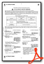
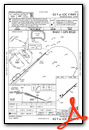
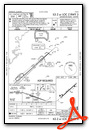
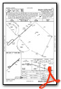
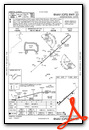
Instrument Approach Procedure (IAP) Charts
Nearby Airports with Instrument Procedures
| ID | Name | Heading / Distance | ||
|---|---|---|---|---|
 |
KASN | Talladega Municipal Airport | 263° | 9.7 |
|
KPLR | St Clair County Airport | 264° | 19.7 |
|
KGAD | Northeast Alabama Regional Airport | 333° | 25.8 |
|
KPYP | Centre-Piedmont-Cherokee County Regional Airport | 022° | 32.5 |
|
KSCD | Merkel Field Sylacauga Municipal Airport | 222° | 33.6 |
|
20A | Robbins Field Airport | 311° | 34.8 |
|
KCTJ | West Georgia Regional - O V Gray Field Airport | 085° | 35.5 |
|
KALX | Thomas C Russell Field Airport | 187° | 40.7 |
|
8A0 | Albertville Regional/Thomas J Brumlik Field Airport | 332° | 43.2 |
|
4A4 | Polk County/Cornelius Moore Field Airport | 053° | 44.0 |
|
KBHM | Birmingham-Shuttlesworth International Airport | 268° | 44.8 |
|
KPUJ | Paulding Northwest Atlanta Airport | 066° | 49.8 |
Airport Images
Do you have a recent image of this airport? Upload it here!


