Login
Register


AOH
Lima Allen County Airport
Official FAA Data Effective 2024-04-18 0901Z
Chart Supplement

VFR Chart of KAOH
Sectional Charts at SkyVector.com
IFR Chart of KAOH
Enroute Charts at SkyVector.com
Location Information for KAOH
Coordinates: N40°42.45' / W84°1.62'Located 05 miles SE of Lima, Ohio on 696 acres of land. View all Airports in Ohio.
Surveyed Elevation is 975 feet MSL.
Operations Data
|
|
Airport Communications
| ASOS: | 128.725 Tel. 419-224-6098 |
|---|---|
| COLUMBUS APPROACH: | 121.825 323.15 |
| COLUMBUS DEPARTURE: | 134.45 323.15 |
| UNICOM: | 122.700 |
| CTAF: | 122.700 |
| AWOS-3PT at AXV (17.6 SW): | 128.325 419-753-2821 |
| AWOS-3 at I95 (18.6 E): | 126.4 419-675-0781 |
| AWOS-3 at OWX (19.7 N): | 120.525 419-523-4151 |
Nearby Navigation Aids
|
| ||||||||||||||||||||||||||||||||||||||||||||||||||||||||||||


Runway 10/28
| Dimensions: | 6000 x 150 feet / 1829 x 46 meters | |
|---|---|---|
| Surface: | Asphalt / Grooved in Good Condition | |
| Weight Limits: | D-60 | |
| Edge Lighting: | High Intensity | |
| Runway 10 | Runway 28 | |
| Coordinates: | N40°42.42' / W84°2.34' | N40°42.42' / W84°1.04' |
| Elevation: | 949.3 | 975.3 |
| Traffic Pattern: | Left | Left |
| Runway Heading: | 90° True | 270° True |
| Markings: | Non-Precision Instrument in good condition. | Precision Instrument in good condition. |
| Glide Slope Indicator | P4L (3.00° Glide Path Angle) | P4L (3.00° Glide Path Angle) |
| REIL: | Yes | Yes |
| Obstacles: | 73 ft Trees 2156 ft from runway, 105 ft left of center | 44 ft Tree 1687 ft from runway, 360 ft left of center |
Services Available
| Fuel: | 100LL (blue), Jet A-1+ |
|---|---|
| Transient Storage: | Hangars,Tiedowns |
| Airframe Repair: | MAJOR |
| Engine Repair: | MAJOR |
| Bottled Oxygen: | NONE |
| Bulk Oxygen: | NONE |
| Other Services: | AVIONICS,PILOT INSTRUCTION,AIRCRAFT RENTAL,AIRCRAFT SALES |
Ownership Information
| Ownership: | Publicly owned | |
|---|---|---|
| Owner: | ALLEN COUNTY RGNL ARPT AUTH | |
| PO BOX 1401 | ||
| LIMA, OH 45802-1401 | ||
| 419-227-3225 | ||
| Manager: | JOSH TATTRIE | |
| 700 AIRPORT DR | ||
| LIMA, OH 45804-4201 | ||
| 419-227-3225 | CELL 567-712-9529. | |
Operational Statistics
| Single Engine Aircraft Based on Field: | 35 | Statistics collected for 12 month period ending 2022-08-11 | |
|---|---|---|---|
| Multi-Engine Aircraft Based on Field: | 6 | Annual Commercial Operations: | none |
| Jet Aircraft Based on Field: | 1 | Annual Commuter Operations: | none |
| Helicopters Based on Field: | none | Annual Air Taxi Operations: | 6000 |
| Military Aircraft Based on Field: | none | Annual Military Operations: | 500 |
| Gliders Based on Field: | none | Annual GA Local Operations: | 20000 |
| Ultralights Based on Field: | none | Annual GA Itinerant Operations: | 6000 |
Other Remarks
- FOR CD CTC COLUMBUS APCH ON FREQ, IF UNA CALL 614-338-8537.
- DEER, BIRDS, & OTR WILDLIFE ON & INVOF ARPT.
- 0LL FUEL AVBL H24.
- + CALL AHD FOR FUEL AFT HRS SUBJ CALL-IN FEE.
- ACTVT REIL RWY 10 & 28; HIRL RWY 10/28 - CTAF. PAPI RWY 10 & 28 OPR CONSLY.
Weather Minimums

Instrument Approach Procedure (IAP) Charts
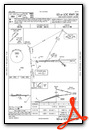
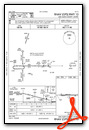
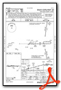
Nearby Airports with Instrument Procedures
| ID | Name | Heading / Distance | ||
|---|---|---|---|---|
 |
5G7 | Bluffton Airport | 034° | 12.9 |
|
KAXV | Neil Armstrong Airport | 224° | 17.8 |
|
I95 | Hardin County Airport | 108° | 18.4 |
|
KOWX | Putnam County Airport | 005° | 19.8 |
|
KEDJ | Bellefontaine Regional Airport | 154° | 22.2 |
|
KFDY | Findlay Airport | 041° | 24.5 |
|
KCQA | Lakefield Airport | 241° | 27.7 |
|
KVNW | Van Wert County Airport | 289° | 28.0 |
|
KSCA | Sidney Municipal Airport | 191° | 28.5 |
|
56D | Wyandot County Airport | 071° | 34.1 |
|
I17 | Piqua/Hartzell Field Airport | 201° | 35.0 |
|
I74 | Grimes Field Airport | 159° | 36.7 |
Airport Images

By: btracy62


