Login
Register


AOO
Altoona/Blair County Airport
Official FAA Data Effective 2024-03-21 0901Z
Chart Supplement

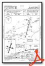
VFR Chart of KAOO
Sectional Charts at SkyVector.com
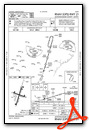
IFR Chart of KAOO
Enroute Charts at SkyVector.com
Location Information for KAOO
Coordinates: N40°17.78' / W78°19.20'Located 12 miles S of Altoona, Pennsylvania on 320 acres of land. View all Airports in Pennsylvania.
Surveyed Elevation is 1503 feet MSL.
Operations Data
|
|
Airport Communications
| ASOS: | 127.125 Tel. 814-793-9655 |
|---|---|
| JOHNSTOWN APPROACH: | 121.2 299.2 |
| JOHNSTOWN DEPARTURE: | 121.2 299.2 |
| CTAF: | 123.600 |
| UNICOM: | 123.000 |
| AWOS-3 at HMZ (15.5 SW): | 123.675 814-623-2936 |
| ASOS at JST (23.6 W): | 814-535-3511 |
| ATIS at JST (23.6 W): | 118.325 |
- APCH/DEP SVC PRVDD BY CLEVELAND ARTCC (ZOB) ON FREQS 124.4/299.2 (ALTOONA RCAG) WHEN JOHNSTOWN APCH CTL CLSD.
Nearby Navigation Aids
|
| ||||||||||||||||||||||||||||||||||||||||||||||||||||||||||||


Runway 03/21
| Dimensions: | 5465 x 100 feet / 1666 x 30 meters | |
|---|---|---|
| Surface: | Asphalt / Grooved in Good Condition | |
| Weight Limits: | 13 /F/B/X/T, S-16, D-44 | |
| Edge Lighting: | High Intensity RY 03/21, THRESHOLD LGTS & EDGE LGTS OTS EXCEPT WITH PCL, AVBL FM 0100-1300Z DAILY. | |
| Runway 03 | Runway 21 | |
| Coordinates: | N40°17.32' / W78°19.39' | N40°18.19' / W78°19.06' |
| Elevation: | 1503.4 | 1469.3 |
| Traffic Pattern: | Left | Left |
| Runway Heading: | 16° True | 196° True |
| Declared Distances: | TORA:5465 TODA:5465 ASDA:5465 LDA:5465 | TORA:5465 TODA:5465 ASDA:5465 LDA:5465 |
| Markings: | Non-Precision Instrument in good condition. | Precision Instrument in good condition. |
| Glide Slope Indicator | P4L (3.00° Glide Path Angle) | P4L (3.00° Glide Path Angle) |
| Approach Lights: | MALSR 1,400 Foot Medium-intensity Approach Lighting System with runway alignment indicator lights. | |
| REIL: | Yes | |
| Obstacles: | 47 ft Trees 904 ft from runway, 522 ft left of center | 72 ft Trees 1949 ft from runway, 687 ft right of center |
Runway 12/30
| Dimensions: | 3668 x 75 feet / 1118 x 23 meters | |
|---|---|---|
| Surface: | Asphalt in Good Condition | |
| Weight Limits: | 11 /F/B/X/T, S-11, D-33 | |
| Edge Lighting: | Medium Intensity RY 12/30, THRESHOLD LGTS & EDGE LGTS OTS EXCEPT WITH PCL, AVBL FM 0100-1300Z DAILY. | |
| Runway 12 | Runway 30 | |
| Coordinates: | N40°17.92' / W78°19.54' | N40°17.73' / W78°18.79' |
| Elevation: | 1472.8 | 1481.5 |
| Traffic Pattern: | Left | Left |
| Runway Heading: | 108° True | 288° True |
| Declared Distances: | TORA:3668 TODA:3668 ASDA:3668 LDA:3668 | TORA:3668 TODA:3668 ASDA:3668 LDA:3668 |
| Markings: | Basic in good condition. | Non-Precision Instrument in good condition. |
| Glide Slope Indicator | P4L (3.00° Glide Path Angle) | P4R (4.00° Glide Path Angle) |
| REIL: | Yes | Yes |
| Obstacles: | 43 ft Trees 919 ft from runway, 287 ft left of center | 16 ft Tree 401 ft from runway, 17 ft left of center HAS + 4 FT GND 20 FT FM RY END 215 FT RIGHT. |
Services Available
| Fuel: | 100LL (blue), Jet-A |
|---|---|
| Transient Storage: | Hangars,Tiedowns |
| Airframe Repair: | MAJOR |
| Engine Repair: | MAJOR |
| Bottled Oxygen: | HIGH |
| Bulk Oxygen: | HIGH |
| Other Services: | AVIONICS,CARGO HANDLING SERVICES,CHARTER SERVICE,PILOT INSTRUCTION,AIRCRAFT RENTAL,AIRCRAFT SALES |
Ownership Information
| Ownership: | Publicly owned | |
|---|---|---|
| Owner: | BLAIR COUNTY AIRPORT AUTH | |
| 310 AIRPORT DRIVE, SUITE 6 | ||
| MARTINSBURG, PA 16662 | ||
| (814) 793-2027 | ||
| Manager: | TRACY PLESSINGER | |
| 310 AIRPORT DRIVE, SUITE 6 | ||
| MARTINSBURG, PA 16662 | ||
| 814-793-2027 | ||
Operational Statistics
| Single Engine Aircraft Based on Field: | 23 | Statistics collected for 12 month period ending 2022-03-31 | |
|---|---|---|---|
| Multi-Engine Aircraft Based on Field: | 4 | Annual Commercial Operations: | none |
| Jet Aircraft Based on Field: | 1 | Annual Commuter Operations: | none |
| Helicopters Based on Field: | none | Annual Air Taxi Operations: | 5150 |
| Military Aircraft Based on Field: | none | Annual Military Operations: | 100 |
| Gliders Based on Field: | none | Annual GA Local Operations: | 4500 |
| Ultralights Based on Field: | none | Annual GA Itinerant Operations: | 14000 |
Other Remarks
- PREFERRED RWY IS RWY 21; FOR NOISE ABATEMENT WHEN DEP RWY 03 MAINT RWY HDG TIL 2 NM N OF ARPT.
- SPECIALIZED ACFT (ULTRALGT, HOMEBUILT, ETC) CTC AMGR 814-793-2027 OR UNICOM PRIOR TO LDG.
- RWY/TWY CONDITIONS UNMONITORED OUTSIDE OF NML ATTENDANCE HRS.
- FOR CD CTC JOHNSTOWN APCH AT 814-532-5960, WHEN APCH CLSD CTC CLEVELAND ARTCC AT 440-774-0213.
- EXCP FOR TAXI, RWY 12/30 NOT AVBL FOR SKED ACR OPNS WITH MORE THAN 9 PAX AND UNSKED FOR ACR OPNS WITH MORE THAN 30 PAX.
- HIRL RY 03/21 & MIRL RY 12/30 PRESET LOW INTST, INCR INTST & ACTVT PAPI RYS 12, 30, 03 & 21, MALSR RY 21 & REIL RYS 03, 12, & 30 - CTAF.
Weather Minimums
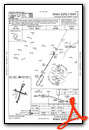
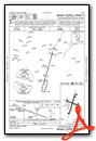
Instrument Approach Procedure (IAP) Charts
Nearby Airports with Instrument Procedures
| ID | Name | Heading / Distance | ||
|---|---|---|---|---|
 |
KHMZ | Bedford County Airport | 215° | 15.4 |
|
9G8 | Ebensburg Airport | 295° | 23.1 |
|
KJST | John Murtha Johnstown/Cambria County Airport | 272° | 23.7 |
|
2G9 | Somerset County Airport | 244° | 35.5 |
|
N68 | Franklin County Regional Airport | 121° | 36.7 |
|
KPSB | Mid-State Airport | 016° | 36.8 |
|
W35 | Potomac Airpark Airport | 168° | 36.9 |
|
KRVL | Mifflin County Airport | 054° | 39.1 |
|
KUNV | State College Regional Airport | 032° | 39.6 |
|
KIDI | Indiana County/Jimmy Stewart Field Airport | 299° | 41.0 |
|
N96 | Bellefonte Airport | 032° | 42.2 |
|
KHGR | Hagerstown Regional/Richard A Henson Field Airport | 141° | 44.6 |


