Login
Register


ARW
Beaufort Exec Airport
Official FAA Data Effective 2024-04-18 0901Z
Chart Supplement

VFR Chart of KARW
Sectional Charts at SkyVector.com
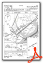
IFR Chart of KARW
Enroute Charts at SkyVector.com
Location Information for KARW
Coordinates: N32°24.73' / W80°38.06'Located 03 miles SE of Beaufort, South Carolina on 110 acres of land. View all Airports in South Carolina.
Surveyed Elevation is 9 feet MSL.
Operations Data
|
|
Airport Communications
| AWOS-3: | 119.675 Tel. 843-524-1000 |
|---|---|
| BEAUFORT APPROACH: | 125.125 292.125 |
| BEAUFORT DEPARTURE: | 125.125 292.125 |
| CLEARANCE DELIVERY: | 121.725 |
| CTAF: | 122.700 |
| UNICOM: | 122.700 |
| ATIS at NBC (5.9 NW): | 279.525 |
| AWOS-3P at HXD (11.6 S): | 121.4 843-342-5072 |
| ATIS at HXD (11.7 S): | 121.4 |
- APCH/DEP SVC PRVDD BY JACKSONVILLE ARTCC (SAVANNAH RCAG) ON FREQS 132.925/363.2 WHEN BEAUFORT APCH CTL CLSD.
Nearby Navigation Aids
|
| ||||||||||||||||||||||||||||||||||||||||||||||||||||||||||||


Runway 07/25
| Dimensions: | 3434 x 75 feet / 1047 x 23 meters | |
|---|---|---|
| Surface: | Asphalt in Good Condition | |
| Weight Limits: | 13 /F/C/X/T, S-35, D-52 | |
| Edge Lighting: | Medium Intensity | |
| Runway 07 | Runway 25 | |
| Coordinates: | N32°24.59' / W80°38.35' | N32°24.87' / W80°37.77' |
| Elevation: | 9.0 | 7.2 |
| Traffic Pattern: | Right | Left |
| Runway Heading: | 60° True | 240° True |
| Markings: | Non-Precision Instrument in good condition. | Non-Precision Instrument in good condition. |
| Glide Slope Indicator | P2L (3.05° Glide Path Angle) | P2L (3.00° Glide Path Angle) |
| REIL: | Yes | |
| Obstacles: | 64 ft Pole 1677 ft from runway, 226 ft left of center | |
Services Available
| Fuel: | 100LL (blue), Jet-A |
|---|---|
| Transient Storage: | Tiedowns |
| Airframe Repair: | NOT AVAILABLE |
| Engine Repair: | NOT AVAILABLE |
| Bottled Oxygen: | NONE |
| Bulk Oxygen: | NONE |
| Other Services: | PILOT INSTRUCTION,AIRCRAFT RENTAL |
Ownership Information
| Ownership: | Publicly owned | |
|---|---|---|
| Owner: | COUNTY OF BEAUFORT | |
| PO DRAWER 1228 | ||
| BEAUFORT, SC 29901 | ||
| 843-525-7151 | ||
| Manager: | PAUL DOLIN | |
| 39 AIRPORT CIRCLE | ||
| BEAUFORT, SC 29907 | ||
| 843-962-2142 | ||
Operational Statistics
| Single Engine Aircraft Based on Field: | 40 | Statistics collected for 12 month period ending 2023-03-28 | |
|---|---|---|---|
| Multi-Engine Aircraft Based on Field: | 7 | Annual Commercial Operations: | none |
| Jet Aircraft Based on Field: | none | Annual Commuter Operations: | none |
| Helicopters Based on Field: | 4 | Annual Air Taxi Operations: | 472 |
| Military Aircraft Based on Field: | none | Annual Military Operations: | none |
| Gliders Based on Field: | none | Annual GA Local Operations: | 9449 |
| Ultralights Based on Field: | none | Annual GA Itinerant Operations: | 8079 |
Other Remarks
- DEER, SEAGULLS & GEESE ON & INVOF ARPT.
- PLINES 100 FT LOCATED 2400 FT SW AER RY 7.
- FOR CD CTC BEAUFORT APCH AT 843-228-6298, WHEN APCH CLSD CTC JACKSONVILLE ARTCC AT 904-845-1592.
- 0LL FUEL 24 HR CREDIT CARD SVC AVBL.
- MIRL RWY 07/25 PRESET LOW INTST; TO INCR INTST - CTAF.
Weather Minimums

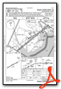
Instrument Approach Procedure (IAP) Charts
Nearby Airports with Instrument Procedures
| ID | Name | Heading / Distance | ||
|---|---|---|---|---|
 |
KHXD | Hilton Head Airport | 195° | 11.7 |
|
KRBW | Lowcountry Regional Airport | 359° | 30.5 |
|
KSAV | Savannah/Hilton Head International Airport | 239° | 33.5 |
|
KSVN | Hunter AAF Airport | 227° | 35.5 |
|
KJZI | Charleston Exec Airport | 061° | 36.4 |
|
KCHS | Charleston AFB/International Airport | 045° | 41.9 |
|
KDYB | Summerville Airport | 024° | 42.8 |
|
6J2 | St George Airport | 007° | 47.3 |
|
KAQX | Allendale County Airport | 317° | 47.5 |
|
KJYL | Plantation Airpark Airport | 286° | 50.8 |
|
KLRO | Mt Pleasant Regional-Faison Field Airport | 055° | 52.0 |
|
KMKS | Berkeley County Airport | 032° | 55.3 |
Airport Images
Do you have a recent image of this airport? Upload it here!


