Login
Register


AVQ
Marana Regional Airport
Official FAA Data Effective 2024-04-18 0901Z
Chart Supplement

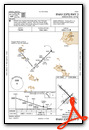
VFR Chart of KAVQ
Sectional Charts at SkyVector.com
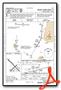
IFR Chart of KAVQ
Enroute Charts at SkyVector.com
Location Information for KAVQ
Coordinates: N32°24.57' / W111°13.10'Located 15 miles NW of Marana, Arizona on 630 acres of land. View all Airports in Arizona.
Surveyed Elevation is 2031 feet MSL.
Operations Data
|
|
Airport Communications
| AWOS-3: | 118.375 Tel. 520-682-1397 |
|---|---|
| TUCSON APPROACH: | 119.4 318.1 |
| TUCSON DEPARTURE: | 119.4 318.1 |
| UNICOM: | 123.000 |
| CTAF: | 123.000 |
| AWOS-3PT at MZJ (8.6 NW): | 130.375 520-682-3519 |
| ATIS at RYN (16.2 S): | 133.35 |
| AWOS-3 at RYN (16.2 S): | 133.35 520-578-0269 |
Nearby Navigation Aids
|
| ||||||||||||||||||||||||||||||||||||||||||||||||


Runway 12/30
RWY 12 CALM WIND RWY. | ||
| Dimensions: | 6901 x 100 feet / 2103 x 30 meters | |
|---|---|---|
| Surface: | Asphalt in Good Condition | |
| Weight Limits: | S-75, D-100, ST-300 | |
| Edge Lighting: | Medium Intensity | |
| Runway 12 | Runway 30 | |
| Coordinates: | N32°25.06' / W111°13.57' | N32°24.25' / W111°12.63' |
| Elevation: | 2010.6 | 2031.4 |
| Traffic Pattern: | Left | Right |
| Runway Heading: | 135° True | 315° True |
| Markings: | Non-Precision Instrument in good condition. | Non-Precision Instrument in good condition. |
| Glide Slope Indicator | P4L (3.06° Glide Path Angle) | P4L (3.41° Glide Path Angle) PAPI UNUSBL BYD 3.5 NM DUE TO TRRN. |
| REIL: | Yes | Yes |
Runway 03/21
| Dimensions: | 3892 x 75 feet / 1186 x 23 meters | |
|---|---|---|
| Surface: | Asphalt in Good Condition | |
| Weight Limits: | S-75, D-100, ST-150 | |
| Edge Lighting: | Medium Intensity | |
| Runway 03 | Runway 21 | |
| Coordinates: | N32°24.21' / W111°13.37' | N32°24.66' / W111°12.83' |
| Elevation: | 2019.0 | 2024.6 |
| Traffic Pattern: | Right | Left |
| Runway Heading: | 45° True | 225° True |
| Displaced Threshold: | 494 Feet | |
| Markings: | Basic in good condition. | Basic in good condition. |
| Glide Slope Indicator | P2L (2.91° Glide Path Angle) | P2L (2.91° Glide Path Angle) PAPI UNUSBL BYD 7.0 NM DUE TO TRRN. |
| REIL: | Yes | Yes |
| Obstacles: | 15 ft Road 200 ft from runway, 250 ft right of center APCH RATIO 50:1 TO DTHR. |
13 ft Brush 225 ft from runway, 150 ft right of center |
Services Available
| Fuel: | 100LL (blue), Jet-A |
|---|---|
| Transient Storage: | Hangars,Tiedowns FOR AVBLTY - 520-682-2999. |
| Airframe Repair: | MAJOR |
| Engine Repair: | MINOR |
| Bottled Oxygen: | HIGH |
| Bulk Oxygen: | NOT AVAILABLE |
| Other Services: | PILOT INSTRUCTION,PARACHUTE JUMP ACTIVITY,AIRCRAFT RENTAL |
Ownership Information
| Ownership: | Publicly owned | |
|---|---|---|
| Owner: | TOWN OF MARANA | |
| 11555 W. CIVIC CENTER DRIVE | ||
| MARANA, AZ 85653 | ||
| 520-382-1999 | ||
| Manager: | GALEN BEEM | |
| 11700 W. AVRA VALLEY RD, #91, TOWN OF MARANA | ||
| MARANA, AZ 85653 | ||
| 520-382-8053 | 520-382-2607 | |
Operational Statistics
| Single Engine Aircraft Based on Field: | 165 | Statistics collected for 12 month period ending 2023-04-15 | |
|---|---|---|---|
| Multi-Engine Aircraft Based on Field: | 15 | Annual Commercial Operations: | none |
| Jet Aircraft Based on Field: | 2 | Annual Commuter Operations: | none |
| Helicopters Based on Field: | none | Annual Air Taxi Operations: | 10000 |
| Military Aircraft Based on Field: | none | Annual Military Operations: | 20252 |
| Gliders Based on Field: | 1 | Annual GA Local Operations: | 30000 |
| Ultralights Based on Field: | 10 | Annual GA Itinerant Operations: | 30000 |
Other Remarks
- AEROBATIC ACT 2 MI SE SFC-7000 FT MSL; HIGH & LOW LEVEL PRCHT TRNG NW QUAD.
- FOR CD CTC TUCSON APCH AT 520-829-6121.
- PREF TFC PAT ALT 3000 FT MSL, LIGHT ACFT; 3500 FT MSL, HEAVY ACFT.
- FRMN FLT PPR WI 5 NM - AMGR.
- SELF SVC CREDIT CARD FUEL H24. AFT HR CALL OUT FEE - 520-730-4318.
- HOT AIR BALLON OPS NA.
- HEL LND SE HELIPAD ONLY; FUEL & TERM RAMP LNDG NA.
- ACTVT REIL RWY 12 & 30; MIRL RWY 03/21 & 12/30 - CTAF. PAPI RWY 03, 12, 21 & 30 ON CONSLY.
Weather Minimums
Instrument Approach Procedure (IAP) Charts


Nearby Airports with Instrument Procedures
| ID | Name | Heading / Distance | ||
|---|---|---|---|---|
 |
KRYN | Ryan Field Airport | 172° | 16.2 |
|
KDMA | Davis Monthan AFB Airport | 130° | 22.4 |
|
KTUS | Tucson International Airport | 141° | 22.5 |
|
P08 | Coolidge Municipal Airport | 341° | 33.2 |
|
KCGZ | Casa Grande Municipal Airport | 319° | 42.9 |
|
KIWA | Phoenix-Mesa Gateway Airport | 337° | 58.1 |
|
KCHD | Chandler Municipal Airport | 329° | 59.6 |
|
KOLS | Nogales International Airport | 162° | 62.3 |
|
P13 | San Carlos Apache Airport | 026° | 63.0 |
|
P19 | Stellar Airpark Airport | 326° | 63.9 |
|
KFHU | Sierra Vista Municipal-Libby AAF Airport | 137° | 66.4 |
|
P33 | Cochise County Airport | 097° | 68.0 |
Airport Images
 taken from the west looking east, early afternoon.")
By: keeganmiller


