Login
Register


AXS
Altus/Quartz Mountain Regional Airport
Official FAA Data Effective 2024-03-21 0901Z
Chart Supplement

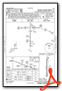
VFR Chart of KAXS
Sectional Charts at SkyVector.com
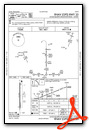
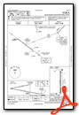
IFR Chart of KAXS
Enroute Charts at SkyVector.com
Location Information for KAXS
Coordinates: N34°41.93' / W99°20.31'Located 03 miles N of Altus, Oklahoma on 434 acres of land. View all Airports in Oklahoma.
Surveyed Elevation is 1433 feet MSL.
Operations Data
|
|
Airport Communications
| AWOS-3PT: | 118.825 Tel. 580-477-1745 |
|---|---|
| ALTUS APPROACH: | 125.1 353.7 |
| ALTUS DEPARTURE: | 125.1 290.9 |
| UNICOM: | 122.800 |
| CTAF: | 122.800 |
| ATIS at LTS (4.0 SE): | 109.8 |
| ASOS at HBR (22.6 NE): | 133.325 580-726-6651 |
| ASOS at FDR (27.2 SE): | 132.675 580-335-7591 |
- APCH/DEP CTL SVC PRVDD BY FORT WORTH ARTCC (ZFW) ON FREQS 128.4/269.375 (CLINTON-SHERMAN RCAG) & 133.5/350.35 (WICHITA FALLS NR 2 RCAG) WHEN ALTUS APCH CTL (LTS) CLSD.
Nearby Navigation Aids
|
| ||||||||||||||||||||||||||||||||||||||||||


Runway 17/35
| Dimensions: | 5501 x 75 feet / 1677 x 23 meters | |
|---|---|---|
| Surface: | Concrete in Good Condition | |
| Weight Limits: | S-30, D-48, ST-90 | |
| Edge Lighting: | Medium Intensity | |
| Runway 17 | Runway 35 | |
| Coordinates: | N34°42.38' / W99°20.31' | N34°41.47' / W99°20.31' |
| Elevation: | 1433.2 | 1412.7 |
| Traffic Pattern: | Right | Left |
| Runway Heading: | 180° True | 360° True |
| Markings: | Non-Precision Instrument in good condition. | Non-Precision Instrument in good condition. |
| Glide Slope Indicator | P4L (3.00° Glide Path Angle) | P4L (3.00° Glide Path Angle) |
| Approach Lights: | ODALS Omnidirectional Approach Lighting System | |
| REIL: | Yes | |
Services Available
| Fuel: | 100LL (blue), Jet A+ |
|---|---|
| Transient Storage: | Hangars,Tiedowns |
| Airframe Repair: | MAJOR |
| Engine Repair: | MAJOR |
| Bottled Oxygen: | NONE |
| Bulk Oxygen: | NONE |
| Other Services: | AIR AMBULANCE SERVICES,PILOT INSTRUCTION,AIRCRAFT RENTAL,AIRCRAFT SALES |
Ownership Information
| Ownership: | Publicly owned | |
|---|---|---|
| Owner: | CITY OF ALTUS | |
| 509 S. MAIN | ||
| ALTUS, OK 73521 | ||
| 580-477-1950 | ||
| Manager: | DANIEL ADAMS | |
| 509 S. MAIN | ||
| ALTUS, OK 73521 | ||
| 580-482-8833 | ||
Operational Statistics
| Single Engine Aircraft Based on Field: | 26 | Statistics collected for 12 month period ending 2023-08-17 | |
|---|---|---|---|
| Multi-Engine Aircraft Based on Field: | none | Annual Commercial Operations: | none |
| Jet Aircraft Based on Field: | none | Annual Commuter Operations: | none |
| Helicopters Based on Field: | 3 | Annual Air Taxi Operations: | none |
| Military Aircraft Based on Field: | none | Annual Military Operations: | 50 |
| Gliders Based on Field: | none | Annual GA Local Operations: | 4379 |
| Ultralights Based on Field: | none | Annual GA Itinerant Operations: | 4043 |
Other Remarks
- THIS AIRPORT HAS BEEN SURVEYED BY THE NATIONAL GEODETIC SURVEY.
- DO NOT MISTAKE ARPT FOR ALTUS AFB 4 MI SE.
- MIL JET, AGRICULTURAL & ULTRALIGHT ACT ON & INVOF ARPT.
- 320 FT TWR 2.6 MI S.
- FOR CD CTC FORT WORTH ARTCC AT 817-858-7584.
- ACTVT ODALS RWY 17; REIL RWY 35; MIRL RWY 17/35 - CTAF. PAPI RWY 17 & 35 ON CONSLY.
Weather Minimums
Instrument Approach Procedure (IAP) Charts
Nearby Airports with Instrument Procedures
| ID | Name | Heading / Distance | ||
|---|---|---|---|---|
 |
KLTS | Altus AFB Airport | 117° | 4.0 |
|
2K4 | Scott Field Airport | 321° | 14.9 |
|
KHBR | Hobart Regional Airport | 038° | 22.4 |
|
KFDR | Frederick Regional Airport | 139° | 27.2 |
|
O35 | Hollis Municipal Airport | 270° | 28.2 |
|
F05 | Wilbarger County Airport | 174° | 28.5 |
|
KCSM | Clinton/Sherman Airport | 010° | 39.0 |
|
KELK | Elk City Regional Business Airport | 356° | 43.9 |
|
KLAW | Lawton-Fort Sill Regional Airport | 099° | 46.3 |
|
KCDS | Childress Municipal Airport | 251° | 49.7 |
|
KCLK | Clinton Regional Airport | 021° | 54.1 |
|
KSPS | Sheppard AFB/Wichita Falls Municipal Airport | 135° | 59.8 |
Fuel Providers

Airport Images

By: kaxs


