Login
Register


B21
Sugarloaf Regional Airport
Official FAA Data Effective 2024-04-18 0901Z
Chart Supplement

VFR Chart of B21
Sectional Charts at SkyVector.com
IFR Chart of B21
Enroute Charts at SkyVector.com
Location Information for B21
Coordinates: N45°5.12' / W70°12.98'Located 01 miles N of Carrabassett, Maine on 65 acres of land. View all Airports in Maine.
Surveyed Elevation is 880 feet MSL.
Operations Data
|
|
Airport Communications
| AWOS-AV: | 120.0 |
|---|---|
| CTAF: | 122.800 |
| UNICOM: | 122.800 |
| AWOS-3PT at 8B0 (19.8 W): | 118.000 207-864-5250 |
| AWOS-AV at OWK (26.7 SE): | 123.075 |
| AWOS-AV at ME23 (27.6 S): | 122.8 207-779-3105 |
- APCH/DEP SVC PRVDD BY BOSTON ARTCC ON FREQS 120.25/346.4 (BANGOR RCAG).
Nearby Navigation Aids
|
| ||||||||||||||||||||||||||||||||||||||||||||||||||||||||||||


Runway 17/35
| Dimensions: | 2797 x 75 feet / 853 x 23 meters | |
|---|---|---|
| Surface: | Asphalt in Good Condition | |
| Weight Limits: | S-12 | |
| Runway 17 | Runway 35 | |
| Coordinates: | N45°5.32' / W70°13.14' | N45°4.92' / W70°12.81' |
| Elevation: | 880.0 | 856.9 |
| Traffic Pattern: | Left | Left |
| Runway Heading: | 149° True | 329° True |
| Displaced Threshold: | 89 Feet | |
| Markings: | Basic in poor condition. | Basic in poor condition. |
| Obstacles: | 10 ft Road 200 ft from runway, 85 ft left of center +10 FT ROADWAY 100-200 FT FM THR, 85-125 FT L OF CNTRLN. |
53 ft Building 316 ft from runway, 160 ft right of center |
Services Available
| Fuel: | 100LL (blue), Automotive Gasoline |
|---|---|
| Transient Storage: | Tiedowns BRING OWN TIE DOWN ROPES OR CHAINS. |
| Airframe Repair: | NONE |
| Engine Repair: | NONE |
| Bottled Oxygen: | NONE |
| Bulk Oxygen: | NONE |
Ownership Information
| Ownership: | Publicly owned | |
|---|---|---|
| Owner: | TOWN OF CARRABASSETT | |
| 1001 CARRIAGE RD | ||
| CARRABASSETT VALLEY, ME 04947 | ||
| 207-235-2646 | ||
| Manager: | TOM WALLACE | ADDNL CTC: TOM WALLACE AT TLWCFII@YAHOO.COM. |
| 1001 CARRIAGE RD | ||
| CARRABASSETT VALLEY, ME 04947 | ||
| 207-350-1415 | ||
Operational Statistics
| Single Engine Aircraft Based on Field: | 14 | Statistics collected for 12 month period ending 2022-08-09 | |
|---|---|---|---|
| Multi-Engine Aircraft Based on Field: | none | Annual Commercial Operations: | none |
| Jet Aircraft Based on Field: | none | Annual Commuter Operations: | none |
| Helicopters Based on Field: | none | Annual Air Taxi Operations: | none |
| Military Aircraft Based on Field: | none | Annual Military Operations: | none |
| Gliders Based on Field: | none | Annual GA Local Operations: | 3500 |
| Ultralights Based on Field: | none | Annual GA Itinerant Operations: | 2500 |
Other Remarks
- HIGH TRRN 4237 FT MSL NORTH/EAST/WEST OF ARPT.
- CALL 207-350-1415 TO CK ARPT CONDS.
- RWY 17/35 SNOWMOBILE/ATV TRAIL 40 FT FM WEST SIDE OF RWY, NORTH OF RAMP.
- DEER, MOOSE & TURKEY ON & INVOF ARPT.
- FOR CD CTC BOSTON ARTCC AT 603-879-6859.
- FADED.
- FADED.
Weather Minimums
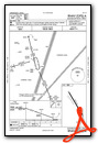
Instrument Approach Procedure (IAP) Charts
Nearby Airports with Instrument Procedures
| ID | Name | Heading / Distance | ||
|---|---|---|---|---|
 |
8B0 | Stephen A Bean Municipal Airport | 253° | 19.9 |
|
M57 | Rangeley Lake Seaplane Base | 247° | 20.6 |
|
KOWK | Central Maine/Norridgewock Airport | 145° | 26.7 |
|
59B | Newton Field Airport | 357° | 32.9 |
|
52B | Moosehead Aero Marine Seaplane Base | 047° | 34.9 |
|
3B1 | Greenville Municipal Airport | 050° | 36.1 |
|
KWVL | Waterville Robert Lafleur Airport | 144° | 40.4 |
|
2B7 | Pittsfield Municipal Airport | 117° | 40.6 |
|
1B0 | Dexter Regional Airport | 096° | 41.9 |
|
0B1 | Bethel Regional Airport | 212° | 47.0 |
|
KAUG | Augusta State Airport | 158° | 49.3 |
|
KBML | Berlin Regional Airport | 233° | 51.1 |
Airport Images
Do you have a recent image of this airport? Upload it here!


