Login
Register


BCB
Virginia Tech/Montgomery Exec Airport
Official FAA Data Effective 2024-04-18 0901Z
Chart Supplement

VFR Chart of KBCB
Sectional Charts at SkyVector.com
IFR Chart of KBCB
Enroute Charts at SkyVector.com
Location Information for KBCB
Coordinates: N37°12.56' / W80°24.73'Located 03 miles S of Blacksburg, Virginia on 248 acres of land. View all Airports in Virginia.
Surveyed Elevation is 2119 feet MSL.
TPA 1000 FT AGL FOR NON TURBINE POWERED ACFT. TPA FOR TURBINE POWERED ACFT 1500 FT AGL.
Operations Data
|
|
Airport Communications
| AWOS-3: | 133.325 Tel. 540-231-4837 |
|---|---|
| ROANOKE APPROACH: | 126.9 339.8 |
| ROANOKE DEPARTURE: | 126.9 339.8 |
| IC: | 126.9 339.8 |
| CLEARANCE DELIVERY: | 124.85 |
| CTAF: | 123.050 |
| UNICOM: | 123.050 |
| AWOS-3 at PSK (13.7 W): | 127.375 540-674-2731 |
| ASOS at ROA (21.9 E): | 540-265-0680 |
| ATIS at ROA (22.0 E): | 132.375 |
Nearby Navigation Aids
|
| ||||||||||||||||||||||||||||||||||||||||||||||||||||||||||||


Runway 13/31
| Dimensions: | 5501 x 100 feet / 1677 x 30 meters | |
|---|---|---|
| Surface: | Asphalt / Grooved in Fair Condition | |
| Edge Lighting: | Medium Intensity | |
| Runway 13 | Runway 31 | |
| Coordinates: | N37°12.77' / W80°25.23' | N37°12.36' / W80°24.22' |
| Elevation: | 2119.2 | 2119.5 |
| Traffic Pattern: | Left | |
| Runway Heading: | 117° True | 297° True |
| Markings: | Non-Precision Instrument in good condition. | Non-Precision Instrument in good condition. |
| Glide Slope Indicator | P4L (3.44° Glide Path Angle) | P2L (3.00° Glide Path Angle) |
| Approach Lights: | ODALS Omnidirectional Approach Lighting System | |
| REIL: | Yes | |
| Obstacles: | 31 ft Sign 1114 ft from runway, 359 ft left of center | 70 ft Brush 2170 ft from runway, 498 ft right of center |
Services Available
| Fuel: | 100LL (blue), Jet A+ |
|---|---|
| Transient Storage: | Tiedowns |
| Airframe Repair: | NONE |
| Engine Repair: | NONE |
| Bottled Oxygen: | NONE |
| Bulk Oxygen: | NONE |
| Other Services: | CHARTER SERVICE,PILOT INSTRUCTION,AIRCRAFT RENTAL |
Ownership Information
| Ownership: | Publicly owned | |
|---|---|---|
| Owner: | VTMRAA | |
| 1601 RESEARCH CENTER DRIVE | ||
| BLACKSBURG, VA 24060 | ||
| 540-231-4444 | ||
| Manager: | KEITH HOLT | |
| 1601 RESEARCH CENTER DRIVE | ||
| BLACKSBURG, VA 24060 | ||
| 540-231-4444 | ||
Operational Statistics
| Single Engine Aircraft Based on Field: | 37 | Statistics collected for 12 month period ending 2019-06-28 | |
|---|---|---|---|
| Multi-Engine Aircraft Based on Field: | 1 | Annual Commercial Operations: | none |
| Jet Aircraft Based on Field: | 3 | Annual Commuter Operations: | none |
| Helicopters Based on Field: | 1 | Annual Air Taxi Operations: | 423 |
| Military Aircraft Based on Field: | none | Annual Military Operations: | 352 |
| Gliders Based on Field: | none | Annual GA Local Operations: | 6700 |
| Ultralights Based on Field: | none | Annual GA Itinerant Operations: | 14425 |
Other Remarks
- OCCASIONAL WILDLIFE ON ARPT.
- VFR DEPARTURES MAINTAIN RWY HEADING UNTIL REACHING 1000 FT AGL.
- NOISE SENSITIVE AREA NORTH OF ARPT.
- ROA TWR SVCS AVBL AT 540-563-1307.
- FOR CD CTC ROANOKE APCH AT 540-563-1307.
- 0LL PPR FOR FUEL WHEN ARPT UNATNDD; PHONE 540-231-4444; FEE FOR AFT HRS.
- ACTVT ODALS RWY 13; REIL RWY 31; PAPI RWY 13 & 31; MIRL RWY 13/31 - CTAF. MIRL RWY 13/31 PRESET LOW INTST.
- TPA 1000 FT AGL FOR NON TURBINE POWERED ACFT. TPA FOR TURBINE POWERED ACFT 1500 FT AGL.
Weather Minimums
Instrument Approach Procedure (IAP) Charts
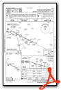

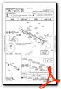
Departure Procedure (DP) Charts
Nearby Airports with Instrument Procedures
| ID | Name | Heading / Distance | ||
|---|---|---|---|---|
 |
KPSK | New River Valley Airport | 251° | 13.5 |
|
KROA | Roanoke/Blacksburg Regional (Woodrum Field) Airport | 071° | 22.0 |
|
KHLX | Twin County Airport | 216° | 33.1 |
|
KBLF | Mercer County Airport | 277° | 38.5 |
|
KLWB | Greenbrier Valley Airport | 000° | 38.9 |
|
KMTV | Blue Ridge Airport | 151° | 39.5 |
|
W91 | Smith Mountain Lake Airport | 098° | 39.8 |
|
KMWK | Mount Airy/Surry County Airport | 188° | 45.3 |
|
KBKW | Raleigh County Memorial Airport | 315° | 48.5 |
|
KMKJ | Mountain Empire Airport | 247° | 48.8 |
|
W90 | New London Airport | 085° | 51.7 |
|
KHSP | Ingalls Field Airport | 031° | 52.3 |
Airport Images

By: Big Orange Bird


