Login
Register


BDQ
Morrilton Municipal Airport
Official FAA Data Effective 2024-04-18 0901Z
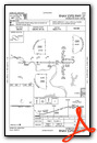
Chart Supplement

VFR Chart of KBDQ
Sectional Charts at SkyVector.com
IFR Chart of KBDQ
Enroute Charts at SkyVector.com
Location Information for KBDQ
Coordinates: N35°8.17' / W92°42.82'Located 02 miles SE of Morrilton, Arkansas on 122 acres of land. View all Airports in Arkansas.
Surveyed Elevation is 321 feet MSL.
Operations Data
|
|
Airport Communications
| UNICOM: | 122.800 |
|---|---|
| CTAF: | 122.800 |
| AWOS-2 at CXW (10.3 SE): | 118.775 501-358-6209 |
| ASOS at RUE (20.0 W): | 132.475 479-968-2267 |
| AWOS-3PT at ORK (29.0 SE): | 123.775 501-906-6529 |
- APCH/DEP SVC PRVDD BY MEMPHIS ARTCC ON FREQS 128.475/377.15 (RUSSELLVILLE RCAG).
Nearby Navigation Aids
|
| ||||||||||||||||||||||||||||||||||||||||||||||||||||||||||||


Runway 09/27
| Dimensions: | 3998 x 75 feet / 1219 x 23 meters | |
|---|---|---|
| Surface: | Asphalt in Good Condition | |
| Weight Limits: | S-4 | |
| Edge Lighting: | Medium Intensity | |
| Runway 09 | Runway 27 | |
| Coordinates: | N35°8.18' / W92°43.22' | N35°8.17' / W92°42.42' |
| Elevation: | 321.4 | 310.1 |
| Runway Heading: | 90° True | 270° True |
| Markings: | Non-Precision Instrument in poor condition. | Non-Precision Instrument in poor condition. |
| Obstacles: | 40 ft Tree 975 ft from runway, 125 ft right of center | 50 ft Trees 1750 ft from runway |
Services Available
| Fuel: | 100LL (blue), Jet A+ |
|---|---|
| Transient Storage: | Hangars,Tiedowns |
| Airframe Repair: | MAJOR |
| Engine Repair: | MAJOR |
| Bottled Oxygen: | NOT AVAILABLE |
| Bulk Oxygen: | NOT AVAILABLE |
| Other Services: | CROP DUSTING SERVICES |
Ownership Information
| Ownership: | Publicly owned | |
|---|---|---|
| Owner: | CITY OF MORRILTON | |
| PO BOX 438 | ||
| MORRILTON, AR 72110 | ||
| 501-354-3484 | ||
| Manager: | GLEN CASTO | |
| 1 AIRPORT ROAD | ||
| MORRILTON, AR 72110 | ||
| (501) 306-5656 | ||
Operational Statistics
| Single Engine Aircraft Based on Field: | 26 | Statistics collected for 12 month period ending 2021-10-31 | |
|---|---|---|---|
| Multi-Engine Aircraft Based on Field: | none | Annual Commercial Operations: | none |
| Jet Aircraft Based on Field: | none | Annual Commuter Operations: | none |
| Helicopters Based on Field: | 1 | Annual Air Taxi Operations: | none |
| Military Aircraft Based on Field: | none | Annual Military Operations: | 400 |
| Gliders Based on Field: | none | Annual GA Local Operations: | 4500 |
| Ultralights Based on Field: | none | Annual GA Itinerant Operations: | 3000 |
Other Remarks
- ULTRALIGHT ACTIVITY ON & INVOF ARPT.
- DEER ON & INVOF ARPT.
- FOR CD CTC MEMPHIS ARTCC AT 901-368-8453/8449.
- FOR AFTER HRS SVC PLEASE CALL 501-306-5656.
- RUNWAY MAKINGS FADED 9 AND 27.
- RUNWAY MAKINGS FADED 9 AND 27
- 0LL JET A & 100LL FUEL SELF SVC WITH CREDIT CARD.
- ACTVT MIRL RWY 09/27 - 122.9.
Weather Minimums

Instrument Approach Procedure (IAP) Charts
Nearby Airports with Instrument Procedures
| ID | Name | Heading / Distance | ||
|---|---|---|---|---|
 |
KMPJ | Petit Jean Park Airport | 270° | 9.6 |
|
KCXW | Conway Regional Airport | 131° | 10.5 |
|
KRUE | Russellville Regional Airport | 291° | 20.0 |
|
KORK | North Little Rock Municipal Airport | 128° | 29.0 |
|
KCCA | Clinton Municipal Airport | 024° | 30.5 |
|
KLRF | Little Rock AFB Airport | 114° | 30.9 |
|
KLIT | Bill and Hillary Clinton Ntl/Adams Field Airport | 135° | 34.3 |
|
2A2 | Holley Mountain Airpark Airport | 026° | 34.4 |
|
KSUZ | Saline County Regional Airport | 160° | 34.7 |
|
32A | Danville Municipal Airport | 265° | 35.3 |
|
H35 | Clarksville Municipal Airport | 299° | 40.4 |
|
KHBZ | Heber Springs Municipal Airport | 056° | 41.1 |
Airport Images
Do you have a recent image of this airport? Upload it here!


