Login
Register


BVO
Bartlesville Municipal Airport
Official FAA Data Effective 2024-04-18 0901Z
Chart Supplement

VFR Chart of KBVO
Sectional Charts at SkyVector.com
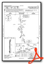
IFR Chart of KBVO
Enroute Charts at SkyVector.com
Location Information for KBVO
Coordinates: N36°45.80' / W96°0.67'Located 02 miles NW of Bartlesville, Oklahoma on 430 acres of land. View all Airports in Oklahoma.
Surveyed Elevation is 716 feet MSL.
Operations Data
|
|
Airport Communications
| ASOS: | 132.675 Tel. 918-336-2070 |
|---|---|
| CTAF: | 122.825 |
| AWOS-3PT at IDP (26.2 NE): | 118.525 620-331-5980 |
| ASOS at CFV (29.0 NE): | 121.275 620-251-1959 |
| D-ATIS at TUL (34.4 S): | 124.9 |
- APCH/DEP CTL SVC PRVDD BY KANSAS CITY ARTCC (ZKC) ON FREQS 128.6/282.325 (EDNA RCAG).
- NOTE: THIS FACILITY IS NOT AN ATCT FACILITY BUT AN ADVISORY COMMUNICATIONS STATION OPERATED BY THE AIRPORT.
- ADZY FREQ 122.825 MONITORED M-F DURG BUS HRS.
Nearby Navigation Aids
|
| ||||||||||||||||||||||||||||||||||||||||||||||||||||||||||||


Runway 17/35
| Dimensions: | 6850 x 100 feet / 2088 x 30 meters | |
|---|---|---|
| Surface: | Concrete / Grooved in Good Condition | |
| Weight Limits: | S-50, D-100, ST-170 | |
| Edge Lighting: | Medium Intensity | |
| Runway 17 | Runway 35 | |
| Coordinates: | N36°46.37' / W96°0.68' | N36°45.24' / W96°0.66' |
| Elevation: | 685.5 | 716.9 |
| Traffic Pattern: | Right | Left |
| Runway Heading: | 179° True | 359° True |
| Displaced Threshold: | 649 Feet | |
| Declared Distances: | TORA:6201 TODA:6201 ASDA:6201 LDA:6201 | TORA:6850 TODA:6850 ASDA:6850 LDA:6201 |
| Markings: | Precision Instrument in good condition. | Precision Instrument in good condition. |
| Glide Slope Indicator | P4L (3.00° Glide Path Angle) | P4L (3.00° Glide Path Angle) |
| Approach Lights: | MALSR 1,400 Foot Medium-intensity Approach Lighting System with runway alignment indicator lights. | |
| REIL: | Yes | |
| Obstacles: | 31 ft Trees 572 ft from runway, 344 ft right of center | |
Services Available
| Fuel: | 100LL (blue), Jet A+ |
|---|---|
| Transient Storage: | Hangars,Tiedowns |
| Airframe Repair: | MAJOR |
| Engine Repair: | MAJOR |
| Bottled Oxygen: | LOW |
| Bulk Oxygen: | NONE |
| Other Services: | CROP DUSTING SERVICES,PILOT INSTRUCTION |
Ownership Information
| Ownership: | Publicly owned | |
|---|---|---|
| Owner: | CITY OF BARTLESVILLE | |
| CITY HALL, 401 S. JOHNSTONE | ||
| BARTLESVILLE, OK 74003 | ||
| 918-338-4282 | ||
| Manager: | MIKE RICHARDSON | |
| 401 NW WILEY POST RD. | ||
| BARTLESVILLE, OK 74003 | ||
| (918) 661-3500 | FOR EMERG ONLY 918-350-0076. | |
Operational Statistics
| Single Engine Aircraft Based on Field: | 41 | Statistics collected for 12 month period ending 2023-03-17 | |
|---|---|---|---|
| Multi-Engine Aircraft Based on Field: | 4 | Annual Commercial Operations: | none |
| Jet Aircraft Based on Field: | 2 | Annual Commuter Operations: | none |
| Helicopters Based on Field: | none | Annual Air Taxi Operations: | none |
| Military Aircraft Based on Field: | none | Annual Military Operations: | none |
| Gliders Based on Field: | none | Annual GA Local Operations: | 3090 |
| Ultralights Based on Field: | none | Annual GA Itinerant Operations: | 9272 |
Other Remarks
- FOR CD IF UNA TO CTC ON FSS FREQ, CTC KANSAS CITY ARTCC AT 913-254-8508.
- ACTVT MALSR RWY 17; REIL RWY 35; PAPI RWY 17 & 35 - CTAF. MIRL RWY 17/35 OPER SS TO SR & PRESET LOW INTST, INCR INTST - CTAF.
- ADZY FREQ 122.825 MNT M-F DURG BUS HRS.
Weather Minimums

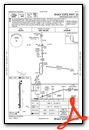
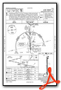
Instrument Approach Procedure (IAP) Charts
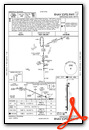
Nearby Airports with Instrument Procedures
| ID | Name | Heading / Distance | ||
|---|---|---|---|---|
 |
KIDP | Independence Municipal Airport | 025° | 26.1 |
|
KCFV | Coffeyville Municipal Airport | 046° | 29.0 |
|
KTUL | Tulsa International Airport | 169° | 34.4 |
|
KOWP | William R Pogue Municipal Airport | 190° | 35.9 |
|
KGCM | Claremore Regional Airport | 137° | 38.2 |
|
KPPF | Tri-City Airport | 035° | 41.8 |
|
H04 | Vinita Municipal Airport | 101° | 42.4 |
|
KRVS | Tulsa Riverside Airport | 178° | 43.4 |
|
2K7 | Neodesha Municipal Airport | 023° | 43.9 |
|
H71 | Mid-America Industrial Airport | 134° | 46.1 |
|
1K8 | South Grand Lake Regional Airport | 104° | 49.9 |
|
KPNC | Ponca City Regional Airport | 268° | 52.5 |
Airport Images

By: jtrolinger


Comments
Very good FBO and overnight visit
If you like aviation and airplanes go to KBVO, get one of the -fleet- of crew cars, and drive to the Woolaroc museum. Then visit the Phillips 66 museum in the downtown to complete the visit with food at the Painted Horse. Great overnight stop.