Login
Register


C77
Poplar Grove Airport
Official FAA Data Effective 2024-03-21 0901Z
Chart Supplement

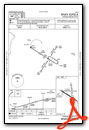
VFR Chart of C77
Sectional Charts at SkyVector.com
IFR Chart of C77
Enroute Charts at SkyVector.com
Location Information for C77
Coordinates: N42°19.37' / W88°50.18'Located 03 miles S of Poplar Grove, Illinois on 500 acres of land. View all Airports in Illinois.
Surveyed Elevation is 857 feet MSL.
Operations Data
|
|
Airport Communications
| ROCKFORD APPROACH: | 121.0 327.0 |
|---|---|
| ROCKFORD DEPARTURE: | 121.0 327.0 |
| CTAF: | 122.800 |
| UNICOM: | 122.800 |
| ATIS at RFD (13.9 SW): | 127.6 |
| ASOS at RFD (13.9 SW): | 815-484-6223 |
| ATIS at JVL (20.0 NW): | 128.25 |
Nearby Navigation Aids
|
| ||||||||||||||||||||||||||||||||||||||||||||||||||||||


Runway 12/30
| Dimensions: | 3773 x 50 feet / 1150 x 15 meters | |
|---|---|---|
| Surface: | Asphalt / Aggregate Friction Seal Coated in Good Condition | |
| Edge Lighting: | Low Intensity NSTD LIRL DUE TO SPACING, INTST & NON-FRANGIBLE MOUNTINGS. | |
| Runway 12 | Runway 30 | |
| Coordinates: | N42°19.44' / W88°50.56' | N42°19.11' / W88°49.85' |
| Elevation: | 855.5 | 850.2 |
| Traffic Pattern: | Left | Left |
| Runway Heading: | 123° True | 303° True |
| Displaced Threshold: | 500 Feet MKD WITH WHITE BARS UNDER NUMBERS; NO ARROWS. |
|
| Markings: | Basic in poor condition. | Basic in poor condition. |
Runway 09/27
CLSD WHEN SNOW COVERED EXCP TO SKI ACFT. | ||
| Dimensions: | 2709 x 200 feet / 826 x 61 meters | |
|---|---|---|
| Surface: | Turf in Good Condition | |
| Runway 09 | Runway 27 | |
| Coordinates: | N42°19.42' / W88°50.51' | N42°19.42' / W88°49.91' |
| Elevation: | 857.4 | 849.0 |
| Traffic Pattern: | Left | Left |
| Runway Heading: | 90° True | 270° True |
| Obstacles: | 62 ft Tree 655 ft from runway, 155 ft right of center | |
Runway 17/35
CLSD WHEN SNOW COVERED EXCP TO SKI ACFT. | ||
| Dimensions: | 2467 x 150 feet / 752 x 46 meters | |
|---|---|---|
| Surface: | Turf in Good Condition | |
| Runway 17 | Runway 35 | |
| Coordinates: | N42°19.66' / W88°50.12' | N42°19.26' / W88°50.08' |
| Elevation: | 850.0 | 848.7 |
| Runway Heading: | 176° True | 356° True |
| Displaced Threshold: | 220 Feet MKD WITH THREE CONES ON EACH SIDE OF RWY. |
|
| Obstacles: | 17 ft Road 0 ft from runway APCH SLOPE IS 20:1 AT DSPLCD THR. |
|
Services Available
| Fuel: | 100LL (blue) |
|---|---|
| Transient Storage: | Hangars,Tiedowns |
| Airframe Repair: | MAJOR |
| Engine Repair: | MAJOR |
| Bottled Oxygen: | NONE |
| Bulk Oxygen: | NONE |
| Other Services: | AIR FREIGHT SERVICES,AVIONICS,CARGO HANDLING SERVICES,CHARTER SERVICE,PILOT INSTRUCTION,AIRCRAFT RENTAL,AIRCRAFT SALES |
Ownership Information
| Ownership: | Privately Owned | |
|---|---|---|
| Owner: | STEVE THOMAS | ALT BLAKE THOMAS |
| 11619 RTE 76 | ||
| POPLAR GROVE, IL 61065 | ||
| 815-544-3471 | ||
| Manager: | BKAKE . THOMAS | |
| 11619 RT 76 | EMAIL ADDRESS: STEVE@POPLARGROVEAIRMOTIVE.COM (ALL LOWER CASE) | |
| POPLAR GROVE, IL 61065 | ||
| 815-544-3471 | ||
Operational Statistics
| Single Engine Aircraft Based on Field: | none | Statistics collected for 12 month period ending 2023-07-31 | |
|---|---|---|---|
| Multi-Engine Aircraft Based on Field: | none | Annual Commercial Operations: | none |
| Jet Aircraft Based on Field: | none | Annual Commuter Operations: | none |
| Helicopters Based on Field: | none | Annual Air Taxi Operations: | none |
| Military Aircraft Based on Field: | none | Annual Military Operations: | none |
| Gliders Based on Field: | none | Annual GA Local Operations: | 48000 |
| Ultralights Based on Field: | none | Annual GA Itinerant Operations: | 18000 |
Other Remarks
- THIS AIRPORT HAS BEEN SURVEYED BY THE NATIONAL GEODETIC SURVEY.
- CAUTION: IMPAIRED SIGHT CLNCS BTN RWY ENDS DUE TO ROLLING TRRN.
- FOR CD CTC CHICAGO ARTCC AT 630-906-8921.
- RWY 12/30 MARKINGS POOR.
- CALM WIND RWY.
Weather Minimums
Instrument Approach Procedure (IAP) Charts
Nearby Airports with Instrument Procedures
| ID | Name | Heading / Distance | ||
|---|---|---|---|---|
 |
44C | Beloit Airport | 330° | 12.0 |
|
KRFD | Chicago/Rockford International Airport | 236° | 13.9 |
|
KJVL | Southern Wisconsin Regional Airport | 333° | 20.0 |
|
10C | Galt Field Airport | 076° | 21.1 |
|
3CK | Lake In The Hills Airport | 106° | 23.9 |
|
KDKB | De Kalb Taylor Municipal Airport | 165° | 24.1 |
|
C02 | Grand Geneva Resort Airport | 048° | 26.4 |
|
KRPJ | Rochelle Municipal/Koritz Field Airport | 202° | 28.0 |
|
KBUU | Burlington Municipal Airport | 046° | 32.3 |
|
KFEP | Albertus Airport | 262° | 33.5 |
|
C81 | Campbell Airport | 089° | 33.9 |
|
57C | East Troy Municipal Airport | 035° | 35.1 |


Comments
Wonderful community airpark,
Wonderful community airpark. Taxiway is not real level, I held yoke full aft to increase dist to prop. Field does have a fuel truck.
william beebe
Pages