Login
Register


CZG
Tri-Cities Airport
Official FAA Data Effective 2024-03-21 0901Z
Chart Supplement

VFR Chart of KCZG
Sectional Charts at SkyVector.com
IFR Chart of KCZG
Enroute Charts at SkyVector.com
Location Information for KCZG
Coordinates: N42°4.71' / W76°5.78'Located 03 miles SW of Endicott, New York on 230 acres of land. View all Airports in New York.
Surveyed Elevation is 832 feet MSL.
Operations Data
|
|
Airport Communications
| AWOS-3: | 119.075 Tel. 607-785-2926 |
|---|---|
| BINGHAMTON APPROACH: | 118.6 257.625 |
| BINGHAMTON DEPARTURE: | 118.6 257.625 |
| CLEARANCE DELIVERY: | 121.7 |
| CTAF: | 122.800 |
| UNICOM: | 122.800 |
| ASOS at BGM (9.3 NE): | 607-729-8335 |
| ATIS at BGM (9.4 NE): | 128.15 |
| AWOS-3 at N27 (25.3 SW): | 119.925 570-265-1024 |
- APCH/DEP SVC PRVDD BY NEW YORK ARTCC ON FREQS 133.35/372.0 (SAYRE RCAG) WHEN BINGHAMTON APCH CTL CLSD.
Nearby Navigation Aids
|
| ||||||||||||||||||||||||||||||||||||||||||||||||||||||||||||


Runway 03/21
| Dimensions: | 3900 x 75 feet / 1189 x 23 meters | |
|---|---|---|
| Surface: | Asphalt in Good Condition | |
| Weight Limits: | S-30 | |
| Edge Lighting: | Medium Intensity | |
| Runway 03 | Runway 21 | |
| Coordinates: | N42°4.42' / W76°5.95' | N42°5.01' / W76°5.61' |
| Elevation: | 829.8 | 826.2 |
| Traffic Pattern: | Left | Left |
| Runway Heading: | 24° True | 204° True |
| Markings: | Non-Precision Instrument in good condition. | Non-Precision Instrument in good condition. |
| Glide Slope Indicator | P2R (4.00° Glide Path Angle) | |
| REIL: | Yes | Yes |
| Obstacles: | 4 ft Road 210 ft from runway +10 FT ROAD 0 FT OUT AND 63 FT RIGHT |
19 ft Road 200 ft from runway, 248 ft right of center |
Services Available
| Fuel: | 100LL (blue) |
|---|---|
| Transient Storage: | Hangars,Tiedowns |
| Airframe Repair: | NONE |
| Engine Repair: | NONE |
| Bottled Oxygen: | NONE |
| Bulk Oxygen: | NONE |
Ownership Information
| Ownership: | Publicly owned | |
|---|---|---|
| Owner: | VILLAGE OF ENDICOTT | |
| MUNICIPAL BLDG | ||
| ENDICOTT, NY 13760 | ||
| 607-757-2420 | ||
| Manager: | GERARD CORPREW | |
| 351 INDUSTRIAL PK | ||
| ENDICOTT, NY 13760 | ||
| 607-785-0467 | ||
Operational Statistics
| Single Engine Aircraft Based on Field: | 16 | Statistics collected for 12 month period ending 2022-09-01 | |
|---|---|---|---|
| Multi-Engine Aircraft Based on Field: | 2 | Annual Commercial Operations: | none |
| Jet Aircraft Based on Field: | none | Annual Commuter Operations: | none |
| Helicopters Based on Field: | none | Annual Air Taxi Operations: | 300 |
| Military Aircraft Based on Field: | none | Annual Military Operations: | 200 |
| Gliders Based on Field: | 1 | Annual GA Local Operations: | 5000 |
| Ultralights Based on Field: | none | Annual GA Itinerant Operations: | 1000 |
Other Remarks
- HIGH TENSION TWRS 2000 FT FROM RWY 21 THLD 60-70 FT TALL.
- MICROWAVE TOWER +600' 2.8 MILES OUT 3150' L OF RY 21; APCH - UNMKD/UNLGTD 24:1 SLOPE.
- HIGH TERRAIN ALL QUADRANTS.
- RWY 21 EXTDD SAFETY AREA HAS SURFACE VARIATIONS/DEPRESSIONS.
- GRVL ACCESS ROAD CROSSES RY 03 APCH.
- WHEN APCH CLSD, FOR CD CTC NEW YORK ARTCC AT 631-468-1425.
- COLD TEMPERATURE AIRPORT. ALTITUDE CORRECTION REQUIRED AT OR BELOW -17C.
- 0LL 24 SELF SVC FUEL AVBL WITH CREDIT CARD.
- ACTVT REIL RY 03/21; MIRL RY 03/21 - CTAF.
Weather Minimums
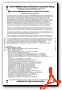
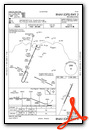
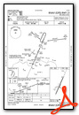
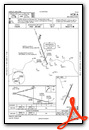
Instrument Approach Procedure (IAP) Charts
Nearby Airports with Instrument Procedures
| ID | Name | Heading / Distance | ||
|---|---|---|---|---|
 |
KBGM | Greater Binghamton/Edwin A Link Field Airport | 033° | 9.4 |
|
N27 | Bradford County Airport | 217° | 25.7 |
|
KITH | Ithaca Tompkins International Airport | 327° | 29.6 |
|
N03 | Cortland County/Chase Field Airport | 350° | 31.3 |
|
9N3 | Seamans Field Airport | 152° | 33.1 |
|
N23 | Sidney Municipal Airport | 065° | 33.2 |
|
KELM | Elmira/Corning Regional Airport | 278° | 35.9 |
|
KOIC | Lt Warren Eaton Airport | 040° | 38.8 |
|
KAVP | Wilkes-Barre/Scranton International Airport | 159° | 47.4 |
|
KWBW | Wilkes-Barre Wyoming Valley Airport | 166° | 48.1 |
|
N30 | Cherry Ridge Airport | 131° | 50.8 |
|
KVGC | Hamilton Municipal Airport | 027° | 51.7 |
Airport Images
Do you have a recent image of this airport? Upload it here!


