Login
Register


DAW
Skyhaven Airport
Official FAA Data Effective 2024-04-18 0901Z
Chart Supplement

VFR Chart of KDAW
Sectional Charts at SkyVector.com
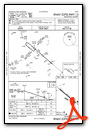
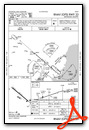
IFR Chart of KDAW
Enroute Charts at SkyVector.com
Location Information for KDAW
Coordinates: N43°17.05' / W70°55.77'Located 03 miles SE of Rochester, New Hampshire on 195 acres of land. View all Airports in New Hampshire.
Surveyed Elevation is 322 feet MSL.
Operations Data
|
|
Airport Communications
| ASOS: | 135.275 Tel. 603-332-7814 |
|---|---|
| BOSTON APPROACH: | 125.05 269.4 |
| BOSTON DEPARTURE: | 125.05 269.4 |
| IC: | 125.05 269.4 |
| CTAF: | 122.700 |
| UNICOM: | 122.700 |
| AWOS-3PT at SFM (11.2 NE): | 120.025 207-324-1958 |
| ATIS at PSM (13.2 S): | 273.5 |
| ASOS at PSM (14.0 S): |
Nearby Navigation Aids
|
| ||||||||||||||||||||||||||||||||||||||||||||||||||||||||||||


Runway 15/33
| Dimensions: | 4201 x 75 feet / 1280 x 23 meters | |
|---|---|---|
| Surface: | Asphalt in Good Condition | |
| Weight Limits: | S-30 | |
| Edge Lighting: | Medium Intensity | |
| Runway 15 | Runway 33 | |
| Coordinates: | N43°17.28' / W70°56.13' | N43°16.83' / W70°55.42' |
| Elevation: | 299.9 | 322.1 |
| Traffic Pattern: | Left | Right |
| Runway Heading: | 131° True | 311° True |
| Markings: | Basic in good condition. | Non-Precision Instrument in good condition. |
| Glide Slope Indicator | P4L (3.00° Glide Path Angle) | |
| Approach Lights: | ODALS Omnidirectional Approach Lighting System | |
| REIL: | Yes | |
| Obstacles: | 49 ft Trees 780 ft from runway, 300 ft right of center | |
Services Available
| Fuel: | 100LL (blue) |
|---|---|
| Transient Storage: | Tiedowns |
| Airframe Repair: | MAJOR |
| Engine Repair: | MAJOR |
| Bottled Oxygen: | NONE |
| Bulk Oxygen: | NONE |
Ownership Information
| Ownership: | Publicly owned | |
|---|---|---|
| Owner: | PEASE DEVELOPMENT AUTHORITY | |
| 55 INTERNATIONAL DR | ||
| PORTSMOUTH, NH 03801 | ||
| 603-433-6536 | ||
| Manager: | ANDREW POMEROY | |
| PDA, 36 AIRLINE AVE | ||
| PORTSMOUTH, NH 03801 | ||
| 603-433-6536 | MGR PHONE 603-948-1142. | |
Operational Statistics
| Single Engine Aircraft Based on Field: | 61 | Statistics collected for 12 month period ending 2022-11-16 | |
|---|---|---|---|
| Multi-Engine Aircraft Based on Field: | 3 | Annual Commercial Operations: | none |
| Jet Aircraft Based on Field: | none | Annual Commuter Operations: | none |
| Helicopters Based on Field: | 2 | Annual Air Taxi Operations: | none |
| Military Aircraft Based on Field: | none | Annual Military Operations: | none |
| Gliders Based on Field: | none | Annual GA Local Operations: | 8000 |
| Ultralights Based on Field: | none | Annual GA Itinerant Operations: | 2250 |
Other Remarks
- DEER ON & INVOF ARPT AFT SS.
- RWY 33 DSGND CALM WIND RWY.
- ULTRALIGHT; ANTIQUE & NORDO TFC IN GOOD WX.
- FOR CD CTC BOSTON APCH AT 603-594-5552.
- 0LL SELF SVC 100LL AVBL 24 HRS WITH CREDIT CARD.
- ACTVT ODALS RWY 33; REIL RWY 15; PAPI RWY 33; MIRL RWY 15/33; WIND CONE LGT - CTAF.
Weather Minimums
Instrument Approach Procedure (IAP) Charts

Nearby Airports with Instrument Procedures
| ID | Name | Heading / Distance | ||
|---|---|---|---|---|
 |
3B4 | Seacoast Airfield Airport | 140° | 10.9 |
|
KSFM | Sanford Seacoast Regional Airport | 055° | 11.7 |
|
KPSM | Portsmouth International At Pease Airport | 159° | 13.2 |
|
B19 | Biddeford Municipal Airport | 061° | 22.7 |
|
KCON | Concord Municipal Airport | 259° | 25.6 |
|
KLCI | Laconia Municipal Airport | 309° | 27.5 |
|
KMHT | Manchester Boston Regional Airport | 226° | 30.6 |
|
KPWM | Portland International Jetport Airport | 051° | 34.7 |
|
KLWM | Lawrence Municipal Airport | 194° | 35.1 |
|
KASH | Boire Field Airport | 220° | 39.6 |
|
KBVY | Beverly Regional Airport | 179° | 42.0 |
|
KIZG | Eastern Slopes Regional Airport | 358° | 42.4 |


