Login
Register


DBN
W H 'Bud' Barron Airport
Official FAA Data Effective 2024-03-21 0901Z
Chart Supplement

VFR Chart of KDBN
Sectional Charts at SkyVector.com
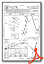
IFR Chart of KDBN
Enroute Charts at SkyVector.com
Location Information for KDBN
Coordinates: N32°33.88' / W82°59.10'Located 03 miles NW of Dublin, Georgia on 905 acres of land. View all Airports in Georgia.
Surveyed Elevation is 311 feet MSL.
Operations Data
|
|
Airport Communications
| AWOS-3: | 118.425 Tel. 478-277-9051 |
|---|---|
| ATLANTA APPROACH: | 124.2 279.6 388.2 ;7000 FT & ABV |
| ATLANTA DEPARTURE: | 124.2 279.6 388.2 ;7000 FT & ABV |
| CTAF: | 122.700 |
| UNICOM: | 122.700 |
| AWOS-3PT at 48A (17.9 SW): | 120.975 478-271-5897 |
| ATIS at EZM (22.1 S): | 119.425 |
| AWOS-3 at EZM (22.3 S): | 119.425 478-374-9979 |
- APCH/DEP SVC PRVDD BY ATLANTA LARGE TRACON 0615-2300; APCH/DEP SVC PRVDD BY ATLANTA ARTCC 2300-0615 ON FREQS 123.95/269.3 (MACON RCAG).
Nearby Navigation Aids
|
| ||||||||||||||||||||||||||||||||||||||||||||||||||||||||||||


Runway 02/20
| Dimensions: | 6501 x 150 feet / 1982 x 46 meters | |
|---|---|---|
| Surface: | Asphalt in Good Condition | |
| Weight Limits: | S-30, D-53 | |
| Edge Lighting: | High Intensity | |
| Runway 02 | Runway 20 | |
| Coordinates: | N32°33.44' / W82°59.09' | N32°34.47' / W82°58.74' |
| Elevation: | 290.9 | 311.0 |
| Traffic Pattern: | Left | Left |
| Runway Heading: | 16° True | 196° True |
| Displaced Threshold: | 489 Feet | |
| Declared Distances: | TORA:6300 TODA:6300 ASDA:6300 LDA:6300 | TORA:6500 TODA:6500 ASDA:6000 LDA:6000 |
| Markings: | Precision Instrument in good condition. | Precision Instrument in good condition. |
| Glide Slope Indicator | P2L (3.00° Glide Path Angle) | P2L (3.00° Glide Path Angle) |
| Approach Lights: | MALSR 1,400 Foot Medium-intensity Approach Lighting System with runway alignment indicator lights. | |
| Obstacles: | 64 ft Trees 1419 ft from runway, 602 ft right of center | 15 ft Road 200 ft from runway, 36 ft left of center CONTROLLING OBSTRUCTION EXCEEDS A 45 DEGREE SLOPE |
Runway 14/32
| Dimensions: | 5171 x 100 feet / 1576 x 30 meters | |
|---|---|---|
| Surface: | Asphalt in Fair Condition | |
| Weight Limits: | S-28, D-44 | |
| Runway 14 | Runway 32 | |
| Coordinates: | N32°34.11' / W82°59.67' | N32°33.49' / W82°58.98' |
| Elevation: | 304.2 | 290.8 |
| Traffic Pattern: | Left | Left |
| Runway Heading: | 136° True | 316° True |
| Declared Distances: | TORA:5171 TODA:5171 ASDA:5171 LDA:5171 | TORA:5171 TODA:5171 ASDA:5171 LDA:5171 |
| Markings: | Basic in good condition. | Basic in good condition. |
| Obstacles: | 64 ft Trees 1445 ft from runway | 98 ft Trees 1604 ft from runway |
Services Available
| Fuel: | 100LL (blue), Jet A+ |
|---|---|
| Transient Storage: | Tiedowns |
| Airframe Repair: | MAJOR |
| Engine Repair: | MAJOR |
| Bottled Oxygen: | NONE |
| Bulk Oxygen: | NONE |
| Other Services: | PILOT INSTRUCTION |
Ownership Information
| Ownership: | Publicly owned | |
|---|---|---|
| Owner: | LAURENS COUNTY | |
| P O BOX 2011 | ||
| DUBLIN, GA 31040 | ||
| 478-272-4755 | ||
| Manager: | BRYAN ROGERS, COUNTY ADM | |
| PO BOX 2011 | ||
| DUBLIN, GA 31040 | ||
| 478-272-4755 | ||
Operational Statistics
| Single Engine Aircraft Based on Field: | 19 | Statistics collected for 12 month period ending 2022-12-31 | |
|---|---|---|---|
| Multi-Engine Aircraft Based on Field: | 2 | Annual Commercial Operations: | none |
| Jet Aircraft Based on Field: | none | Annual Commuter Operations: | none |
| Helicopters Based on Field: | 1 | Annual Air Taxi Operations: | none |
| Military Aircraft Based on Field: | none | Annual Military Operations: | 200 |
| Gliders Based on Field: | none | Annual GA Local Operations: | 18800 |
| Ultralights Based on Field: | none | Annual GA Itinerant Operations: | 6000 |
Other Remarks
- FOR APCH/DEP SVC CTC ATLANTA APCH AT 678-364-6131. WHEN ATLANTA APCH UNAVBL CTC ATLANTA ARTCC AT 770-210-7692.
- FOR CD IF UNA TO CTC ON FSS FREQ, CTC ATLANTA APCH AT 678-364-6132, WHEN ATCT CLSD CTC ATLANTA ARTCC AT 770-210-7692.
- 0LL SELF-SERVICE FUEL AVBL 24 HRS WITH CREDIT CARD.
- ACTVT MALSR RY 02 - CTAF. HIRL RY 02/20 OPER CONT DUSK-2200; AFTER 2200 ACTVT - CTAF.
Weather Minimums
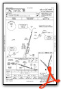
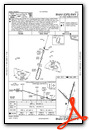
Instrument Approach Procedure (IAP) Charts
Nearby Airports with Instrument Procedures
| ID | Name | Heading / Distance | ||
|---|---|---|---|---|
 |
48A | Cochran Airport | 236° | 17.8 |
|
KEZM | Heart of Georgia Regional Airport | 199° | 22.1 |
|
KOKZ | Kaolin Field Airport | 017° | 25.2 |
|
KMQW | Telfair-Wheeler Airport | 169° | 28.5 |
|
KWRB | Robins AFB Airport | 278° | 31.1 |
|
KSBO | East Georgia Regional Airport | 084° | 31.3 |
|
KMAC | Macon Downtown Airport | 297° | 33.0 |
|
KMCN | Middle Georgia Regional Airport | 283° | 34.5 |
|
KMLJ | Baldwin County Regional Airport | 339° | 37.6 |
|
KVDI | Vidalia Regional Airport | 125° | 38.3 |
|
2J3 | Louisville Municipal Airport | 050° | 39.5 |
|
KPXE | Perry-Houston County Airport | 265° | 39.8 |
Airport Images
Do you have a recent image of this airport? Upload it here!


