Login
Register


FFT
Capital City Airport
Official FAA Data Effective 2024-04-18 0901Z
Chart Supplement

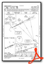
VFR Chart of KFFT
Sectional Charts at SkyVector.com
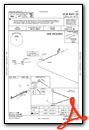
IFR Chart of KFFT
Enroute Charts at SkyVector.com
Location Information for KFFT
Coordinates: N38°10.90' / W84°54.40'Located 01 miles SW of Frankfort, Kentucky on 375 acres of land. View all Airports in Kentucky.
Surveyed Elevation is 812 feet MSL.
Operations Data
|
|
Airport Communications
| ASOS: | 119.275 Tel. 502-227-5087 |
|---|---|
| LEXINGTON APPROACH: | 120.75 298.9 |
| LEXINGTON DEPARTURE: | 120.75 298.9 |
| CLEARANCE DELIVERY: | 118.65 |
| UNICOM: | 122.800 |
| CTAF: | 122.800 |
| ATIS at LEX (16.6 SE): | 126.3 |
| ASOS at LEX (16.6 SE): | 126.3 859-281-5700 |
| AWOS-3 at 27K (22.6 E): | 119.975 502-867-1564 |
Nearby Navigation Aids
|
| ||||||||||||||||||||||||||||||||||||||||||||||||||||||||||||


Runway 07/25
| Dimensions: | 5506 x 100 feet / 1678 x 30 meters | |
|---|---|---|
| Surface: | Asphalt in Good Condition | |
| Weight Limits: | 29 /F/C/X/T, S-76, D-100, ST-82 | |
| Edge Lighting: | Medium Intensity | |
| Runway 07 | Runway 25 | |
| Coordinates: | N38°10.70' / W84°54.92' | N38°11.10' / W84°53.89' |
| Elevation: | 812.3 | 783.4 |
| Traffic Pattern: | Left | Left |
| Runway Heading: | 64° True | 244° True |
| Markings: | Non-Precision Instrument in good condition. | Non-Precision Instrument in good condition. |
| Glide Slope Indicator | P4L (3.00° Glide Path Angle) | P4L (3.50° Glide Path Angle) PAPI RWY 25 UNUSBL BYD 8 DEGS RIGHT OF CNTRLN. |
| REIL: | Yes | Yes |
| Obstacles: | 66 ft Trees 1649 ft from runway, 384 ft right of center | 57 ft Tree 1607 ft from runway, 311 ft left of center |
Services Available
| Fuel: | 100LL (blue), Jet A+ |
|---|---|
| Transient Storage: | Hangars,Tiedowns |
| Airframe Repair: | MAJOR |
| Engine Repair: | MAJOR |
| Bottled Oxygen: | NOT AVAILABLE |
| Bulk Oxygen: | NOT AVAILABLE |
| Other Services: | PILOT INSTRUCTION |
Ownership Information
| Ownership: | Publicly owned | |
|---|---|---|
| Owner: | COMMONWEALTH OF KENTUCKY | |
| 90 AIRPORT RD | ||
| FRANKFORT, KY 40601 | ||
| 502-564-3714 | ||
| Manager: | ANTHONY ADAMS | |
| 88 AIRPORT ROAD | ||
| FRANKFORT, KY 40601 | ||
| 502-564-0339 | MANAGER'S CELL (502) 545-8111 | |
Operational Statistics
| Single Engine Aircraft Based on Field: | 43 | Statistics collected for 12 month period ending 2022-06-20 | |
|---|---|---|---|
| Multi-Engine Aircraft Based on Field: | 5 | Annual Commercial Operations: | none |
| Jet Aircraft Based on Field: | 1 | Annual Commuter Operations: | none |
| Helicopters Based on Field: | 7 | Annual Air Taxi Operations: | 3570 |
| Military Aircraft Based on Field: | 3 | Annual Military Operations: | 5000 |
| Gliders Based on Field: | none | Annual GA Local Operations: | 10450 |
| Ultralights Based on Field: | 1 | Annual GA Itinerant Operations: | 20196 |
Other Remarks
- CAUTION: DANIEL BOONE HELI 1/2 NM N OF RWY 25 THR; MIL HEL TFC OPS N OF RWY.
- CTC ANG OPS 42.25/139.35/226.6.
- DEER & BIRDS ON & INVOF ARPT.
- MIL HEL USE RIGHT BASE TO RWY 25.
- PVT AP WITH TURF RWY LCTD 3/4 NM NW OF RWY 07 THR.
- NOISE ABATEMENT PROCS: RWY 7 DEPG ACFT MNTN RWY HDG TO 1800 FT MSL BFR TURNING.
- MILITARY: ARNG OPS - UHF FREQ 226.55
- ACTVT REIL RWY 07 & 25; PAPI RWY 07 & 25; MIRL RWY 07/25 - CTAF.
Weather Minimums
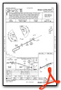
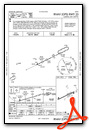
Instrument Approach Procedure (IAP) Charts
Nearby Airports with Instrument Procedures
| ID | Name | Heading / Distance | ||
|---|---|---|---|---|
 |
KLEX | Blue Grass Airport | 121° | 16.6 |
|
27K | Georgetown-Scott County Regional Airport | 081° | 22.5 |
|
0I8 | Cynthiana-Harrison County Airport | 069° | 31.5 |
|
KBRY | Samuels Field Airport | 232° | 35.7 |
|
KLOU | Bowman Field Airport | 274° | 35.9 |
|
6I2 | Lebanon Springfield-George Hoerter Field Airport | 205° | 36.5 |
|
KDVK | Stuart Powell Field Airport | 169° | 36.8 |
|
KSDF | Louisville Muhammad Ali International Airport | 269° | 39.3 |
|
K62 | Gene Snyder Airport | 037° | 39.6 |
|
KJVY | Clark Regional Airport | 286° | 40.8 |
|
KRGA | Central Kentucky Regional Airport | 140° | 42.8 |
|
KIMS | Madison Municipal Airport | 322° | 43.5 |
Airport Images
Do you have a recent image of this airport? Upload it here!


