Login
Register


FLP
Marion County Regional Airport
Official FAA Data Effective 2024-04-18 0901Z
Chart Supplement

VFR Chart of KFLP
Sectional Charts at SkyVector.com
IFR Chart of KFLP
Enroute Charts at SkyVector.com
Location Information for KFLP
Coordinates: N36°17.45' / W92°35.41'Located 01 miles N of Flippin, Arkansas on 80 acres of land. View all Airports in Arkansas.
Surveyed Elevation is 719 feet MSL.
Operations Data
|
|
Airport Communications
| AWOS-3PT: | 132.075 Tel. 870-453-2380 |
|---|---|
| CTAF: | 123.000 |
| UNICOM: | 123.000 |
| ASOS at BPK (7.4 NE): | 133.975 870-481-5946 |
| ASOS at HRO (27.4 W): | 121.125 870-365-8550 |
| AWOS-3 at BBG (32.9 NW): | 124.625 417-334-0218 |
- APCH/DEP SVC PRVDD BY MEMPHIS ARTCC ON FREQS 126.85/281.55 (HARRISON RCAG).
Nearby Navigation Aids
|
| ||||||||||||||||||||||||||||||||||||||||||||||||||||||||||||


Runway 04/22
| Dimensions: | 5001 x 75 feet / 1524 x 23 meters | |
|---|---|---|
| Surface: | Asphalt in Good Condition | |
| Weight Limits: | S-30 | |
| Edge Lighting: | Medium Intensity | |
| Runway 04 | Runway 22 | |
| Coordinates: | N36°17.20' / W92°35.81' | N36°17.71' / W92°35.02' |
| Elevation: | 652.3 | 719.5 |
| Traffic Pattern: | Left | Left |
| Runway Heading: | 51° True | 231° True |
| Markings: | Non-Precision Instrument in good condition. | Non-Precision Instrument in good condition. |
| Glide Slope Indicator | P2L (3.50° Glide Path Angle) | P2L (3.50° Glide Path Angle) |
| REIL: | Yes | Yes |
| Obstacles: | 20 ft Tree 700 ft from runway, 100 ft left of center | 40 ft Trees 525 ft from runway, 180 ft left of center |
Services Available
| Fuel: | 100LL (blue), Jet-A |
|---|---|
| Transient Storage: | Hangars,Tiedowns |
| Airframe Repair: | MINOR |
| Engine Repair: | MINOR |
| Bottled Oxygen: | NONE |
| Bulk Oxygen: | NONE |
| Other Services: | PILOT INSTRUCTION |
Ownership Information
| Ownership: | Publicly owned | |
|---|---|---|
| Owner: | MARION COUNTY | |
| BOX 545 | ||
| YELLVILLE, AR 72687 | ||
| 870-449-6231 | ||
| Manager: | DOUG HARRISON | |
| 954 AIRPORT 980 | ||
| FLIPPIN, AR 72634 | ||
| 870-453-2241 | ||
Operational Statistics
| Single Engine Aircraft Based on Field: | 17 | Statistics collected for 12 month period ending 2022-02-28 | |
|---|---|---|---|
| Multi-Engine Aircraft Based on Field: | 3 | Annual Commercial Operations: | none |
| Jet Aircraft Based on Field: | none | Annual Commuter Operations: | none |
| Helicopters Based on Field: | none | Annual Air Taxi Operations: | none |
| Military Aircraft Based on Field: | none | Annual Military Operations: | 200 |
| Gliders Based on Field: | none | Annual GA Local Operations: | 7000 |
| Ultralights Based on Field: | none | Annual GA Itinerant Operations: | 3000 |
Other Remarks
- FOR CD CTC MEMPHIS ARTCC AT 901-368-8453/8449.
- NO LINE OF SIGHT BTN RY ENDS.
- ULTRALIGHT ACTIVITY ON & INVOF ARPT.
- WILDLIFE ON & INVOF ARPT.
- 0LL FUEL AVBL 24 HRS SELF SVC (100LL & JET A).
- ACTVT MIRL RY 04/22; PAPI AND REIL RYS 04 & 22 - CTAF.
Weather Minimums

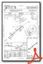
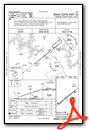
Instrument Approach Procedure (IAP) Charts
Nearby Airports with Instrument Procedures
| ID | Name | Heading / Distance | ||
|---|---|---|---|---|
 |
KBPK | Baxter County Airport | 051° | 7.5 |
|
4A5 | Searcy County Airport | 187° | 23.7 |
|
KHRO | Boone County Airport | 266° | 27.4 |
|
KBBG | Branson Airport | 296° | 32.9 |
|
7M2 | Mountain View Wilcox Memorial Field Airport | 136° | 35.3 |
|
KPLK | M Graham Clark Downtown Airport | 303° | 36.9 |
|
42A | Melbourne Municipal - John E Miller Field Airport | 109° | 39.2 |
|
2A2 | Holley Mountain Airpark Airport | 166° | 39.4 |
|
6M2 | Horseshoe Bend Airport | 095° | 40.7 |
|
KAOV | Ava Bill Martin Memorial Airport | 353° | 41.0 |
|
KCCA | Clinton Municipal Airport | 170° | 42.1 |
|
KFWB | Branson West Municipal - Emerson Field Airport | 302° | 46.3 |
Airport Images
Do you have a recent image of this airport? Upload it here!


