Login
Register


I23
Fayette County Airport
Official FAA Data Effective 2024-04-18 0901Z
Chart Supplement

VFR Chart of I23
Sectional Charts at SkyVector.com
IFR Chart of I23
Enroute Charts at SkyVector.com
Location Information for I23
Coordinates: N39°34.22' / W83°25.23'Located 02 miles NE of Washington Court House, Ohio on 40 acres of land. View all Airports in Ohio.
Surveyed Elevation is 979 feet MSL.
Operations Data
|
|
Airport Communications
| AWOS-3: | 118.775 |
|---|---|
| COLUMBUS APPROACH: | 134.0 279.6 |
| COLUMBUS DEPARTURE: | 134.0 279.6 |
| IC: | 134.0 279.6 |
| CTAF: | 122.800 |
| UNICOM: | 122.800 |
| D-ATIS at ILN (19.2 SW): | 124.925 |
| ASOS at ILN (19.2 SW): | 937-383-7334 |
| AWOS-3 at RZT (20.1 SE): | 119.225 740-779-1364 |
Nearby Navigation Aids
|
| ||||||||||||||||||||||||||||||||||||||||||||||||||||||||||||


Runway 05/23
| Dimensions: | 5097 x 75 feet / 1554 x 23 meters | |
|---|---|---|
| Surface: | Asphalt in Excellent Condition | |
| Weight Limits: | S-30, D-40 | |
| Edge Lighting: | Medium Intensity | |
| Runway 05 | Runway 23 | |
| Coordinates: | N39°33.88' / W83°25.53' | N39°34.57' / W83°24.93' |
| Elevation: | 978.3 | 975.4 |
| Traffic Pattern: | Left | Left |
| Runway Heading: | 34° True | 214° True |
| Markings: | Non-Precision Instrument in poor condition. | Non-Precision Instrument in poor condition. |
| Glide Slope Indicator | P4L (3.00° Glide Path Angle) | |
| REIL: | Yes | |
| Obstacles: | 28 ft Railroad 201 ft from runway, 240 ft left of center +28 FT RR, 0 FT DIST, 230 FT L. |
|
Services Available
| Fuel: | 100LL (blue), Jet-A |
|---|---|
| Transient Storage: | Hangars,Tiedowns PRIOR CDN RQRD. |
| Airframe Repair: | MAJOR |
| Engine Repair: | MAJOR |
| Bottled Oxygen: | NONE |
| Bulk Oxygen: | NONE |
| Other Services: | PILOT INSTRUCTION,AIRCRAFT RENTAL |
Ownership Information
| Ownership: | Publicly owned | |
|---|---|---|
| Owner: | FAYETTE COUNTY COMMISSIONERS | |
| 2770 STATE ROUTE 38 NE | ||
| WASHINGTON COURT HOUSE, OH 43160-9006 | ||
| 740-335-2430 | ||
| Manager: | JERRY VAN DYKE | |
| 2770 STATE ROUTE 38 NE | ||
| WASHINGTON COURT HOUSE, OH 43160-9006 | ||
| 740-335-2430 | CELL 740-937-7170. | |
Operational Statistics
| Single Engine Aircraft Based on Field: | 30 | Statistics collected for 12 month period ending 2021-07-20 | |
|---|---|---|---|
| Multi-Engine Aircraft Based on Field: | 1 | Annual Commercial Operations: | none |
| Jet Aircraft Based on Field: | none | Annual Commuter Operations: | none |
| Helicopters Based on Field: | none | Annual Air Taxi Operations: | 605 |
| Military Aircraft Based on Field: | none | Annual Military Operations: | 300 |
| Gliders Based on Field: | none | Annual GA Local Operations: | 13000 |
| Ultralights Based on Field: | none | Annual GA Itinerant Operations: | 15500 |
Other Remarks
- FOR CD CTC COLUMBUS APCH AT 614-338-8537.
- BIRDS INVOF ARPT.
- FADED.
- FADED.
- 0LL 100LL & JET A AVBL FULL SVC ON REQ DRG BUS HRS; H24 SELF SVC VIA CREDIT CARD.
- ROPES AVBL ON REQ.
- ACTVT REIL RWY 23; MIRL RWY 05/23 - CTAF. PAPI RWY 23 OPR CONSLY.
Weather Minimums

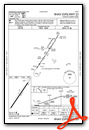
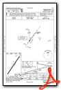
Instrument Approach Procedure (IAP) Charts
Nearby Airports with Instrument Procedures
| ID | Name | Heading / Distance | ||
|---|---|---|---|---|
 |
KILN | Wilmington Air Park Airport | 243° | 19.3 |
|
KRZT | Ross County Airport | 112° | 20.0 |
|
KCYO | Pickaway County Memorial Airport | 098° | 20.6 |
|
I66 | Clinton Field Airport | 258° | 21.0 |
|
KUYF | Madison County Airport | 354° | 21.8 |
|
KHOC | Highland County Airport | 193° | 23.5 |
|
KTZR | Bolton Field Airport | 033° | 23.8 |
|
KSGH | Springfield/Beckley Municipal Airport | 309° | 25.3 |
|
KLCK | Rickenbacker International Airport | 057° | 27.1 |
|
KGDK | Greene County/Lewis A Jackson Regional Airport | 285° | 27.5 |
|
KFFO | Wright-Patterson AFB Airport | 298° | 32.8 |
|
KEOP | Pike County Airport | 136° | 33.3 |
Airport Images
Do you have a recent image of this airport? Upload it here!


