Login
Register


LUX
Laurens County Airport
Official FAA Data Effective 2024-04-18 0901Z
Chart Supplement

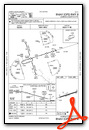
VFR Chart of KLUX
Sectional Charts at SkyVector.com
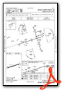
IFR Chart of KLUX
Enroute Charts at SkyVector.com
Location Information for KLUX
Coordinates: N34°30.43' / W81°56.82'Located 03 miles E of Laurens, South Carolina on 83 acres of land. View all Airports in South Carolina.
Surveyed Elevation is 697 feet MSL.
TPA: 803 FT AGL.
Operations Data
|
|
Airport Communications
| AWOS-3: | 123.975 Tel. 864-682-3639 |
|---|---|
| GREER APPROACH: | 120.6 350.2 |
| GREER DEPARTURE: | 120.6 350.2 |
| UNICOM: | 122.800 |
| CTAF: | 122.800 |
| AWOS-3PT at 35A (18.5 NE): | 119.45 864-427-1514 |
| ASOS at GRD (18.7 SW): | 121.125 864-388-9115 |
| AWOS-3 at EOE (19.4 SE): | 124.275 803-276-2419 |
- APCH/DEP SVC PRVDD BY ATLANTA ARTCC ON FREQS 135.35/263.125 (OWING RCAG) WHEN GREER APCH CTL CLSD.
Nearby Navigation Aids
|
| ||||||||||||||||||||||||||||||||||||||||||||||||||||||||||||


Runway 08/26
| Dimensions: | 4051 x 75 feet / 1235 x 23 meters | |
|---|---|---|
| Surface: | Concrete in Excellent Condition | |
| Weight Limits: | S-12 | |
| Edge Lighting: | Medium Intensity | |
| Runway 08 | Runway 26 | |
| Coordinates: | N34°30.33' / W81°57.20' | N34°30.53' / W81°56.43' |
| Elevation: | 697.2 | 693.1 |
| Traffic Pattern: | Left | Left |
| Runway Heading: | 72° True | 252° True |
| Markings: | Non-Precision Instrument in good condition. | Non-Precision Instrument in good condition. |
| Glide Slope Indicator | P2L (3.00° Glide Path Angle) | P2L (3.25° Glide Path Angle) |
| REIL: | Yes | Yes |
| Obstacles: | 54 ft Tree 1042 ft from runway, 229 ft left of center | 64 ft Tree 1122 ft from runway, 57 ft right of center |
Services Available
| Fuel: | 100LL (blue) |
|---|---|
| Transient Storage: | Tiedowns |
| Airframe Repair: | MAJOR |
| Engine Repair: | MAJOR |
| Bottled Oxygen: | NONE |
| Bulk Oxygen: | NONE |
| Other Services: | PILOT INSTRUCTION |
Ownership Information
| Ownership: | Publicly owned | |
|---|---|---|
| Owner: | LAURENS COUNTY | |
| 606 SOUTH ADAIR STREET | ||
| CLINTON, SC 29360 | ||
| (864) 833-4304 | ||
| Manager: | GIFFORD A. BOYTER | |
| 3985 TORRINGTON ROAD | ||
| LAURENS, SC 29360 | ||
| (864) 923-3507 | ||
Operational Statistics
| Single Engine Aircraft Based on Field: | 17 | Statistics collected for 12 month period ending 2023-07-06 | |
|---|---|---|---|
| Multi-Engine Aircraft Based on Field: | 1 | Annual Commercial Operations: | none |
| Jet Aircraft Based on Field: | none | Annual Commuter Operations: | none |
| Helicopters Based on Field: | none | Annual Air Taxi Operations: | 134 |
| Military Aircraft Based on Field: | none | Annual Military Operations: | 150 |
| Gliders Based on Field: | none | Annual GA Local Operations: | 1970 |
| Ultralights Based on Field: | none | Annual GA Itinerant Operations: | 896 |
Other Remarks
- FOR CD CTC GREER APCH AT 864-877-8275. WHEN GREER APCH CLSD, FOR CD CTC ATLANTA ARTCC AT 770-210-7692.
- 0LL SELF SVC 24 HR FUEL WITH CREDIT CARD.
- ACTVT REIL RWY 08 & 26; MIRL RWY 08/26 - CTAF. PAPI RWY 08 & 26 OPR CONSLY.
- TPA: 803 FT AGL.
Weather Minimums

Instrument Approach Procedure (IAP) Charts
Nearby Airports with Instrument Procedures
| ID | Name | Heading / Distance | ||
|---|---|---|---|---|
 |
35A | Union County, Troy Shelton Field Airport | 054° | 18.6 |
|
KGRD | Greenwood County Airport | 214° | 18.6 |
|
KEOE | Newberry County Airport | 127° | 19.3 |
|
KSPA | Spartanburg Downtown Memorial/Simpson Field Airport | 358° | 24.5 |
|
KGYH | Donaldson Field Airport | 305° | 26.0 |
|
KGSP | Greenville Spartanburg International Airport | 330° | 26.9 |
|
KGMU | Greenville Downtown Airport | 315° | 28.5 |
|
6J4 | Saluda County Airport | 167° | 35.6 |
|
KAND | Anderson Regional Airport | 269° | 37.8 |
|
KDCM | Chester Catawba Regional Airport | 065° | 40.8 |
|
KLQK | Pickens County Airport | 296° | 41.6 |
|
KFDW | Fairfield County Airport | 105° | 43.2 |
Airport Images
Do you have a recent image of this airport? Upload it here!


