Login
Register


M78
Malvern Municipal Airport
Official FAA Data Effective 2024-04-18 0901Z
Chart Supplement

VFR Chart of M78
Sectional Charts at SkyVector.com
IFR Chart of M78
Enroute Charts at SkyVector.com
Location Information for M78
Coordinates: N34°20.00' / W92°45.69'Located 03 miles SE of Malvern, Arkansas on 114 acres of land. View all Airports in Arkansas.
Surveyed Elevation is 538 feet MSL.
Operations Data
|
|
Airport Communications
| UNICOM: | 122.800 |
|---|---|
| CTAF: | 122.800 |
| ASOS at HOT (18.7 NW): | 119.925 501-624-7633 |
| AWOS-3PT at ADF (20.6 SW): | 118.175 870-403-0945 |
| AWOS-3 at SUZ (20.6 NE): | 132.125 501-847-3883 |
- APCH/DEP SVC PRVDD BY MEMPHIS ARTCC ON FREQS 128.475/377.15 (HOT SPRINGS RCAG).
Nearby Navigation Aids
|
| ||||||||||||||||||||||||||||||||||||||||||||||||||||||||||||


Runway 04/22
| Dimensions: | 3188 x 60 feet / 972 x 18 meters | |
|---|---|---|
| Surface: | Asphalt in Excellent Condition | |
| Weight Limits: | S-10 | |
| Edge Lighting: | Medium Intensity | |
| Runway 04 | Runway 22 | |
| Coordinates: | N34°19.79' / W92°45.88' | N34°20.21' / W92°45.50' |
| Elevation: | 538.0 | 533.0 |
| Traffic Pattern: | Left | Left |
| Runway Heading: | 38° True | 218° True |
| Displaced Threshold: | 376 Feet | |
| Markings: | Basic in good condition. | Basic in good condition. |
| Obstacles: | 41 ft Trees 725 ft from runway, 325 ft right of center APCH RATIO 25:1 FM DSPLCD THLD. ROAD & 4 FT FENCE 28 FT FM THLD. |
|
Services Available
| Fuel: | 100LL (blue) |
|---|---|
| Transient Storage: | Hangars,Tiedowns |
| Airframe Repair: | MAJOR |
| Engine Repair: | MAJOR |
| Bottled Oxygen: | NOT AVAILABLE |
| Bulk Oxygen: | NOT AVAILABLE |
Ownership Information
| Ownership: | Publicly owned | |
|---|---|---|
| Owner: | CITY OF MALVERN | |
| 305 LOCUST | ||
| MALVERN, AR 72104 | ||
| 501-332-3638 | ||
| Manager: | JOHN NEELY | |
| 115 AIRPORT ROAD | ||
| MALVERN, AR 72104 | ||
| 501-337-9939 | ||
Operational Statistics
| Single Engine Aircraft Based on Field: | 18 | Statistics collected for 12 month period ending 2021-08-31 | |
|---|---|---|---|
| Multi-Engine Aircraft Based on Field: | 3 | Annual Commercial Operations: | none |
| Jet Aircraft Based on Field: | none | Annual Commuter Operations: | none |
| Helicopters Based on Field: | 2 | Annual Air Taxi Operations: | none |
| Military Aircraft Based on Field: | none | Annual Military Operations: | 150 |
| Gliders Based on Field: | none | Annual GA Local Operations: | 9500 |
| Ultralights Based on Field: | none | Annual GA Itinerant Operations: | 2350 |
Other Remarks
- THIS AIRPORT HAS BEEN SURVEYED BY THE NATIONAL GEODETIC SURVEY.
- FOR CD CTC LITTLE ROCK APCH 501-379-2908 OR LITTLE ROCK ATCT 501-379-2911.
- 0LL FOR SVC AFT HRS CALL 501-315-9004.
- ACTVT MIRL RWY 04/22 - CTAF.
Weather Minimums

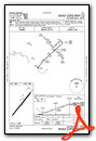
Instrument Approach Procedure (IAP) Charts
Nearby Airports with Instrument Procedures
| ID | Name | Heading / Distance | ||
|---|---|---|---|---|
 |
KHOT | Memorial Field Airport | 297° | 18.7 |
|
9M8 | Sheridan-Grant County Regional Airport | 090° | 20.4 |
|
KADF | Dexter B Florence Memorial Field Airport | 227° | 20.6 |
|
KSUZ | Saline County Regional Airport | 042° | 20.8 |
|
KLIT | Bill and Hillary Clinton Ntl/Adams Field Airport | 048° | 35.6 |
|
KORK | North Little Rock Municipal Airport | 039° | 39.1 |
|
KPBF | Pinebluff Regional/Grider Field Airport | 102° | 42.2 |
|
KCXW | Conway Regional Airport | 013° | 42.4 |
|
KCDH | Harrell Field Airport | 180° | 42.6 |
|
KLRF | Little Rock AFB Airport | 040° | 46.4 |
|
KBDQ | Morrilton Municipal Airport | 002° | 48.2 |
|
KMPJ | Petit Jean Park Airport | 351° | 48.8 |
Airport Images
Do you have a recent image of this airport? Upload it here!


