Login
Register


MCD
Mackinac Island Airport
Official FAA Data Effective 2024-04-18 0901Z
Chart Supplement

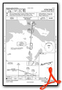
VFR Chart of KMCD
Sectional Charts at SkyVector.com
IFR Chart of KMCD
Enroute Charts at SkyVector.com
Location Information for KMCD
Coordinates: N45°51.90' / W84°38.23'Located 01 miles NW of Mackinac Island, Michigan on 125 acres of land. View all Airports in Michigan.
Surveyed Elevation is 741 feet MSL.
Operations Data
|
|
Airport Communications
| AWOS-3: | 118.275 Tel. 906-847-3778 |
|---|---|
| UNICOM: | 122.700 |
| CTAF: | 122.700 |
| AWOS-3 at SLH (13.7 S): | 118.175 231-627-4671 |
| ASOS at PLN (18.9 S): | 119.025 231-539-7700 |
| AWOS-3PT at CIU (24.2 N): | 127.575 906-495-1156 |
- APCH/DEP SVC PRVDD BY MINNEAPOLIS ARTCC ON FREQS 134.6/354.05 (PELLSTON RCAG).
Nearby Navigation Aids
|
| ||||||||||||||||||||||||||||||||||||||||||||||||||||||


Runway 08/26
| Dimensions: | 3501 x 75 feet / 1067 x 23 meters | |
|---|---|---|
| Surface: | Asphalt / Porous Friction Course in Good Condition | |
| Weight Limits: | S-13 | |
| Edge Lighting: | Medium Intensity | |
| Runway 08 | Runway 26 | |
| Coordinates: | N45°51.83' / W84°38.62' | N45°51.97' / W84°37.83' |
| Elevation: | 728.7 | 741.0 |
| Traffic Pattern: | Left | Left |
| Runway Heading: | 75° True | 255° True |
| Markings: | Non-Precision Instrument in good condition. | Non-Precision Instrument in good condition. |
| Glide Slope Indicator | P4L (3.50° Glide Path Angle) PAPI UNUSBL BYD 5 DEGS LEFT OF CNTRLN. | P4L (3.80° Glide Path Angle) PAPI UNUSBL BYD 5 DEGS LEFT OF CNTRLN. |
| REIL: | Yes | Yes |
| Obstacles: | 29 ft Tree 374 ft from runway, 290 ft left of center +4 FT FENCE, 0 FT DIST, 210 FT L/R. |
34 ft Tree 491 ft from runway, 275 ft left of center |
Services Available
| Fuel: | NONE |
|---|---|
| Transient Storage: | Tiedowns |
| Airframe Repair: | NONE |
| Engine Repair: | NONE |
| Bottled Oxygen: | NONE |
| Bulk Oxygen: | NONE |
Ownership Information
| Ownership: | Publicly owned | |
|---|---|---|
| Owner: | MACKINAC ISLAND STATE PARK CMSN | |
| PO BOX 370 | ||
| MACKINAC ISLAND, MI 49757-0370 | ||
| 906-847-3231 | ||
| Manager: | MYRON JOHNSON | |
| PO BOX 370 | ||
| MACKINAC ISLAND, MI 49757-0370 | ||
| 906-847-3231 | ||
Operational Statistics
| Single Engine Aircraft Based on Field: | 1 | Statistics collected for 12 month period ending 2022-12-31 | |
|---|---|---|---|
| Multi-Engine Aircraft Based on Field: | none | Annual Commercial Operations: | none |
| Jet Aircraft Based on Field: | none | Annual Commuter Operations: | none |
| Helicopters Based on Field: | none | Annual Air Taxi Operations: | 3500 |
| Military Aircraft Based on Field: | none | Annual Military Operations: | none |
| Gliders Based on Field: | none | Annual GA Local Operations: | 100 |
| Ultralights Based on Field: | none | Annual GA Itinerant Operations: | 7500 |
Other Remarks
- LRG BIRDS ON & INVOF ARPT; FLOCKS OF SEAGULLS INVOF LANDFILL 0.3 NM NE.
- NOISE ABATEMENT PROCS: CLIMB TO TPA BFR TURNING; AVD FLT OVR SHORE & TOWN; TGL NA.
- OBSTN LGTS ARE IN THE APCH TO RWY 26.
- PITOT COVS RCMDD WHILE PARKED; CK TUBES BFR DEP DUE TO MUD DAUBERS.
- FOR CD CTC MINNEAPOLIS ARTCC AT 651-463-5588.
- ACTVT REIL RWY 08 & 26; PAPI RWY 08 & 26; MIRL RWY 08/26 - 122.8.
Weather Minimums
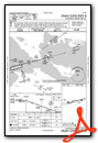
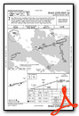
Instrument Approach Procedure (IAP) Charts
Nearby Airports with Instrument Procedures
| ID | Name | Heading / Distance | ||
|---|---|---|---|---|
 |
83D | Mackinac County Airport | 290° | 4.5 |
|
6Y1 | Bois Blanc Island Airport | 136° | 8.1 |
|
KSLH | Cheboygan County Airport | 158° | 13.6 |
|
KPLN | Pellston Regional/Emmet County Airport | 200° | 18.9 |
|
KCIU | Chippewa County International Airport | 016° | 24.2 |
|
KMGN | Harbor Springs Airport | 203° | 28.8 |
|
CYAM | Sault Ste Marie Airport | 008° | 37.6 |
|
KDRM | Drummond Island Airport | 076° | 38.4 |
|
KANJ | Sault Ste Marie Municipal/Sanderson Field Airport | 016° | 38.5 |
|
CPF2 | Bar River Airport | 033° | 40.1 |
|
KSJX | Beaver Island Airport | 255° | 40.4 |
|
N98 | Boyne City Municipal Airport | 200° | 42.1 |
Airport Images

By: davedudek


