Login
Register


MPI
Mariposa-Yosemite Airport
Official FAA Data Effective 2024-04-18 0901Z
Chart Supplement

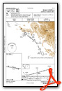
VFR Chart of KMPI
Sectional Charts at SkyVector.com
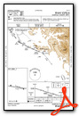
IFR Chart of KMPI
Enroute Charts at SkyVector.com
Location Information for KMPI
Coordinates: N37°30.65' / W120°2.37'Located 04 miles W of Mariposa, California on 100 acres of land. View all Airports in California.
Surveyed Elevation is 2254 feet MSL.
Operations Data
|
|
Airport Communications
| AWOS-3: | 135.6 Tel. 209-966-2912 |
|---|---|
| UNICOM: | 122.700 |
| CTAF: | 122.700 |
| AWOS-3 at MER (26.0 W): | 209-725-0104 |
| ATIS at MER (26.4 W): | 124.475 |
| ASOS at MCE (26.4 SW): | 132.175 209-381-0926 |
- APCH/DEP CTL SVC PRVDD BY OAKLAND ARTCC (ZOA) ON FREQ 121.25/327.0 (ANGELS CAMP RCAG).
Nearby Navigation Aids
|
| ||||||||||||||||||||||||||||||||||||


Runway 08/26
| Dimensions: | 3305 x 60 feet / 1007 x 18 meters | |
|---|---|---|
| Surface: | Asphalt in Fair Condition | |
| Weight Limits: | S-12 | |
| Edge Lighting: | Medium Intensity | |
| Runway 08 | Runway 26 | |
| Coordinates: | N37°30.70' / W120°2.71' | N37°30.61' / W120°2.04' |
| Elevation: | 2254.2 | 2222.9 |
| Traffic Pattern: | Right | Left |
| Runway Heading: | 100° True | 280° True |
| Markings: | Non-Precision Instrument in good condition. | Non-Precision Instrument in good condition. |
| Glide Slope Indicator | P2L (4.00° Glide Path Angle) | P2L (4.50° Glide Path Angle) |
| Obstacles: | 45 ft Tree 1340 ft from runway, 130 ft right of center | 29 ft Tree 762 ft from runway, 83 ft left of center |
Services Available
| Fuel: | 100LL (blue), Jet-A |
|---|---|
| Transient Storage: | Tiedowns |
| Airframe Repair: | MINOR |
| Engine Repair: | MINOR |
| Bottled Oxygen: | NONE |
| Bulk Oxygen: | NONE |
| Other Services: | PILOT INSTRUCTION,PARACHUTE JUMP ACTIVITY,AIRCRAFT RENTAL,AIRCRAFT SALES |
Ownership Information
| Ownership: | Publicly owned | |
|---|---|---|
| Owner: | COUNTY OF MARIPOSA | |
| 4639 BEN HUR ROAD | ||
| MARIPOSA, CA 95338 | ||
| 209-966-5356 | ||
| Manager: | SAMUEL CERVENY | WWW.YOSEMITEAVIATION.COM |
| 4639 BEN HUR ROAD | ||
| MARIPOSA, CA 95338 | ||
| 209-966-5356 | ||
Operational Statistics
| Single Engine Aircraft Based on Field: | 15 | Statistics collected for 12 month period ending 2019-06-13 | |
|---|---|---|---|
| Multi-Engine Aircraft Based on Field: | none | Annual Commercial Operations: | none |
| Jet Aircraft Based on Field: | none | Annual Commuter Operations: | none |
| Helicopters Based on Field: | none | Annual Air Taxi Operations: | 108 |
| Military Aircraft Based on Field: | none | Annual Military Operations: | none |
| Gliders Based on Field: | none | Annual GA Local Operations: | 6300 |
| Ultralights Based on Field: | none | Annual GA Itinerant Operations: | 3150 |
Other Remarks
- TRANSITIONAL SURFACE OBSTRUCTION: MOUNTAINS TO NORTH OF RWY 08/26.
- RY 08 TERRAIN DROPS ALONG BOTH SIDES OF TWY 45 FT FM RY EDGE.
- BIRDS ON AND INVOF ARPT.
- FOR CD CTC OAKLAND ARTCC AT 510-745-3380.
- 0LL FUEL AVBL 24 HRS WITH CREDIT CARD.
- ACTVT PAPI RWY 08 & 26; MIRL RWY 08/26 - CTAF.
Weather Minimums
Instrument Approach Procedure (IAP) Charts
Nearby Airports with Instrument Procedures
| ID | Name | Heading / Distance | ||
|---|---|---|---|---|
 |
E45 | Pine Mountain Lake Airport | 342° | 22.0 |
|
KMCE | Merced Yosemite Regional Airport | 239° | 26.4 |
|
KMER | Castle Airport | 252° | 26.4 |
|
KMAE | Madera Municipal Airport | 186° | 31.5 |
|
O22 | Columbia Airport | 330° | 35.9 |
|
O27 | Oakdale Airport | 292° | 39.1 |
|
F34 | Firebaugh Airport | 207° | 44.0 |
|
KMOD | Modesto City-County-Harry Sham Field Airport | 279° | 44.2 |
|
KFAT | Fresno Yosemite International Airport | 160° | 46.6 |
|
KCPU | Calaveras County-Maury Rasmussen Field Airport | 322° | 47.8 |
|
KLSN | Los Banos Municipal Airport | 236° | 47.9 |
|
KFCH | Fresno Chandler Exec Airport | 167° | 47.8 |
Airport Images
Do you have a recent image of this airport? Upload it here!


