Login
Register


MRF
Marfa Municipal Airport
Official FAA Data Effective 2024-04-18 0901Z
Chart Supplement

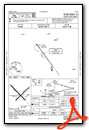
VFR Chart of KMRF
Sectional Charts at SkyVector.com
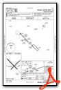
IFR Chart of KMRF
Enroute Charts at SkyVector.com
Location Information for KMRF
Coordinates: N30°22.27' / W104°1.05'Located 03 miles N of Marfa, Texas on 816 acres of land. View all Airports in Texas.
Surveyed Elevation is 4848 feet MSL.
Operations Data
|
|
Airport Communications
| AWOS-3PT: | 134.025 Tel. 432-729-3364 |
|---|---|
| CTAF: | 122.800 |
| UNICOM: | 122.800 |
| AWOS-3 at E38 (17.3 E): | 119.025 432-837-9613 |
| AWOS-3PT at PRS (47.6 S): | 118.0 432-229-4805 |
| AWOS-3PT at VHN (57.4 NW): | 119.925 432-283-2418 |
- APCH/DEP SVC PRVDD BY ALBUQUERQUE ARTCC (ABQ) ON FREQS 135.875/292.15 (FORT STOCKTON RCAG).
Nearby Navigation Aids
|
| ||||||||||||||||||||||||||||||||||||


Runway 13/31
| Dimensions: | 6203 x 75 feet / 1891 x 23 meters | |
|---|---|---|
| Surface: | Asphalt in Good Condition | |
| Weight Limits: | S-18 | |
| Edge Lighting: | Medium Intensity | |
| Runway 13 | Runway 31 | |
| Coordinates: | N30°22.68' / W104°1.53' | N30°21.96' / W104°0.70' |
| Elevation: | 4840.5 | 4830.0 |
| Traffic Pattern: | Left | Left |
| Runway Heading: | 135° True | 315° True |
| Markings: | Non-Precision Instrument in good condition. | Non-Precision Instrument in good condition. |
| Glide Slope Indicator | P2L (3.00° Glide Path Angle) | P2L (3.00° Glide Path Angle) |
| Obstacles: | 19 ft Tree 870 ft from runway, 250 ft left of center | |
Runway 04/22
| Dimensions: | 5309 x 75 feet / 1618 x 23 meters | |
|---|---|---|
| Surface: | Asphalt in Good Condition | |
| Weight Limits: | S-18 | |
| Runway 04 | Runway 22 | |
| Coordinates: | N30°21.94' / W104°1.23' | N30°22.56' / W104°0.51' |
| Elevation: | 4827.2 | 4848.7 |
| Traffic Pattern: | Left | Left |
| Runway Heading: | 45° True | 225° True |
| Markings: | Basic in good condition. | Basic in good condition. |
Runway 09/27
| Dimensions: | 2825 x 60 feet / 861 x 18 meters | |
|---|---|---|
| Surface: | Dirt in Poor Condition | |
| Runway 09 | Runway 27 | |
| Coordinates: | N30°22.18' / W104°1.52' | N30°22.17' / W104°0.98' |
| Elevation: | 4828.7 | 4834.5 |
| Traffic Pattern: | Left | Left |
| Runway Heading: | 91° True | 271° True |
| Obstacles: | 4 ft Fence 132 ft from runway | |
Services Available
| Fuel: | 100LL (blue), Jet-A |
|---|---|
| Transient Storage: | Tiedowns |
| Airframe Repair: | NONE |
| Engine Repair: | NONE |
| Bottled Oxygen: | NONE |
| Bulk Oxygen: | NONE |
| Other Services: | PILOT INSTRUCTION,GLIDER TOWING SERVICES GLIDER INSTRUCTION ONLY |
Ownership Information
| Ownership: | Publicly owned | |
|---|---|---|
| Owner: | PRESIDIO COUNTY | |
| P.O. BOX 606 | ||
| MARFA, TX 79843 | ||
| 432-729-4452 | ||
| Manager: | RUDY ESTOR | |
| 45101 SH 17 | ||
| MARFA, TX 79843 | ||
| 432-295-3906 | ||
Operational Statistics
| Single Engine Aircraft Based on Field: | 23 | Statistics collected for 12 month period ending 2024-03-09 | |
|---|---|---|---|
| Multi-Engine Aircraft Based on Field: | 1 | Annual Commercial Operations: | none |
| Jet Aircraft Based on Field: | none | Annual Commuter Operations: | none |
| Helicopters Based on Field: | none | Annual Air Taxi Operations: | none |
| Military Aircraft Based on Field: | none | Annual Military Operations: | none |
| Gliders Based on Field: | 6 | Annual GA Local Operations: | 4000 |
| Ultralights Based on Field: | none | Annual GA Itinerant Operations: | 2000 |
Other Remarks
- 105 FT AGL LGTD WATER TWR 1168 FT SW OF AER 31.
- GLIDER OPNS ON & INVOF ARPT.
- WILDLIFE ON & INVOF ARPT.
- PARL TWY ADJ RWY 04/22 CLSD EXC BTN TWY A AND RWY 13/31.
- FOR CD IF UNA TO CTC ON FSS FREQ, CTC ALBUQUERQUE ARTCC AT 505-856-4561.
- TWY A NORTHWEST OF RWY 04/22 CLSD TO ACFT MORE THAN 18000 LB.
- RWY 9 THLD MKD W/3 WHITE TIRES EACH SIDE OF RWY CNTRLN.
- 0LL 100LL, JET-A, SELF SERVE AVLBL 24 HRS.
- MIRL RWY 13/31 PRESET LOW INTST; TO INCR INTST ACTVT - CTAF.
Weather Minimums
Instrument Approach Procedure (IAP) Charts
Nearby Airports with Instrument Procedures
| ID | Name | Heading / Distance | ||
|---|---|---|---|---|
 |
E38 | Alpine-Casparis Municipal Airport | 087° | 17.3 |
|
KPRS | Presidio Lely International Airport | 202° | 47.6 |
|
KVHN | Culberson County Airport | 316° | 57.1 |
|
KFST | Fort Stockton-Pecos County Airport | 060° | 65.8 |
|
KPEQ | Pecos Municipal Airport | 023° | 66.0 |
|
E01 | Roy Hurd Memorial Airport | 037° | 92.3 |
|
KINK | Winkler County Airport | 026° | 94.2 |
|
KCNM | Cavern City Air Trml Airport | 353° | 118.4 |
|
KODO | Odessa-Schlemeyer Field Airport | 041° | 125.1 |
|
KMAF | Midland International Air and Space Port Airport | 044° | 132.6 |
|
E11 | Andrews County Airport | 032° | 140.0 |
|
E41 | Reagan County Airport | 068° | 140.4 |
Airport Images
Do you have a recent image of this airport? Upload it here!


