Login
Register


N13
Bloomsburg Municipal Airport
Official FAA Data Effective 2024-03-21 0901Z
Chart Supplement

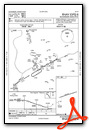
VFR Chart of N13
Sectional Charts at SkyVector.com
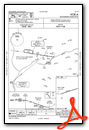
IFR Chart of N13
Enroute Charts at SkyVector.com
Location Information for N13
Coordinates: N40°59.86' / W76°26.11'Located 00 miles E of Bloomsburg, Pennsylvania on 69 acres of land. View all Airports in Pennsylvania.
Surveyed Elevation is 481 feet MSL.
Operations Data
|
|
Airport Communications
| WILKES-BARRE APPROACH: | 120.95 256.7 |
|---|---|
| WILKES-BARRE DEPARTURE: | 120.95 256.7 |
| CTAF: | 122.800 |
| UNICOM: | 122.800 |
| AWOS-3 at 79PN (8.0 W): | 118.075 570-271-8192 |
| AWOS-3 at N79 (11.0 SW): | 119.175 570-672-0389 |
| AWOS-3 at ZER (17.7 S): | 127.575 570-544-2778 |
Nearby Navigation Aids
|
| ||||||||||||||||||||||||||||||||||||||||||||||||


Runway 09/27
| Dimensions: | 3200 x 60 feet / 975 x 18 meters | |
|---|---|---|
| Surface: | Asphalt in Good Condition | |
| Weight Limits: | S-12 | |
| Edge Lighting: | Medium Intensity | |
| Runway 09 | Runway 27 | |
| Coordinates: | N40°59.80' / W76°26.45' | N40°59.92' / W76°25.78' |
| Elevation: | 481.2 | 481.2 |
| Traffic Pattern: | Left | Left |
| Runway Heading: | 77° True | 257° True |
| Markings: | Basic in good condition. | Basic in good condition. |
| Obstacles: | 47 ft Trees 868 ft from runway, 137 ft left of center | |
Services Available
| Fuel: | 100LL (blue) |
|---|---|
| Transient Storage: | Tiedowns AIRCRAFT MUST BRING OWN TIEDOWNS |
| Airframe Repair: | MAJOR |
| Engine Repair: | MAJOR |
| Bottled Oxygen: | NONE |
| Bulk Oxygen: | NONE |
| Other Services: | PILOT INSTRUCTION |
Ownership Information
| Ownership: | Publicly owned | |
|---|---|---|
| Owner: | TOWN OF BLOOMSBURG | |
| BLOOMSBURG TOWN HALL, 301 E 2ND ST | ||
| BLOOMSBURG, PA 17815-9588 | ||
| (570) 784-7123 | ||
| Manager: | BJ TEICHMAN | |
| 301 AIRPORT ROAD | ||
| BLOOMSBURG, PA 17815-9588 | ||
| (570) 317-2481 | ||
Operational Statistics
| Single Engine Aircraft Based on Field: | 14 | Statistics collected for 12 month period ending 2023-07-26 | |
|---|---|---|---|
| Multi-Engine Aircraft Based on Field: | 1 | Annual Commercial Operations: | none |
| Jet Aircraft Based on Field: | 1 | Annual Commuter Operations: | none |
| Helicopters Based on Field: | 1 | Annual Air Taxi Operations: | 50 |
| Military Aircraft Based on Field: | none | Annual Military Operations: | 50 |
| Gliders Based on Field: | none | Annual GA Local Operations: | 9500 |
| Ultralights Based on Field: | none | Annual GA Itinerant Operations: | 5500 |
Other Remarks
- DEER AND GEESE INVOF RWY. AFT DUSK, RWY 9 PREF DUE TO DEER ACT EAST END OF ARPT
- FOR CD CTC WILKES-BARRE APCH AT 570-655-2084.
- ACTVT MIRL RWY 09/27- CTAF.
Weather Minimums
Instrument Approach Procedure (IAP) Charts
Nearby Airports with Instrument Procedures
| ID | Name | Heading / Distance | ||
|---|---|---|---|---|
 |
8N8 | Danville Airport | 252° | 9.9 |
|
N79 | Northumberland County Airport | 208° | 11.0 |
|
KZER | Schuylkill County/Joe Zerbey Airport | 170° | 17.7 |
|
KHZL | Hazleton Regional Airport | 091° | 20.0 |
|
KSEG | Penn Valley Airport | 241° | 22.2 |
|
KIPT | Williamsport Regional Airport | 303° | 26.5 |
|
74N | Bendigo Airport | 192° | 26.9 |
|
KWBW | Wilkes-Barre Wyoming Valley Airport | 055° | 32.0 |
|
22N | Jake Arner Memorial Airport | 109° | 32.7 |
|
KAVP | Wilkes-Barre/Scranton International Airport | 057° | 38.2 |
|
9D4 | Deck Airport | 172° | 39.0 |
|
08N | Keller Brothers Airport | 173° | 42.6 |


