Login
Register


OCQ
Oconto/J Douglas Bake Municipal Airport
Official FAA Data Effective 2024-04-18 0901Z
Chart Supplement

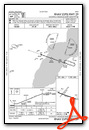
VFR Chart of KOCQ
Sectional Charts at SkyVector.com
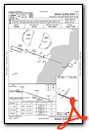
IFR Chart of KOCQ
Enroute Charts at SkyVector.com
Location Information for KOCQ
Coordinates: N44°52.44' / W87°54.59'Located 02 miles SW of Oconto, Wisconsin on 304 acres of land. View all Airports in Wisconsin.
Surveyed Elevation is 604 feet MSL.
Operations Data
|
|
Airport Communications
| AWOS-3: | 120.925 Tel. 920-835-1599 |
|---|---|
| GREEN BAY APPROACH: | 120.3 338.2 |
| GREEN BAY DEPARTURE: | 120.3 338.2 |
| CTAF: | 122.800 |
| UNICOM: | 122.800 |
| AWOS-3PT at MNM (19.0 NE): | 121.45 906-863-8801 |
| AWOS-3PT at SUE (20.9 E): | 128.325 920-743-7087 |
| AWOS-2 at 4WN7 (24.4 S): |
- APCH/DEP SVC PRVDD BY MINNEAPOLIS ARTCC ON 125.55/370.9 (GREEN BAY RCAG) WHEN GREEN BAY APCH CLSD.
Nearby Navigation Aids
|
| ||||||||||||||||||||||||||||||||||||||||||||||||||||||||||||


Runway 11/29
| Dimensions: | 3198 x 75 feet / 975 x 23 meters | |
|---|---|---|
| Surface: | Asphalt in Excellent Condition | |
| Weight Limits: | S-40, D-55, ST-90 | |
| Edge Lighting: | Medium Intensity | |
| Runway 11 | Runway 29 | |
| Coordinates: | N44°52.50' / W87°54.89' | N44°52.33' / W87°54.19' |
| Elevation: | 604.3 | 601.5 |
| Traffic Pattern: | Left | Left |
| Runway Heading: | 109° True | 289° True |
| Markings: | Non-Precision Instrument in good condition. | Non-Precision Instrument in good condition. |
| Glide Slope Indicator | P2L (4.00° Glide Path Angle) | P2L (4.00° Glide Path Angle) RWY 29 PAPI UNUSBL BYD 8 DEGS RIGHT OF CNTRLN. |
| REIL: | Yes | Yes |
Runway 04/22
RWY 4/22 NOT PLWD NOV-APR. | ||
| Dimensions: | 1840 x 150 feet / 561 x 46 meters | |
|---|---|---|
| Surface: | Turf in Fair Condition | |
| Runway 04 | Runway 22 | |
| Coordinates: | N44°52.38' / W87°54.80' | N44°52.61' / W87°54.52' |
| Elevation: | 602.9 | 601.6 |
| Traffic Pattern: | Left | Left |
| Runway Heading: | 41° True | 221° True |
| Markings: | None | None |
Services Available
| Fuel: | 100LL (blue) |
|---|---|
| Transient Storage: | Hangars,Tiedowns |
| Airframe Repair: | NONE |
| Engine Repair: | NONE |
| Bottled Oxygen: | NONE |
| Bulk Oxygen: | NONE |
| Other Services: | PILOT INSTRUCTION |
Ownership Information
| Ownership: | Publicly owned | |
|---|---|---|
| Owner: | OCONTO CITY AND COUNTY | |
| 1210 MAIN STREET | ||
| OCONTO, WI 54153 | ||
| 920-834-7711 | ||
| Manager: | FRANK CALVERT | |
| 2983 AIRPORT RD | ||
| OCONTO, WI 54153 | ||
| 920-834-7727 | ||
Operational Statistics
| Single Engine Aircraft Based on Field: | 19 | Statistics collected for 12 month period ending 2021-09-14 | |
|---|---|---|---|
| Multi-Engine Aircraft Based on Field: | none | Annual Commercial Operations: | none |
| Jet Aircraft Based on Field: | none | Annual Commuter Operations: | none |
| Helicopters Based on Field: | none | Annual Air Taxi Operations: | 100 |
| Military Aircraft Based on Field: | none | Annual Military Operations: | 20 |
| Gliders Based on Field: | none | Annual GA Local Operations: | 5000 |
| Ultralights Based on Field: | none | Annual GA Itinerant Operations: | 6500 |
Other Remarks
- CONFIRM WINTER RY CONDITIONS & SNOW REMOVAL WITH AMGR 920-834-7727.
- MIGRATORY WATERFOWL ON & INVOF ARPT.
- FOR CD CTC GREEN BAY APCH AT 920-431-5741, WHEN GREEN BAY APCH CLSD, FOR CD CTC MINNEAPOLIS ARTCC AT 651-463-5588.
- RWY 04/22 MKD WITH WHITE CONES.
- 0LL 24 HR FUEL AVBL WITH CREDIT CARD.
- ACTVT REIL RWY 11 & 29; MIRL RWY 11/29 - CTAF.
Weather Minimums
Instrument Approach Procedure (IAP) Charts
Nearby Airports with Instrument Procedures
| ID | Name | Heading / Distance | ||
|---|---|---|---|---|
 |
KMNM | Menominee Regional Airport | 037° | 19.1 |
|
KSUE | Door County Cherryland Airport | 094° | 20.9 |
|
KGRB | Green Bay/Austin Straubel International Airport | 202° | 25.2 |
|
KEZS | Shawano Municipal Airport | 259° | 28.2 |
|
3D2 | Ephraim/Gibraltar Airport | 062° | 34.5 |
|
KCLI | Clintonville Municipal Airport | 246° | 38.4 |
|
KATW | Appleton International Airport | 215° | 45.3 |
|
KMTW | Manitowoc County Airport | 167° | 45.8 |
|
2P2 | Washington Island Airport | 053° | 52.0 |
|
KAIG | Langlade County Airport | 288° | 53.8 |
|
8D1 | New Holstein Municipal Airport | 189° | 56.5 |
|
KIMT | Ford Airport | 351° | 57.3 |
Airport Images
Do you have a recent image of this airport? Upload it here!


