Login
Register


ONA
Winona Municipal-Max Conrad Field Airport
Official FAA Data Effective 2024-03-21 0901Z
Chart Supplement

VFR Chart of KONA
Sectional Charts at SkyVector.com
IFR Chart of KONA
Enroute Charts at SkyVector.com
Location Information for KONA
Coordinates: N44°4.78' / W91°42.70'Located 03 miles NW of Winona, Minnesota on 575 acres of land. View all Airports in Minnesota.
Surveyed Elevation is 656 feet MSL.
Operations Data
|
|
Airport Communications
| AWOS-3: | 118.075 Tel. 507-453-2991 |
|---|---|
| CTAF: | 122.800 |
| UNICOM: | 122.800 |
| ATIS at LSE (23.0 SE): | 124.95 |
| ASOS at LSE (23.2 SE): | 124.95 608-781-9067 |
| AWOS-3PT at FKA (31.5 SW): | 118.550 507-765-2182 |
- APCH/DEP SVC PRVDD BY MINNEAPOLIS ARTCC ON FREQS 128.6/363.0 (LA CROSSE RCAG).
Nearby Navigation Aids
|
| ||||||||||||||||||||||||||||||||||||||||||||||||||||||||||||


Runway 12/30
RUNWAY 30 IS CALM WIND RUNWAY | ||
| Dimensions: | 5679 x 100 feet / 1731 x 30 meters | |
|---|---|---|
| Surface: | Asphalt / Grooved in Good Condition | |
| Weight Limits: | S-30, D-55 | |
| Edge Lighting: | Medium Intensity | |
| Runway 12 | Runway 30 | |
| Coordinates: | N44°5.01' / W91°43.26' | N44°4.55' / W91°42.13' |
| Elevation: | 656.2 | 656.1 |
| Traffic Pattern: | Left | Right |
| Runway Heading: | 119° True | 299° True |
| Displaced Threshold: | 480 Feet | |
| Declared Distances: | TORA:5679 TODA:5679 ASDA:5199 LDA:5199 | TORA:5679 TODA:5679 ASDA:5679 LDA:5199 |
| Markings: | Precision Instrument in fair condition. | Precision Instrument in fair condition. |
| Glide Slope Indicator | P4L (3.00° Glide Path Angle) | P4L (3.00° Glide Path Angle) |
| Approach Lights: | MALSR 1,400 Foot Medium-intensity Approach Lighting System with runway alignment indicator lights. | |
| REIL: | Yes | |
| Obstacles: | RWY 30 HAS 75 FT TREE 2449 FT FM RWY END, 635 FT R. |
75 ft Trees 2449 ft from runway, 635 ft right of center |
Services Available
| Fuel: | 100LL (blue), Jet-A |
|---|---|
| Transient Storage: | Hangars,Tiedowns |
| Airframe Repair: | MAJOR |
| Engine Repair: | MAJOR |
| Bottled Oxygen: | NONE |
| Bulk Oxygen: | NONE |
| Other Services: | CHARTER SERVICE,PILOT INSTRUCTION,AIRCRAFT RENTAL,AIRCRAFT SALES,ANNUAL SURVEYING |
Ownership Information
| Ownership: | Publicly owned | |
|---|---|---|
| Owner: | CITY OF WINONA | |
| BOX 378 | ||
| WINONA, MN 55987 | ||
| 507-457-8274 | ||
| Manager: | BRIAN DEFRANG | |
| BOX 378 | ||
| WINONA, MN 55987 | ||
| 507-457-8274 | ||
Operational Statistics
| Single Engine Aircraft Based on Field: | 27 | Statistics collected for 12 month period ending 2019-07-31 | |
|---|---|---|---|
| Multi-Engine Aircraft Based on Field: | 2 | Annual Commercial Operations: | none |
| Jet Aircraft Based on Field: | none | Annual Commuter Operations: | none |
| Helicopters Based on Field: | none | Annual Air Taxi Operations: | 850 |
| Military Aircraft Based on Field: | none | Annual Military Operations: | 25 |
| Gliders Based on Field: | 1 | Annual GA Local Operations: | 6075 |
| Ultralights Based on Field: | none | Annual GA Itinerant Operations: | 3500 |
Other Remarks
- DEER AND WATERFOWL ON AND INVOF ARPT.
- FOR CD IF UNA TO CTC ON FSS FREQ, CTC MINNEAPOLIS ARTCC AT 651-463-5588.
- 0LL FOR SVC AFT HRS CALL 507-429-6321 OR 507-313-8720.
- MIRL RY 12/30 PRESET ON LOW INTST, TO INCR INTST & ACTVT MALSR RY 30; REIL RY 12; PAPI RY 12/30; MIRL RY 12/30 - CTAF.
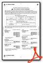
Weather Minimums
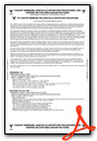
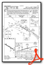
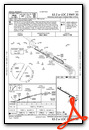
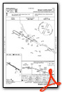
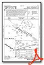
Instrument Approach Procedure (IAP) Charts
Nearby Airports with Instrument Procedures
| ID | Name | Heading / Distance | ||
|---|---|---|---|---|
 |
55Y | Rushford Municipal/Robert W Bunke Field Airport | 198° | 16.6 |
|
KLSE | La Crosse Regional Airport | 121° | 23.1 |
|
KCHU | Houston County Airport | 162° | 30.4 |
|
KFKA | Fillmore County Airport | 220° | 31.6 |
|
KRST | Rochester International Airport | 253° | 35.7 |
|
KBCK | Black River Falls Area Airport | 074° | 38.4 |
|
KCMY | Sparta/Fort Mc Coy Airport | 099° | 42.8 |
|
KRGK | Red Wing Regional Airport | 312° | 45.2 |
|
Y51 | Viroqua Municipal Airport | 130° | 46.4 |
|
KCJJ | Ellen Church Field Airport | 203° | 46.6 |
|
KEAU | Chippewa Valley Regional Airport | 011° | 48.2 |
|
KDEH | Decorah Municipal Airport | 181° | 48.3 |
Airport Images
Do you have a recent image of this airport? Upload it here!


