Login
Register


PRN
Mac Crenshaw Memorial Airport
Official FAA Data Effective 2024-04-18 0901Z
Chart Supplement

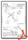
VFR Chart of KPRN
Sectional Charts at SkyVector.com
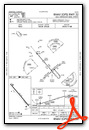
IFR Chart of KPRN
Enroute Charts at SkyVector.com
Location Information for KPRN
Coordinates: N31°50.74' / W86°36.64'Located 02 miles NE of Greenville, Alabama on 89 acres of land. View all Airports in Alabama.
Surveyed Elevation is 451 feet MSL.
TPA: 1000 FT AGL CAT A AND B ACFT, 1500 FT AGL CAT C ACFT.
Operations Data
|
|
Airport Communications
| ASOS: | 120.0 Tel. 334-383-9676 |
|---|---|
| UNICOM: | 122.800 |
| CTAF: | 122.800 |
| ASOS at MGM (29.5 N): | 334-288-0445 |
| ATIS at MGM (29.5 N): | 120.675 |
| ATIS at TOI (30.5 E): | 120.925 |
- APCH/DEP SVC PRVDD BY ATLANTA ARTCC ON FREQS 120.55/270.25 (MONTGOMERY RCAG).
Nearby Navigation Aids
|
| ||||||||||||||||||||||||||||||||||||||||||||||||||||||||||||


Runway 14/32
| Dimensions: | 5501 x 80 feet / 1677 x 24 meters | |
|---|---|---|
| Surface: | Asphalt / Grooved in Good Condition | |
| Weight Limits: | S-15 | |
| Edge Lighting: | Medium Intensity | |
| Runway 14 | Runway 32 | |
| Coordinates: | N31°51.09' / W86°36.99' | N31°50.40' / W86°36.30' |
| Elevation: | 451.4 | 424.2 |
| Traffic Pattern: | Left | Left |
| Runway Heading: | 140° True | 320° True |
| Displaced Threshold: | 300 Feet | |
| Declared Distances: | TORA:5200 TODA:5500 ASDA:5200 LDA:5200 | TORA:5500 TODA:5500 ASDA:5500 LDA:5200 |
| Markings: | Non-Precision Instrument in good condition. | Non-Precision Instrument in good condition. |
| Glide Slope Indicator | P2L (3.00° Glide Path Angle) | P2L (3.00° Glide Path Angle) |
| REIL: | Yes | Yes |
| Obstacles: | 135 ft Tree 2512 ft from runway, 233 ft right of center | 35 ft Trees 1013 ft from runway, 51 ft left of center CLNC SLOPE 37:1 FM DSPLCD THR. |
Services Available
| Fuel: | 100LL (blue) |
|---|---|
| Transient Storage: | Hangars,Tiedowns |
| Airframe Repair: | NONE |
| Engine Repair: | NONE |
| Bottled Oxygen: | NONE |
| Bulk Oxygen: | NONE |
Ownership Information
| Ownership: | Publicly owned | |
|---|---|---|
| Owner: | CITY OF GREENVILLE | |
| PO BOX 158 | ||
| GREENVILLE, AL 36037 | ||
| 334-382-2647 | ||
| Manager: | BRUCE D. EDWARDS | |
| 117 COMMANCHE DRIVE | ||
| GREENVILLE, AL 36037 | ||
| 334-382-8166 | ||
Operational Statistics
| Single Engine Aircraft Based on Field: | 7 | Statistics collected for 12 month period ending 2020-06-01 | |
|---|---|---|---|
| Multi-Engine Aircraft Based on Field: | 2 | Annual Commercial Operations: | none |
| Jet Aircraft Based on Field: | none | Annual Commuter Operations: | none |
| Helicopters Based on Field: | 1 | Annual Air Taxi Operations: | none |
| Military Aircraft Based on Field: | none | Annual Military Operations: | 500 |
| Gliders Based on Field: | none | Annual GA Local Operations: | 567 |
| Ultralights Based on Field: | none | Annual GA Itinerant Operations: | 3207 |
Other Remarks
- FOR CD CTC ATLANTA ARTCC AT 770-210-7692.
- 0LL SVC CHARGE FOR FUEL AFT HRS CALL 334-300-0032.
- ACTVT REIL RWY 14 & 32; PAPI RWY 14 & 32; MIRL RWY 14/32 - CTAF.
- TPA: 1000 FT AGL CAT A AND B ACFT, 1500 FT AGL CAT C ACFT.
Weather Minimums

Instrument Approach Procedure (IAP) Charts
Nearby Airports with Instrument Procedures
| ID | Name | Heading / Distance | ||
|---|---|---|---|---|
 |
KMGM | Montgomery Regional (Dannelly Field) Airport | 022° | 29.4 |
|
KTOI | Troy Municipal At N Kenneth Campbell Field Airport | 088° | 30.5 |
|
KGZH | Evergreen Regional/Middleton Field Airport | 220° | 34.0 |
|
79J | South Alabama Regional At Bill Benton Field Airport | 160° | 34.1 |
|
KMXF | Maxwell AFB Airport | 021° | 34.5 |
|
KSEM | Craig Field Airport | 327° | 35.5 |
|
1A9 | Prattville/Grouby Field Airport | 007° | 35.9 |
|
61A | Camden Municipal Airport | 282° | 38.1 |
|
08A | Wetumpka Municipal Airport | 019° | 43.2 |
|
KMVC | Monroe County Aeroplex Airport | 238° | 44.5 |
|
KEDN | Enterprise Municipal Airport | 131° | 49.0 |
|
0J4 | Florala Municipal Airport | 162° | 50.5 |
Airport Images
Do you have a recent image of this airport? Upload it here!


