Login
Register


PWT
Bremerton Ntl Airport
Official FAA Data Effective 2024-04-18 0901Z
Chart Supplement

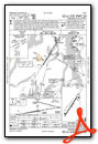
VFR Chart of KPWT
Sectional Charts at SkyVector.com
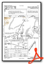
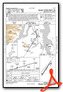
IFR Chart of KPWT
Enroute Charts at SkyVector.com
Location Information for KPWT
Coordinates: N47°29.42' / W122°45.89'Located 07 miles SW of Bremerton, Washington on 1729 acres of land. View all Airports in Washington.
Surveyed Elevation is 444 feet MSL.
Operations Data
|
|
Airport Communications
| AWOS-3PT: | 121.2 Tel. 360-674-2811 |
|---|---|
| SEATTLE APPROACH: | 120.1 254.4 269.125 269.125 |
| SEATTLE DEPARTURE: | 120.1 254.4 269.125 269.125 |
| CLEARANCE DELIVERY: | 127.1 |
| UNICOM: | 123.050 |
| CTAF: | 123.050 |
| ATIS at TIW (15.4 SE): | 124.05 |
| ASOS at TIW (15.4 SE): | 253-858-6507 |
| D-ATIS at SEA (18.5 E): | 118.0 |
Nearby Navigation Aids
|
| ||||||||||||||||||||||||||||||||||||||||||||||||||||||


Runway 02/20
| Dimensions: | 6000 x 150 feet / 1829 x 46 meters | |
|---|---|---|
| Surface: | Asphalt / Grooved in Good Condition | |
| Weight Limits: | S-66, D-150, ST-336 | |
| Edge Lighting: | High Intensity | |
| Runway 02 | Runway 20 | |
| Coordinates: | N47°29.00' / W122°46.28' | N47°29.83' / W122°45.49' |
| Elevation: | 444.0 | 441.5 |
| Traffic Pattern: | Right | Left |
| Runway Heading: | 33° True | 213° True |
| Markings: | Non-Precision Instrument in good condition. | Precision Instrument in good condition. |
| Glide Slope Indicator | P4L (3.00° Glide Path Angle) | P4L (2.83° Glide Path Angle) |
| Approach Lights: | MALSR 1,400 Foot Medium-intensity Approach Lighting System with runway alignment indicator lights. | |
| REIL: | Yes | |
| Obstacles: | +6 FT TRN 25 FT FM RWY END & 250 FT R. |
33 ft Fence 1740 ft from runway, 300 ft left of center +6 FT' FENCE 0 TO 200 FT FM RWY END 300 FT R. |
Services Available
| Fuel: | 100LL (blue), Jet-A |
|---|---|
| Transient Storage: | Tiedowns PILOT MUST PRVD TIEDOWNS. |
| Airframe Repair: | MAJOR |
| Engine Repair: | MAJOR |
| Bottled Oxygen: | NONE |
| Bulk Oxygen: | NONE |
| Other Services: | AIR FREIGHT SERVICES,AIR AMBULANCE SERVICES,AVIONICS,CHARTER SERVICE,PILOT INSTRUCTION,AIRCRAFT RENTAL |
Ownership Information
| Ownership: | Publicly owned | |
|---|---|---|
| Owner: | PORT OF BREMERTON | |
| 8850 SW STATE HIGHWAY 3 | ||
| BREMERTON, WA 98312 | ||
| (360) 674-2381 | ||
| Manager: | MONROE WHITMAN | |
| 8850 SW STATE HIGHWAY 3 | ||
| BREMERTON, WA 98312 | ||
| (360) 813-0828 | ||
Operational Statistics
| Single Engine Aircraft Based on Field: | 94 | Statistics collected for 12 month period ending 2022-12-31 | |
|---|---|---|---|
| Multi-Engine Aircraft Based on Field: | 4 | Annual Commercial Operations: | none |
| Jet Aircraft Based on Field: | 3 | Annual Commuter Operations: | none |
| Helicopters Based on Field: | 2 | Annual Air Taxi Operations: | 100 |
| Military Aircraft Based on Field: | none | Annual Military Operations: | 900 |
| Gliders Based on Field: | 1 | Annual GA Local Operations: | 39000 |
| Ultralights Based on Field: | none | Annual GA Itinerant Operations: | 26000 |
Other Remarks
- THIS AIRPORT HAS BEEN SURVEYED BY THE NATIONAL GEODETIC SURVEY.
- FOR CD CTC SEATTLE APCH AT 206-214-4723.
- WINTER WEATHER OPS AND REPORTING MON - FRI 8:00-16:30.
- FENCE CROSSES N END OF ABND RWY.
- 0LL 24 HR FUEL TRML 300 FT WSW OF TWY A4, ONLY FOR 100LL.
- ACTVT MALSR RWY 20; REIL RWY 02; PAPI RWY 02; HIRL 02/20; TWY LGTS - CTAF. PAPI RWY 20 OPR CONSLY.
Weather Minimums
Instrument Approach Procedure (IAP) Charts
Nearby Airports with Instrument Procedures
| ID | Name | Heading / Distance | ||
|---|---|---|---|---|
 |
KTIW | Tacoma Narrows Airport | 150° | 15.4 |
|
KSEA | Seattle-Tacoma International Airport | 097° | 18.6 |
|
KBFI | Boeing Field/King County International Airport | 082° | 19.0 |
|
KSHN | Sanderson Field Airport | 225° | 21.9 |
|
KRNT | Renton Municipal Airport | 089° | 22.3 |
|
S50 | Auburn Municipal Airport | 113° | 24.0 |
|
KTCM | Mcchord Field (Joint Base Lewis-Mcchord) Airport | 150° | 24.2 |
|
KGRF | Gray AAF (Joint Base Lewis-Mcchord) Airport | 162° | 25.8 |
|
KPLU | Pierce County - Thun Field Airport | 139° | 30.3 |
|
KPAE | Seattle Paine Field International Airport | 037° | 31.8 |
|
KOLM | Olympia Regional Airport | 190° | 31.8 |
|
0S9 | Jefferson County International Airport | 356° | 33.9 |


