Login
Register


REI
Redlands Municipal Airport
Official FAA Data Effective 2024-04-18 0901Z
Chart Supplement

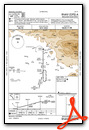
VFR Chart of KREI
Sectional Charts at SkyVector.com
IFR Chart of KREI
Enroute Charts at SkyVector.com
Location Information for KREI
Coordinates: N34°5.12' / W117°8.78'Located 02 miles NE of Redlands, California on 194 acres of land. View all Airports in California.
Surveyed Elevation is 1574 feet MSL.
TPA - 929 FOR FIXED WING ACFT, N SIDE OF RWY 08/26; 500 FOR HEL, S SIDE OF RWY 08/26.
Operations Data
|
|
Airport Communications
| SOCAL APPROACH: | 127.0 ;NORTH-NE 318.2 ;NORTH-NE |
|---|---|
| SOCAL DEPARTURE: | 127.0 ;NORTH-NE 318.2 ;NORTH-NE |
| UNICOM: | 123.050 |
| CTAF: | 123.050 |
| CLASS C: | 127.0 ;NORTH-NE |
| AWOS-3 at SBD (4.4 W): | 909-382-0067 |
| ATIS at SBD (4.4 W): | 124.175 |
| ATIS at RIV (13.4 SW): | 134.75 |
Nearby Navigation Aids
|
| ||||||||||||||||||||||||||||||||||||||||||


Runway 08/26
| Dimensions: | 4504 x 75 feet / 1373 x 23 meters | |
|---|---|---|
| Surface: | Asphalt in Good Condition | |
| Weight Limits: | S-12 | |
| Edge Lighting: | Medium Intensity | |
| Runway 08 | Runway 26 | |
| Coordinates: | N34°5.11' / W117°9.23' | N34°5.12' / W117°8.34' |
| Elevation: | 1471.7 | 1574.4 |
| Traffic Pattern: | Left | Right |
| Runway Heading: | 90° True | 270° True |
| Markings: | Basic in good condition. | Basic in good condition. |
| Glide Slope Indicator | P2L (3.00° Glide Path Angle) | |
| REIL: | Yes | Yes |
| Obstacles: | 4 ft Fence 300 ft from runway, 125 ft left of center | 60 ft Trees 1500 ft from runway, 120 ft left of center |
Services Available
| Fuel: | 100LL (blue) |
|---|---|
| Transient Storage: | Tiedowns |
| Airframe Repair: | MAJOR |
| Engine Repair: | MAJOR |
| Bottled Oxygen: | NONE |
| Bulk Oxygen: | HIGH/LOW |
| Other Services: | CHARTER SERVICE,PILOT INSTRUCTION,AIRCRAFT RENTAL,AIRCRAFT SALES |
Ownership Information
| Ownership: | Publicly owned | |
|---|---|---|
| Owner: | CITY OF REDLANDS | |
| 35 CAJON STREET, SUITE 15A | ||
| REDLANDS, CA 92374 | ||
| 909-798-7668 | ||
| Manager: | ADARIAN "AJ" LAWSON | |
| 1745 SESSUMS DRIVE | ||
| REDLANDS, CA 92373 | ||
| 909-557-8520 | MAIN NO: 909-557-8520 | |
Operational Statistics
| Single Engine Aircraft Based on Field: | 160 | Statistics collected for 12 month period ending 2021-09-30 | |
|---|---|---|---|
| Multi-Engine Aircraft Based on Field: | 10 | Annual Commercial Operations: | none |
| Jet Aircraft Based on Field: | 1 | Annual Commuter Operations: | none |
| Helicopters Based on Field: | 12 | Annual Air Taxi Operations: | none |
| Military Aircraft Based on Field: | none | Annual Military Operations: | none |
| Gliders Based on Field: | 2 | Annual GA Local Operations: | 54800 |
| Ultralights Based on Field: | none | Annual GA Itinerant Operations: | 12000 |
Other Remarks
- AVOID NOISE SENSITIVE AREAS S OF ARPT.
- AEROBATIC ACT NE OF ARPT FROM 3500 FT MSL TO 7500 FT MSL; SEE SPECIAL NOTICE - AEROBATIC OPERATIONS NORTHEAST OF REDLANDS, CA.
- COYOTES AND WATERFOWL ON AND INVOF ARPT.
- FOR CD CTC SOCAL APCH AT 800-448-3724.
- RMN VIGILANT TO SEE AND AVOID LRG AND HVY ACFT WI 5 NM OF REI AND ON SBD RWY 24 APCH WI 1.5 NM EAST THRU NORTH OF RWY; CTN WAKE TURB. ACTVLY MNT REI CTAF AND, IF POSS, SBD ON 119.45. OPR TRANSPONDER AND ADS-B OUT STRONGLY ENCOURAGED.
- TSNT HEL PRKG ON WEST RAMP ONLY. HEL NOSE FACING EAST OR WEST. CALL ARPT MGMT FOR PRKG DTLS AT 909-557-8520.
- 0LL SELF SERVE 100LL FUEL AVBL 24-7.
- ACTVT REIL RWYS 08 & 26; PAPI RWY 08; MIRL RWY 08/26 - CTAF.
- AUTOMATED UNICOM; 3 CLICKS FOR WX AND ADZY, 4 CLICKS FOR RADIO CHECK.
- TPA - 929 FOR FIXED WING ACFT, N SIDE OF RWY 08/26; 500 FOR HEL, S SIDE OF RWY 08/26.
Weather Minimums
Instrument Approach Procedure (IAP) Charts
Nearby Airports with Instrument Procedures
| ID | Name | Heading / Distance | ||
|---|---|---|---|---|
 |
KSBD | San Bernardino International Airport | 277° | 4.5 |
|
KRIV | March Arb Airport | 204° | 13.4 |
|
KRIR | Flabob Airport | 246° | 14.4 |
|
KRAL | Riverside Municipal Airport | 241° | 16.9 |
|
L35 | Big Bear City Airport | 053° | 18.0 |
|
KHMT | Hemet-Ryan Airport | 163° | 21.9 |
|
KONT | Ontario International Airport | 265° | 22.7 |
|
KCNO | Chino Airport | 254° | 25.3 |
|
KAJO | Corona Municipal Airport | 243° | 25.4 |
|
KCCB | Cable Airport | 273° | 27.0 |
|
KAPV | Apple Valley Airport | 356° | 29.4 |
|
F70 | French Valley Airport | 178° | 30.6 |
Airport Images

By: Dave


