Login
Register


S12
Albany Municipal Airport
Official FAA Data Effective 2024-04-18 0901Z
Chart Supplement

VFR Chart of S12
Sectional Charts at SkyVector.com
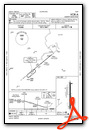
IFR Chart of S12
Enroute Charts at SkyVector.com
Location Information for S12
Coordinates: N44°38.27' / W123°3.57'Located 03 miles E of Albany, Oregon on 147 acres of land. View all Airports in Oregon.
Surveyed Elevation is 226 feet MSL.
Operations Data
|
|
Airport Communications
| AWOS-3PT: | 119.925 Tel. 541-967-3508 |
|---|---|
| CASCADE APPROACH: | 127.5 348.7 |
| CASCADE DEPARTURE: | 127.5 348.7 |
| CTAF: | 122.725 |
| UNICOM: | 122.725 |
| AWOS-3PT at CVO (12.9 SW): | 135.775 541-754-0081 |
| ASOS at SLE (16.5 N): | 124.55 503-371-1062 |
| ATIS at SLE (16.5 N): | 124.55 |
- APCH/DEP CTL SVC PRVDD BY SEATTLE ARTCC (ZSE) ON FREQ 125.8/291.7 (HORTON RCAG) WHEN CASCADE APCH CTL (EUG) CLSD.
Nearby Navigation Aids
|
| ||||||||||||||||||||||||||||||||||||||||||||||||


Runway 16/34
| Dimensions: | 3004 x 75 feet / 916 x 23 meters | |
|---|---|---|
| Surface: | Asphalt in Good Condition | |
| Weight Limits: | S-30, D-43, ST-71 | |
| Edge Lighting: | Medium Intensity | |
| Runway 16 | Runway 34 | |
| Coordinates: | N44°38.52' / W123°3.57' | N44°38.02' / W123°3.57' |
| Elevation: | 225.8 | 226.3 |
| Traffic Pattern: | Left | Left |
| Runway Heading: | 180° True | 360° True |
| Markings: | Basic in good condition. | Basic in good condition. |
| Glide Slope Indicator | V4L (4.00° Glide Path Angle) | V2L (4.00° Glide Path Angle) |
| REIL: | Yes | Yes |
| Obstacles: | 13 ft Road 427 ft from runway, 148 ft right of center RY 16 80 FT UNMARKED TREE AT 1530 FT ON CNTRLN AT 18:1. |
80 ft Trees 1520 ft from runway 65 FT MKD PLINE AT 1575 FT ON CNTRLN AT 20:1. |
Services Available
| Fuel: | 100LL (blue), Jet-A |
|---|---|
| Transient Storage: | Tiedowns |
| Airframe Repair: | NONE |
| Engine Repair: | NONE |
| Bottled Oxygen: | NONE |
| Bulk Oxygen: | NOT AVAILABLE |
| Other Services: | PILOT INSTRUCTION,AIRCRAFT RENTAL,AIRCRAFT SALES |
Ownership Information
| Ownership: | Publicly owned | |
|---|---|---|
| Owner: | CITY OF ALBANY | |
| P O BOX 490 | ||
| ALBANY, OR 97321 | ||
| 541-917-7600 | ||
| Manager: | ROBB ROMEO | |
| 310 NE WAVERLY DRIVE | ||
| ALBANY, OR 97321 | ||
| 541-917-7605 | ||
Operational Statistics
| Single Engine Aircraft Based on Field: | 64 | Statistics collected for 12 month period ending 2019-10-21 | |
|---|---|---|---|
| Multi-Engine Aircraft Based on Field: | 3 | Annual Commercial Operations: | none |
| Jet Aircraft Based on Field: | 1 | Annual Commuter Operations: | none |
| Helicopters Based on Field: | none | Annual Air Taxi Operations: | 650 |
| Military Aircraft Based on Field: | none | Annual Military Operations: | none |
| Gliders Based on Field: | none | Annual GA Local Operations: | 10000 |
| Ultralights Based on Field: | none | Annual GA Itinerant Operations: | 12650 |
Other Remarks
- TWY MKD BY REFLECTORS. NON STD COLOR ON NORTH AND SOUTH ENDS.
- RY 34 HAS A 160 FT OVERRUN.
- RY 16 HAS A 497 FT OVERRUN.
- FOR CD CTC CASCADE APCH AT 541-607-4674/4675, WHEN APCH CLSD CTC SEATTLE ARTCC AT 253-351-3694.
- ACTVT MIRL RY 16/34, REIL RY 16 & 34 AND VASI RY 16 - CTAF.
Weather Minimums
Instrument Approach Procedure (IAP) Charts
Nearby Airports with Instrument Procedures
| ID | Name | Heading / Distance | ||
|---|---|---|---|---|
 |
KCVO | Corvallis Municipal Airport | 229° | 13.0 |
|
KSLE | Mcnary Field Airport | 008° | 16.5 |
|
KEUG | Mahlon Sweet Field Airport | 192° | 31.5 |
|
KMMV | Mc Minnville Municipal Airport | 354° | 33.6 |
|
KUAO | Aurora State Airport | 018° | 38.6 |
|
77S | Hobby Field Airport | 176° | 42.5 |
|
KONP | Newport Municipal Airport | 265° | 42.9 |
|
KHIO | Portland-Hillsboro Airport | 004° | 54.5 |
|
KTMK | Tillamook Airport | 325° | 56.8 |
|
KPDX | Portland International Airport | 018° | 60.4 |
|
KVUO | Pearson Field Airport | 016° | 61.4 |
|
KTTD | Portland-Troutdale Airport | 026° | 61.4 |
Airport Images

By: 2appraise


