Login
Register


SEG
Penn Valley Airport
Official FAA Data Effective 2024-04-18 0901Z
Chart Supplement

VFR Chart of KSEG
Sectional Charts at SkyVector.com
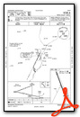
IFR Chart of KSEG
Enroute Charts at SkyVector.com
Location Information for KSEG
Coordinates: N40°49.27' / W76°51.85'Located 01 miles N of Selinsgrove, Pennsylvania on 149 acres of land. View all Airports in Pennsylvania.
Surveyed Elevation is 463 feet MSL.
Operations Data
|
|
Airport Communications
| ASOS: | 123.975 Tel. 570-374-4099 |
|---|---|
| HARRISBURG APPROACH: | 118.25 269.45 |
| HARRISBURG DEPARTURE: | 118.25 269.45 |
| UNICOM: | 122.700 |
| CTAF: | 122.700 |
| AWOS-3 at N79 (14.2 E): | 119.175 570-672-0389 |
| AWOS-3 at 79PN (14.6 NE): | 118.075 570-271-8192 |
| AWOS-3 at ZER (23.4 E): | 127.575 570-544-2778 |
Nearby Navigation Aids
|
| ||||||||||||||||||||||||||||||||||||||||||||||||


Runway 17/35
| Dimensions: | 4760 x 75 feet / 1451 x 23 meters | |
|---|---|---|
| Surface: | Asphalt in Excellent Condition | |
| Weight Limits: | S-27, D-27 | |
| Edge Lighting: | Medium Intensity | |
| Runway 17 | Runway 35 | |
| Coordinates: | N40°49.64' / W76°52.04' | N40°48.91' / W76°51.66' |
| Elevation: | 463.5 | 441.9 |
| Traffic Pattern: | Left | Left |
| Runway Heading: | 159° True | 339° True |
| Displaced Threshold: | 388 Feet | 250 Feet |
| Markings: | Non-Precision Instrument in good condition. | Non-Precision Instrument in good condition. |
| Glide Slope Indicator | P4L (3.50° Glide Path Angle) | |
| REIL: | Yes | Yes |
| Obstacles: | 29 ft Tree 587 ft from runway, 123 ft left of center 26:1 APCH SLOPE TO DTHR. |
30 ft Trees 409 ft from runway, 156 ft right of center APCH SLOPE 19:1 TO DTHR. |
Services Available
| Fuel: | 100LL (blue), Jet-A |
|---|---|
| Transient Storage: | Hangars,Tiedowns |
| Airframe Repair: | MINOR |
| Engine Repair: | MINOR |
| Bottled Oxygen: | NONE |
| Bulk Oxygen: | NONE |
| Other Services: | PILOT INSTRUCTION |
Ownership Information
| Ownership: | Publicly owned | |
|---|---|---|
| Owner: | PENN VALLEY AIRPORT AUTH | |
| 100 AIRPORT RD | ||
| SELINSGROVE, PA 17870 | ||
| 570-374-7671 | ||
| Manager: | STEPHEN BOWERS | |
| 100 AIRPORT RD | ||
| SELINSGROVE, PA 17870 | ||
| 570-809-4701 | AFT HOURS CTC 570-809-4701. | |
Operational Statistics
| Single Engine Aircraft Based on Field: | 24 | Statistics collected for 12 month period ending 2023-12-19 | |
|---|---|---|---|
| Multi-Engine Aircraft Based on Field: | 2 | Annual Commercial Operations: | none |
| Jet Aircraft Based on Field: | 2 | Annual Commuter Operations: | none |
| Helicopters Based on Field: | 2 | Annual Air Taxi Operations: | 2800 |
| Military Aircraft Based on Field: | none | Annual Military Operations: | 200 |
| Gliders Based on Field: | none | Annual GA Local Operations: | 13000 |
| Ultralights Based on Field: | none | Annual GA Itinerant Operations: | 6000 |
Other Remarks
- FOR CD CTC HARRISBURG APCH AT 800-932-0712.
- DEER & BIRDS ON AND INVOF ARPT.
- RISING TERRAIN BOTH SIDES OF APCH TO RWY 17..
- COLD TEMPERATURE AIRPORT. ALTITUDE CORRECTION REQUIRED AT OR BELOW -15C.
- ACTVT REIL RWY 17/35; PAPI RWY 35; MIRL RWY 17/35 - CTAF.
Weather Minimums
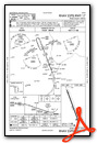
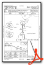
Instrument Approach Procedure (IAP) Charts
Nearby Airports with Instrument Procedures
| ID | Name | Heading / Distance | ||
|---|---|---|---|---|
 |
8N8 | Danville Airport | 052° | 12.6 |
|
N79 | Northumberland County Airport | 086° | 14.2 |
|
74N | Bendigo Airport | 138° | 21.0 |
|
N13 | Bloomsburg Municipal Airport | 061° | 22.2 |
|
KZER | Schuylkill County/Joe Zerbey Airport | 106° | 23.4 |
|
KIPT | Williamsport Regional Airport | 354° | 25.3 |
|
P34 | Mifflintown Airport | 241° | 28.1 |
|
KLHV | William T Piper Memorial Airport | 306° | 31.6 |
|
58N | Reigle Field Airport | 157° | 34.6 |
|
KRVL | Mifflin County Airport | 256° | 35.8 |
|
KCXY | Capital City Airport | 179° | 36.2 |
|
9D4 | Deck Airport | 138° | 37.3 |


