Login
Register


SLG
Smith Field Airport
Official FAA Data Effective 2024-04-18 0901Z
Chart Supplement

VFR Chart of KSLG
Sectional Charts at SkyVector.com
IFR Chart of KSLG
Enroute Charts at SkyVector.com
Location Information for KSLG
Coordinates: N36°11.51' / W94°29.40'Located 03 miles NE of Siloam Springs, Arkansas on 270 acres of land. View all Airports in Arkansas.
Surveyed Elevation is 1191 feet MSL.
Operations Data
|
|
Airport Communications
| AWOS-3PT: | 118.375 Tel. 479-524-9893 |
|---|---|
| RAZORBACK APPROACH: | 121.0 244.575 |
| RAZORBACK DEPARTURE: | 121.0 244.575 |
| CTAF: | 122.800 |
| UNICOM: | 122.800 |
| ATIS at XNA (10.3 NE): | 119.425 |
| ASOS at XNA (10.4 NE): | 119.425 479-203-0109 |
| AWOS-3PT at VBT (16.0 NE): | 134.975 479-273-9198 |
- APCH/DEP SVC PRVDD BY MEMPHIS ARTCC ON FREQS 126.1/269.0 (FAYETTEVILLE RCAG) WHEN RAZORBACK APCH CTL CLSD.
Nearby Navigation Aids
|
| ||||||||||||||||||||||||||||||||||||||||||||||||||||||||||||


Runway 18/36
| Dimensions: | 4997 x 75 feet / 1523 x 23 meters | |
|---|---|---|
| Surface: | Asphalt in Good Condition | |
| Weight Limits: | S-24 | |
| Edge Lighting: | Medium Intensity | |
| Runway 18 | Runway 36 | |
| Coordinates: | N36°11.92' / W94°29.35' | N36°11.10' / W94°29.45' |
| Elevation: | 1191.3 | 1175.4 |
| Traffic Pattern: | Left | Left |
| Runway Heading: | 185° True | 5° True |
| Markings: | Non-Precision Instrument in fair condition. | Non-Precision Instrument in fair condition. |
| Glide Slope Indicator | P2L (3.00° Glide Path Angle) | P2L (3.00° Glide Path Angle) UNUSBL BYD 7 DEGS RIGHT OF CNTRLN. |
| REIL: | Yes | Yes |
Services Available
| Fuel: | 100LL (blue), Jet-A |
|---|---|
| Transient Storage: | Tiedowns |
| Airframe Repair: | MAJOR |
| Engine Repair: | MAJOR |
| Bottled Oxygen: | NONE |
| Bulk Oxygen: | NONE |
| Other Services: | PILOT INSTRUCTION,AIRCRAFT SALES |
Ownership Information
| Ownership: | Publicly owned | |
|---|---|---|
| Owner: | CITY OF SILOAM SPRINGS | |
| PO BOX 80 | ||
| SILOAM SPRINGS, AR 72761 | ||
| 479-524-5136 | ||
| Manager: | JAMES HARRIS | |
| 20610 SMITH FIELD DRIVE | ||
| SILOAM SPRINGS, AR 72761 | ||
| 479-524-4103 | ||
Operational Statistics
| Single Engine Aircraft Based on Field: | 23 | Statistics collected for 12 month period ending 2021-02-28 | |
|---|---|---|---|
| Multi-Engine Aircraft Based on Field: | 5 | Annual Commercial Operations: | none |
| Jet Aircraft Based on Field: | 2 | Annual Commuter Operations: | none |
| Helicopters Based on Field: | none | Annual Air Taxi Operations: | none |
| Military Aircraft Based on Field: | none | Annual Military Operations: | 50 |
| Gliders Based on Field: | none | Annual GA Local Operations: | 15000 |
| Ultralights Based on Field: | none | Annual GA Itinerant Operations: | 15000 |
Other Remarks
- FOR CD CTC RAZORBACK APCH 479-649-2416, WHEN APCH CLSD CTC MEMPHIS ARTCC AT 901-368-8453/8449.
- 0LL SELF-SERVE 100LL AVBL 24 HR WITH CREDIT CARD.
- ACTVT REIL RWY 18 & 36; PAPI RWY 18 & 36; MIRL RWY 18/36 - CTAF.
Weather Minimums

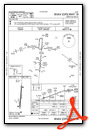
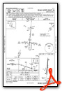
Instrument Approach Procedure (IAP) Charts
Nearby Airports with Instrument Procedures
| ID | Name | Heading / Distance | ||
|---|---|---|---|---|
 |
5M5 | Crystal Lake Airport | 013° | 9.4 |
|
KXNA | Northwest Arkansas Ntl Airport | 058° | 10.4 |
|
KVBT | Bentonville Municipal/Louise M Thaden Field Airport | 054° | 16.0 |
|
KASG | Springdale Municipal Airport | 092° | 18.0 |
|
KFYV | Drake Field Airport | 125° | 19.2 |
|
KROG | Rogers Exec - Carter Field Airport | 059° | 21.5 |
|
KGMJ | Grove Regional Airport | 334° | 27.6 |
|
KTQH | Tahlequah Municipal Airport | 238° | 29.5 |
|
1K8 | South Grand Lake Regional Airport | 310° | 33.1 |
|
H34 | Huntsville Municipal Airport | 100° | 36.4 |
|
KEOS | Neosho Hugh Robinson Airport | 007° | 37.4 |
|
H71 | Mid-America Industrial Airport | 273° | 40.8 |
Airport Images
Do you have a recent image of this airport? Upload it here!


