Login
Register


SUZ
Saline County Regional Airport
Official FAA Data Effective 2024-04-18 0901Z
Chart Supplement

VFR Chart of KSUZ
Sectional Charts at SkyVector.com
IFR Chart of KSUZ
Enroute Charts at SkyVector.com
Location Information for KSUZ
Coordinates: N34°35.42' / W92°28.77'Located 05 miles E of Benton, Arkansas on 1200 acres of land. View all Airports in Arkansas.
Estimated Elevation is 389 feet MSL.
Operations Data
|
|
Airport Communications
| AWOS-3: | 132.125 Tel. 501-847-3883 |
|---|---|
| LITTLE ROCK APPROACH: | 119.5 306.2 |
| LITTLE ROCK DEPARTURE: | 119.5 306.2 |
| UNICOM: | 122.800 |
| CTAF: | 122.800 |
| ASOS at LIT (14.6 NE): | 501-376-0247 |
| D-ATIS at LIT (15.1 NE): | 125.65 |
| AWOS-3PT at ORK (18.3 NE): | 123.775 501-906-6529 |
Nearby Navigation Aids
|
| ||||||||||||||||||||||||||||||||||||||||||||||||||||||||||||


Runway 02/20
| Dimensions: | 5002 x 100 feet / 1525 x 30 meters | |
|---|---|---|
| Surface: | Asphalt in Excellent Condition | |
| Weight Limits: | S-54, D-65, ST-111 | |
| Edge Lighting: | Medium Intensity | |
| Runway 02 | Runway 20 | |
| Coordinates: | N34°35.04' / W92°28.94' | N34°35.81' / W92°28.60' |
| Elevation: | 389.4 | 387.5 |
| Traffic Pattern: | Right | |
| Runway Heading: | 20° True | 200° True |
| Markings: | Non-Precision Instrument in good condition. | Non-Precision Instrument in good condition. |
| Glide Slope Indicator | P4L (3.00° Glide Path Angle) | P4L (3.00° Glide Path Angle) |
| REIL: | Yes | Yes |
| Obstacles: | 38 ft Trees 1650 ft from runway | 30 ft Tree 980 ft from runway, 575 ft right of center |
Services Available
| Fuel: | 100LL (blue), Jet A+ |
|---|---|
| Transient Storage: | Tiedowns |
| Airframe Repair: | MINOR |
| Engine Repair: | MAJOR |
| Bottled Oxygen: | NOT AVAILABLE |
| Bulk Oxygen: | NOT AVAILABLE |
| Other Services: | PILOT INSTRUCTION,AIRCRAFT RENTAL |
Ownership Information
| Ownership: | Publicly owned | |
|---|---|---|
| Owner: | SALINE COUNTY | |
| 200 N MAIN ST | ||
| BENTON, AR 72015 | ||
| 501-303-5690 | ||
| Manager: | AJ AMBORT | |
| 1100 HILL FARM ROAD | ||
| BRYANT, AR 72022 | ||
| (501) 672-9809 | ||
Operational Statistics
| Single Engine Aircraft Based on Field: | 66 | Statistics collected for 12 month period ending 2021-07-31 | |
|---|---|---|---|
| Multi-Engine Aircraft Based on Field: | 7 | Annual Commercial Operations: | none |
| Jet Aircraft Based on Field: | 1 | Annual Commuter Operations: | none |
| Helicopters Based on Field: | 5 | Annual Air Taxi Operations: | none |
| Military Aircraft Based on Field: | none | Annual Military Operations: | 500 |
| Gliders Based on Field: | none | Annual GA Local Operations: | 30000 |
| Ultralights Based on Field: | none | Annual GA Itinerant Operations: | 27000 |
Other Remarks
- COURTESY CAR AVBL. AFT HRS, CTC AMGR FOR TRML BLDG ENTRY CODE.
- FOR CD CTC LITTLE ROCK APCH 501-379-2908 OR LITTLE ROCK ATCT 501-379-2911.
- 0LL SELF SVC FUEL AVBL 24 HRS WITH CREDIT CARD.
- ACTVT REIL RWYS 02 & 20; MIRL RWY 02/20 - CTAF.
Weather Minimums

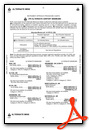
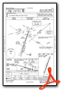
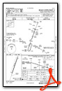
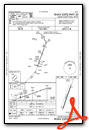
Instrument Approach Procedure (IAP) Charts
Nearby Airports with Instrument Procedures
| ID | Name | Heading / Distance | ||
|---|---|---|---|---|
 |
KLIT | Bill and Hillary Clinton Ntl/Adams Field Airport | 056° | 15.1 |
|
9M8 | Sheridan-Grant County Regional Airport | 157° | 17.0 |
|
KORK | North Little Rock Municipal Airport | 037° | 18.3 |
|
M78 | Malvern Municipal Airport | 222° | 20.8 |
|
KLRF | Little Rock AFB Airport | 040° | 25.6 |
|
KCXW | Conway Regional Airport | 351° | 26.0 |
|
KHOT | Memorial Field Airport | 257° | 31.3 |
|
KBDQ | Morrilton Municipal Airport | 340° | 34.7 |
|
KPBF | Pinebluff Regional/Grider Field Airport | 132° | 36.7 |
|
KMPJ | Petit Jean Park Airport | 327° | 39.1 |
|
4M3 | Carlisle Municipal Airport | 070° | 40.1 |
|
KADF | Dexter B Florence Memorial Field Airport | 224° | 41.4 |
Airport Images
Do you have a recent image of this airport? Upload it here!


