Login
Register


SVMG
Margarita Del Caribe International Airport
VFR Chart of SVMG
Sectional Charts at SkyVector.com
IFR Chart of SVMG
Enroute Charts at SkyVector.com
Location Information for SVMG
Coordinates: N10°54.75' / W63°57.98'View all Airports in Nueva Esparta, Venezuela.
Elevation is 72.0 feet MSL.
Operations Data
|
|
Airport Communications
| MARGARITA Approach: | 119.90 |
|---|---|
| MARGARITA Approach: | 120.50 |
| MARAGRITA DEL CARIBE INTL ATIS: | 132.65 |
| MARGARITA Tower: | 118.60 |
| MARGARITA Tower: | 123.50 |
Nearby Navigation Aids
|
| ||||||||||||||||||||||||||||||||||||||||||||||||||||||||||||


Runway 09/27
| Dimensions: | 9843 x 148 feet / 3000 x 45 meters | |
|---|---|---|
| Surface: | Hard | |
| Runway 09 | Runway 27 | |
| Coordinates: | N10°54.58' / W63°58.85' | N10°54.91' / W63°57.22' |
| Elevation: | 72 | 30 |
| Runway Heading: | 092° | 272° |
Nearby Airports with Instrument Procedures
| ID | Name | Heading / Distance | ||
|---|---|---|---|---|
 |
SVCU | Cumana Airport | 199° | 29.4 |
|
SVBC | Barcelona Airport | 221° | 64.3 |
|
SVMT | Maturin Airport | 145° | 84.5 |
|
SVGI | Guiria Airport | 101° | 99.8 |
|
SVST | Don Edmundo Barrios Ntl Airport | 185° | 118.0 |
|
TGPY | St. Georges/Maurice Bishop - I Airport | 062° | 144.1 |
|
TTPP | Port of Spain-Piarco Airport | 096° | 156.4 |
|
SVCS | Oscar Machado Zuloaga Airport | 257° | 172.5 |
|
TVSC | Canouan/Canouan Island Airport | 055° | 187.6 |
Airport Images
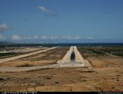
By: Lukeman


