Login
Register


UOX
University-Oxford Airport
Official FAA Data Effective 2024-04-18 0901Z
Chart Supplement

VFR Chart of KUOX
Sectional Charts at SkyVector.com
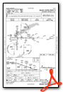
IFR Chart of KUOX
Enroute Charts at SkyVector.com
Location Information for KUOX
Coordinates: N34°23.06' / W89°32.21'Located 02 miles NW of Oxford, Mississippi on 297 acres of land. View all Airports in Mississippi.
Surveyed Elevation is 452 feet MSL.
TPA: 800 FT AGL LGT ACFT, 1200 FT AGL HI SPD ACFT.
Operations Data
|
|
Airport Communications
| AWOS-3PT: | 132.725 Tel. 662-234-9751 |
|---|---|
| CTAF: | 123.000 |
| UNICOM: | 123.000 |
| AWOS-3PT at PMU (17.7 W): | 118.225 662-563-6267 |
| AWOS-3PT at GNF (35.6 S): | 118.025 662-227-3407 |
| ATIS at OLV (37.8 N): | 119.925 |
- APCH/DEP SVC PRVDD BY MEMPHIS ARTCC (ZME) ON FREQS 128.5/279.55 (TUPELO RCAG).
Nearby Navigation Aids
|
| ||||||||||||||||||||||||||||||||||||||||||||||||||||||||||||


Runway 09/27
| Dimensions: | 5600 x 100 feet / 1707 x 30 meters | |
|---|---|---|
| Surface: | Asphalt in Fair Condition | |
| Weight Limits: | 29 /F/C/X/T, S-38, D-55, ST-90 | |
| Edge Lighting: | Medium Intensity | |
| Runway 09 | Runway 27 | |
| Coordinates: | N34°23.07' / W89°32.76' | N34°23.05' / W89°31.65' |
| Elevation: | 412.7 | 452.0 |
| Traffic Pattern: | Left | Left |
| Runway Heading: | 91° True | 271° True |
| Markings: | Non-Precision Instrument in fair condition. | Non-Precision Instrument in fair condition. |
| Glide Slope Indicator | P4L (3.00° Glide Path Angle) | P4L (3.60° Glide Path Angle) PAPI UNUSBL BYD 6 DEG L OF CNTRLN. |
| REIL: | Yes | Yes |
| Obstacles: | 40 ft Tree 800 ft from runway, 75 ft right of center | |
Services Available
| Fuel: | 100LL (blue), Jet-A, Jet A+ |
|---|---|
| Transient Storage: | Hangars,Tiedowns |
| Airframe Repair: | MINOR |
| Engine Repair: | NONE |
| Bottled Oxygen: | NONE |
| Bulk Oxygen: | NONE |
| Other Services: | PILOT INSTRUCTION,AIRCRAFT RENTAL |
Ownership Information
| Ownership: | Publicly owned | |
|---|---|---|
| Owner: | UNIVERSITY OF MISSISSIPPI | |
| PO BOX 1848 | ||
| UNIVERSITY, MS 38677 | ||
| 662-915-7044 | ||
| Manager: | JACOB PIND | |
| UNIVERSITY-OXFORD AIRPORT | ||
| OXFORD, MS 38655 | ||
| 662-234-2036 | ||
Operational Statistics
| Single Engine Aircraft Based on Field: | 12 | Statistics collected for 12 month period ending 2021-02-28 | |
|---|---|---|---|
| Multi-Engine Aircraft Based on Field: | 7 | Annual Commercial Operations: | 28 |
| Jet Aircraft Based on Field: | 3 | Annual Commuter Operations: | none |
| Helicopters Based on Field: | none | Annual Air Taxi Operations: | 5146 |
| Military Aircraft Based on Field: | none | Annual Military Operations: | 1516 |
| Gliders Based on Field: | none | Annual GA Local Operations: | 37241 |
| Ultralights Based on Field: | none | Annual GA Itinerant Operations: | 16322 |
Other Remarks
- GCO AVBL ON FREQ 135.075 FOR MEMPHIS ARTCC (ZME).
- FOR CD IF UNA VIA GCO CTC MEMPHIS ARTCC AT 901-368-8453/8449.
- MIRL RWY 09/27 OPRS DUSK-2200. AFT 2200, ACTVT REIL 09 & 27; PAPI RWY 09; MIRL RWY 09/27 - CTAF. PAPI RWY 27 OPR CONSLY.
- TPA: 800 FT AGL LGT ACFT, 1200 FT AGL HI SPD ACFT.
Weather Minimums
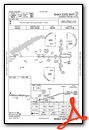
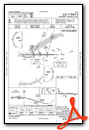
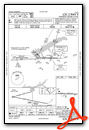
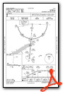
Instrument Approach Procedure (IAP) Charts
Nearby Airports with Instrument Procedures
| ID | Name | Heading / Distance | ||
|---|---|---|---|---|
 |
KPMU | Panola County Airport | 266° | 17.7 |
|
M41 | Holly Springs-Marshall County Airport | 001° | 25.2 |
|
M72 | New Albany/Union County Airport | 068° | 27.3 |
|
25M | Ripley Airport | 051° | 32.9 |
|
KGNF | Grenada Municipal Airport | 201° | 35.5 |
|
KOLV | Olive Branch/Taylor Field Airport | 340° | 37.7 |
|
KMMS | Selfs Airport | 256° | 38.5 |
|
KTUP | Tupelo Regional Airport | 100° | 38.7 |
|
KUTA | Tunica Municipal Airport | 294° | 44.1 |
|
KMEM | Memphis International Airport | 331° | 45.0 |
|
8M1 | Booneville/Baldwyn Airport | 073° | 45.8 |
|
5A4 | Okolona Municipal/Richard Stovall Field Airport | 118° | 46.0 |
Airport Images
Do you have a recent image of this airport? Upload it here!


