Login
Register


VBT
Bentonville Municipal/Louise M Thaden Field Airport
Official FAA Data Effective 2024-04-18 0901Z
Chart Supplement

VFR Chart of KVBT
Sectional Charts at SkyVector.com
IFR Chart of KVBT
Enroute Charts at SkyVector.com
Location Information for KVBT
Coordinates: N36°20.72' / W94°13.17'Located 02 miles S of Bentonville, Arkansas on 130 acres of land. View all Airports in Arkansas.
Surveyed Elevation is 1298 feet MSL.
Operations Data
|
|
Airport Communications
| AWOS-3PT: | 134.975 Tel. 479-273-9198 |
|---|---|
| RAZORBACK APPROACH: | 121.0 244.575 |
| RAZORBACK DEPARTURE: | 121.0 244.575 |
| CLEARANCE DELIVERY: | 121.05 263.125 |
| CTAF: | 122.975 |
| UNICOM: | 122.975 |
| AWOS-3PT at ROG (5.7 E): | 134.375 479-631-9196 |
| ASOS at XNA (5.7 SW): | 119.425 479-203-0109 |
| ATIS at XNA (5.7 SW): | 119.425 |
- APCH/DEP SVC PRVDD BY MEMPHIS ARTCC ON FREQS126.1/269.0 (FAYETTEVILLE RCAG) WHEN RAZORBACK APCH CTL CLSD.
Nearby Navigation Aids
|
| ||||||||||||||||||||||||||||||||||||||||||||||||||||||||||||


Runway 18/36
| Dimensions: | 4426 x 75 feet / 1349 x 23 meters | |
|---|---|---|
| Surface: | Asphalt in Fair Condition | |
| Weight Limits: | S-30, D-59
PCR VALUE: 214/F/D/X/T
| |
| Edge Lighting: | Medium Intensity | |
| Runway 18 | Runway 36 | |
| Coordinates: | N36°21.08' / W94°13.16' | N36°20.35' / W94°13.16' |
| Elevation: | 1289.3 | 1292.6 |
| Traffic Pattern: | Left | Left |
| Runway Heading: | 180° True | 0 |
| Displaced Threshold: | 230 Feet | |
| Declared Distances: | LDA:4196 | ASDA:4196 LDA:4196 |
| Markings: | Non-Precision Instrument in poor condition. | Non-Precision Instrument in poor condition. |
| Glide Slope Indicator | P2L (3.00° Glide Path Angle) | P2R (3.00° Glide Path Angle) |
| REIL: | Yes | Yes |
| Obstacles: | 19 ft Brush 510 ft from runway, 285 ft right of center APCH RATIO 38:1 TO DTHR. |
12 ft Pole 615 ft from runway, 170 ft left of center |
Runway 17/35
| Dimensions: | 2448 x 75 feet / 746 x 23 meters | |
|---|---|---|
| Surface: | Turf | |
| Runway 17 | Runway 35 | |
| Coordinates: | N36°20.93' / W94°13.19' | N36°20.53' / W94°13.19' |
| Elevation: | 1288.7 | 1292.5 |
| Runway Heading: | 180° True | 0 |
| Declared Distances: | TORA:2448 TODA:2448 | TORA:2448 TODA:2448 |
Services Available
| Fuel: | 100LL (blue), Jet-A |
|---|---|
| Transient Storage: | Hangars,Tiedowns |
| Airframe Repair: | MAJOR |
| Engine Repair: | MAJOR |
| Bottled Oxygen: | HIGH |
| Bulk Oxygen: | NONE |
| Other Services: | CHARTER SERVICE,PILOT INSTRUCTION,AIRCRAFT RENTAL,AIRCRAFT SALES |
Ownership Information
| Ownership: | Publicly owned | |
|---|---|---|
| Owner: | CITY OF BENTONVILLE | |
| 305 SW A STREET | ||
| BENTONVILLE, AR 72712 | ||
| 479-271-3112 | ||
| Manager: | DEBBIE GRIFFIN | |
| 305 SW A ST | ||
| BENTONVILLE, AR 72712 | ||
| 479-254-2028 | ||
Operational Statistics
| Single Engine Aircraft Based on Field: | 42 | Statistics collected for 12 month period ending 2023-02-28 | |
|---|---|---|---|
| Multi-Engine Aircraft Based on Field: | 4 | Annual Commercial Operations: | none |
| Jet Aircraft Based on Field: | 1 | Annual Commuter Operations: | none |
| Helicopters Based on Field: | 2 | Annual Air Taxi Operations: | 200 |
| Military Aircraft Based on Field: | none | Annual Military Operations: | 100 |
| Gliders Based on Field: | none | Annual GA Local Operations: | 21000 |
| Ultralights Based on Field: | none | Annual GA Itinerant Operations: | 11000 |
Other Remarks
- BEGINNING 60 FT BYD NORTH END OF RY 18 PAVEMENT, GND HAS APROXLY 12 FT DROP OVER 60 FT LENGTH TO POND.
- FOR CD CTC RAZORBACK APCH 479-649-2416, WHEN APCH CLSD CTC MEMPHIS ARTCC AT 901-368-8453/8449.
- MIGRATORY BIRDS ON & INVOF ARPT
- RWY 17/35 VFR DALGT OPNS ONLY.
- SIMUL USE OF RWYS 17/35 AND 18/36 NA.
- MKGS FADED.
- MKGS FADED.
- ACTVT MIRL RWY 18/36, PAPI RWY 18/36 - CTAF.
Weather Minimums

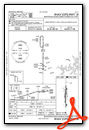
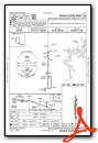
Instrument Approach Procedure (IAP) Charts
Departure Procedure (DP) Charts
Nearby Airports with Instrument Procedures
| ID | Name | Heading / Distance | ||
|---|---|---|---|---|
 |
KROG | Rogers Exec - Carter Field Airport | 073° | 5.7 |
|
KXNA | Northwest Arkansas Ntl Airport | 228° | 5.7 |
|
5M5 | Crystal Lake Airport | 269° | 10.9 |
|
KASG | Springdale Municipal Airport | 154° | 11.2 |
|
KSLG | Smith Field Airport | 235° | 16.0 |
|
KFYV | Drake Field Airport | 173° | 20.5 |
|
94K | Cassville Municipal Airport | 036° | 26.1 |
|
H34 | Huntsville Municipal Airport | 125° | 27.7 |
|
4M1 | Carroll County Airport | 085° | 28.9 |
|
KEOS | Neosho Hugh Robinson Airport | 343° | 29.1 |
|
KGMJ | Grove Regional Airport | 302° | 29.6 |
|
KHFJ | Monett Regional Airport | 016° | 35.0 |
Airport Images

By: japanjeff


