Login
Register


2R9
Kenedy Regional Airport
Official FAA Data Effective 2024-03-21 0901Z
Chart Supplement

VFR Chart of 2R9
Sectional Charts at SkyVector.com
IFR Chart of 2R9
Enroute Charts at SkyVector.com
Location Information for 2R9
Coordinates: N28°49.50' / W97°51.93'Located 01 miles NW of Kenedy, Texas on 261 acres of land. View all Airports in Texas.
Surveyed Elevation is 288 feet MSL.
Operations Data
|
|
Airport Communications
| AWOS-3PT: | 118.45 Tel. 830-583-8080 |
|---|---|
| UNICOM: | 123.000 |
| CTAF: | 123.000 |
| ASOS at NGT (18.5 SE): | 353.675 |
| AWOS-3 at BEA (27.6 S): | 118.675 361-362-7627 |
| AWOS-3PT at 8T6 (30.6 SW): | 119.05 361-449-1119 |
- APCH/DEP CTL SVC PRVDD BY HOUSTON ARTCC (ZHU) ON FREQS 134.6/322.5 (THREE RIVERS RCAG).
Nearby Navigation Aids
|
| ||||||||||||||||||||||||||||||||||||||||||||||||


Runway 16/34
| Dimensions: | 3218 x 60 feet / 981 x 18 meters | |
|---|---|---|
| Surface: | Asphalt in Excellent Condition | |
| Weight Limits: | S-11 | |
| Edge Lighting: | Medium Intensity | |
| Runway 16 | Runway 34 | |
| Coordinates: | N28°49.76' / W97°51.99' | N28°49.24' / W97°51.88' |
| Elevation: | 288.7 | 272.2 |
| Traffic Pattern: | Right | Left |
| Runway Heading: | 169° True | 349° True |
| Markings: | Non-Precision Instrument in good condition. | Non-Precision Instrument in good condition. |
| Glide Slope Indicator | P2L (3.00° Glide Path Angle) | P2L (3.60° Glide Path Angle) RSTRD 7 DEGS LEFT DUE TO OBSTS. |
| REIL: | Yes | |
| Obstacles: | 55 ft Sign 1347 ft from runway, 77 ft left of center 8 FT FENCE, 30-199 FT DSTC, 202 FT R. |
12 ft Trees 201 ft from runway, 105 ft left of center 8FT FENCE 0-199 DSTC. |
Services Available
| Fuel: | 100LL (blue), Jet-A |
|---|---|
| Transient Storage: | Tiedowns |
| Airframe Repair: | MAJOR |
| Engine Repair: | MAJOR |
| Bottled Oxygen: | NOT AVAILABLE |
| Bulk Oxygen: | NOT AVAILABLE |
| Other Services: | PILOT INSTRUCTION |
Ownership Information
| Ownership: | Publicly owned | |
|---|---|---|
| Owner: | CITY OF KENEDY | |
| 303 W.MAIN | ||
| KENEDY, TX 78119 | ||
| 830-583-2230 | ||
| Manager: | RON HYDE | |
| P.O. BOX 569 | ||
| KENEDY, TX 78119 | ||
| (830) 583-5930 | ||
Operational Statistics
| Single Engine Aircraft Based on Field: | 12 | Statistics collected for 12 month period ending 2023-05-25 | |
|---|---|---|---|
| Multi-Engine Aircraft Based on Field: | 2 | Annual Commercial Operations: | none |
| Jet Aircraft Based on Field: | none | Annual Commuter Operations: | none |
| Helicopters Based on Field: | none | Annual Air Taxi Operations: | none |
| Military Aircraft Based on Field: | none | Annual Military Operations: | none |
| Gliders Based on Field: | none | Annual GA Local Operations: | 2000 |
| Ultralights Based on Field: | none | Annual GA Itinerant Operations: | 1000 |
Other Remarks
- DEER ON & INVOF ARPT.
- ACFT AIRFRAME & POWER PLANT REPAIRS ON CALL 830-299-2295.
- FOR CD CTC HOUSTON ARTCC AT 281-230-5622.
- MIRL RWY 16/34 & TWY LGTS PRESET LOW INTST; TO INCR INTST ACTVT - CTAF.
Weather Minimums
Instrument Approach Procedure (IAP) Charts
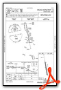
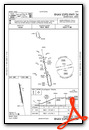
Nearby Airports with Instrument Procedures
| ID | Name | Heading / Distance | ||
|---|---|---|---|---|
 |
KBEA | Beeville Municipal Airport | 171° | 27.8 |
|
TX2 | Chase Field Industrial Airport | 158° | 29.7 |
|
8T6 | Live Oak County Airport | 205° | 30.7 |
|
KPEZ | Pleasanton Municipal Airport | 282° | 35.3 |
|
KSSF | Stinson Municipal Airport | 314° | 44.2 |
|
KRND | Randolph AFB Airport | 332° | 47.4 |
|
T85 | Yoakum Municipal Airport | 052° | 48.1 |
|
KVCT | Victoria Regional Airport | 087° | 49.9 |
|
T69 | Alfred C 'Bubba' Thomas Airport | 159° | 50.1 |
|
KSKF | Kelly Field Airport | 311° | 50.3 |
|
KSAT | San Antonio International Airport | 323° | 53.0 |
|
KBAZ | New Braunfels Ntl Airport | 350° | 53.5 |
Airport Images
Do you have a recent image of this airport? Upload it here!


