Login
Register


CNY
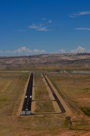
Canyonlands Regional Airport
Official FAA Data Effective 2024-04-18 0901Z
Chart Supplement

VFR Chart of KCNY
Sectional Charts at SkyVector.com
IFR Chart of KCNY
Enroute Charts at SkyVector.com
Location Information for KCNY
Coordinates: N38°45.46' / W109°45.21'Located 15 miles NW of Moab, Utah on 985 acres of land. View all Airports in Utah.
Surveyed Elevation is 4579 feet MSL.
Operations Data
|
|
Airport Communications
| ASOS: | 118.525 Tel. 435-259-8576 |
|---|---|
| CTAF: | 122.800 |
| UNICOM: | 122.800 |
| AWOS-3 at HVE (49.1 SW): | 120.0 435-542-1020 |
| AWOS-3PT at U64 (53.2 S): | 121.025 435-298-8856 |
| ATIS at GJT (61.3 E): | 118.55 |
- APCH/DEP CTL SVC PRVDD BY DENVER ARTCC (ZDV) ON FREQS 134.5/327.8 (GRAND MESA/B/ RCAG).
- COMMUNICATIONS PRVDD BY CEDAR CITY RADIO ON FREQ 122.3 (MOAB RCO).
Nearby Navigation Aids
|
| ||||||||||||||||||||||||||||||||||||


Runway 03/21
| Dimensions: | 7360 x 100 feet / 2243 x 30 meters | |
|---|---|---|
| Surface: | Asphalt / Grooved in Good Condition | |
| Weight Limits: | 30 /F/C/X/T, D-85 | |
| Edge Lighting: | Medium Intensity | |
| Runway 03 | Runway 21 | |
| Coordinates: | N38°44.82' / W109°45.80' | N38°45.75' / W109°44.81' |
| Elevation: | 4552.7 | 4557.9 |
| Traffic Pattern: | Right | |
| Runway Heading: | 40° True | 220° True |
| Displaced Threshold: | 260 Feet | |
| Declared Distances: | TORA:7101 TODA:7361 ASDA:7101 LDA:7101 | TORA:7361 TODA:7361 ASDA:7361 LDA:7101 |
| Markings: | Non-Precision Instrument in good condition. | Non-Precision Instrument in good condition. |
| Glide Slope Indicator | P4L (3.35° Glide Path Angle) | P4L (3.00° Glide Path Angle) PAPI DOES NOT PROVD OBST CLNC BYD 2.9 NM FM RWY THLD. |
| REIL: | Yes | Yes |
| Obstacles: | 36 ft Power Line 912 ft from runway, 464 ft left of center | |
Runway 15/33
| Dimensions: | 2121 x 60 feet / 646 x 18 meters | |
|---|---|---|
| Surface: | Gravel in Good Condition | |
| Runway 15 | Runway 33 | |
| Coordinates: | N38°46.23' / W109°44.94' | N38°45.91' / W109°44.77' |
| Elevation: | 4579.2 | 4563.5 |
| Runway Heading: | 158° True | 338° True |
| Declared Distances: | TORA:2000 TODA:2000 ASDA:2000 LDA:2000 | TORA:2000 TODA:2000 ASDA:2000 LDA:2000 |
| Markings: | None in poor condition. | None in poor condition. |
Services Available
| Fuel: | 100LL (blue), Jet-A |
|---|---|
| Transient Storage: | Hangars,Tiedowns |
| Airframe Repair: | MINOR |
| Engine Repair: | MINOR |
| Bottled Oxygen: | NOT AVAILABLE |
| Bulk Oxygen: | HIGH/LOW |
| Other Services: | CHARTER SERVICE,PILOT INSTRUCTION,AIRCRAFT RENTAL |
Ownership Information
| Ownership: | Publicly owned | |
|---|---|---|
| Owner: | GRAND COUNTY | |
| 125 E. CENTER | ||
| MOAB, UT 84532 | ||
| (435) 259-1347 | ||
| Manager: | TAMMY HOWLAND | |
| 110 W. AVIATION WAY | ||
| MOAB, UT 84532 | ||
| 435-259-4120 | ||
Operational Statistics
| Single Engine Aircraft Based on Field: | 40 | Statistics collected for 12 month period ending 2018-12-31 | |
|---|---|---|---|
| Multi-Engine Aircraft Based on Field: | 1 | Annual Commercial Operations: | none |
| Jet Aircraft Based on Field: | none | Annual Commuter Operations: | none |
| Helicopters Based on Field: | 3 | Annual Air Taxi Operations: | 4350 |
| Military Aircraft Based on Field: | none | Annual Military Operations: | 250 |
| Gliders Based on Field: | none | Annual GA Local Operations: | 6800 |
| Ultralights Based on Field: | 2 | Annual GA Itinerant Operations: | 4350 |
Other Remarks
- RWY 15/33 AND TWY B CLSD TO ACR OPNS.
- PAJA ON AND INVOF ARPT PRIMARILY SOUTH OF HNGRS, AVOID OTFC MID FIELD.
- ACTVT REIL RWY 03 & 21; MIRL RWY 03/21 - CTAF. PAPI RWY 03 & 21 ON CONSLY DURG DALGT HRS; ACTVT SS-SR - CTAF.
Weather Minimums
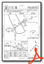
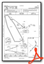
Instrument Approach Procedure (IAP) Charts
Nearby Airports with Instrument Procedures
| ID | Name | Heading / Distance | ||
|---|---|---|---|---|
 |
U64 | Monticello Airport | 158° | 53.1 |
|
KGJT | Grand Junction Regional Airport | 068° | 61.4 |
|
KAIB | Hopkins Field Airport | 118° | 64.1 |
|
69V | Huntington Municipal Airport | 304° | 65.3 |
|
KPUC | Carbon County Regional/Buck Davis Field Airport | 318° | 69.3 |
|
KBDG | Blanding Municipal Airport | 169° | 71.5 |
|
KAJZ | Blake Field Airport | 088° | 79.4 |
|
KMTJ | Montrose Regional Airport | 099° | 88.7 |
|
74V | Roosevelt Municipal Airport | 351° | 92.2 |
|
4V0 | Rangely Airport | 029° | 92.4 |
|
41U | Manti-Ephraim Airport | 292° | 93.5 |
|
KTEX | Telluride Regional Airport | 118° | 99.5 |
Airport Images

By: helipilot303
By: helipilot303


