Login
Register
CYMO
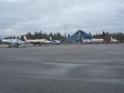
Moosonee Airport
VFR Chart of CYMO
Sectional Charts at SkyVector.com
IFR Chart of CYMO
Enroute Charts at SkyVector.com
Location Information for CYMO
Coordinates: N51°17.52' / W80°36.50'View all Airports in Ontario, Canada.
Elevation is 30 feet MSL.
Magnetic Variation is 13° West
Time Zone is UTC-5(4).
Operations Data
|
|
Airport Communications
| Remote Communications Outlet (RCO) | Timmins Radio 122.5 PTC avbl (RAAS) 12-02Z London Radio 123.475 (FISE) 126.7(bcst) |
|---|---|
| Mandatory Frequency (MF) | Timmins Radio limited hours other times traffic 122.5 3NM 3000 ASL (CAR 602.98) |
| Peripheral Station (PAL) | Toronto Center 133.725 |
| Automated Weather Observation System (AWOS) | 124.8 |
Nearby Navigation Aids
|
| ||||||||||||||||||||||||
Runway 06/24
| Dimensions: | 4000 x 100 feet. | |
|---|---|---|
| Surface: | ||
| Remarks | ASPH Rwy 14(136°)/32 | |
| Runway 06 | Runway 24 | |
| Runway Heading: | 057 ° | 237° |
| Approach Lights | Omni-Directional Approach Lighting System | Omni-Directional Approach Lighting System |
| Glide Slope Indicator | APAPI - Abbreviated PAPI for aircraft with eye-to-wheel height up to 10 feet. | APAPI - Abbreviated PAPI for aircraft with eye-to-wheel height up to 10 feet. |
Runway Conditions Reporting Source
Operator CRFI/RSC avbl ltd hrs. PCN
Services Available
| Information | Call out chg may be levied for one or more svcs. 12-02Z Sun-Fri, 12-23Z Sat, O/T 705-336-3517. |
|---|---|
| Fuel Available | JA-1 |
| Oil Available | 100 |
Public Facilities
| Location | Facilities | Remarks |
|---|---|---|
| In Terminal Building | Telephone, Food | |
| Within 5 NM | Taxi, Medical Aid, Accomodations, Car Rental |
Flight Planning
| Instructions | Pilots to open/close VFR flt plan with London rdo, FISE or by phone. |
|---|---|
| Flight Information Centre (FIC) | London 866-WXBRIEF (Toll free within Canada) or 866-541-4104 (Toll free within Canada & USA) |
| Weather (WX) | METAR AUTO H24 (see COMM) TAF H24, issue times: 0540, 1140, 1740, 2340Z. WxCam |
Aerodrome Operator
Corporation of the Town of Moosonee
705-336-2731/2681 Cert
Nearby Airports with Instrument Procedures
| ID | Name | Heading / Distance | ||
|---|---|---|---|---|
 |
CZKE | Kashechewan Airport | 339° | 71.6 |
 |
CZEM | Eastmain River Airport | 066° | 95.9 |
 |
CYYU | Kapuskasing Airport | 226° | 133.7 |
 |
CYNM | Matagami Airport | 142° | 141.4 |


